Cold Front On The Way
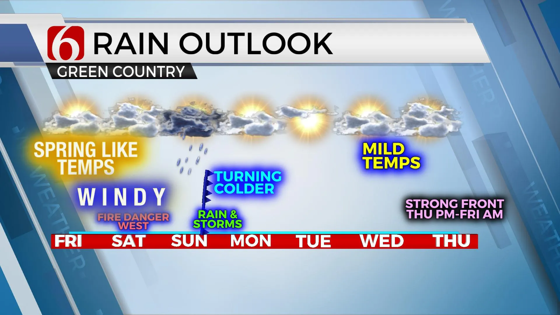
Spring like temperatures will remain on Friday and Saturday before a strong cold front moves across the state Sunday bringing thunderstorms and eventually colder air into early next week.Friday, March 4th 2022, 7:55 am
TULSA, Oklahoma -
Spring-like temperatures will remain on Friday and Saturday before a strong cold front moves across the state Sunday bringing thunderstorms and eventually colder air into early next week.
Here are the details from News On 6 Meteorologist Alan Crone:
Fire weather concerns are likely near and west of Tulsa Saturday. Strong to severe storm potential remains Sunday across southeastern to east-central Oklahoma.
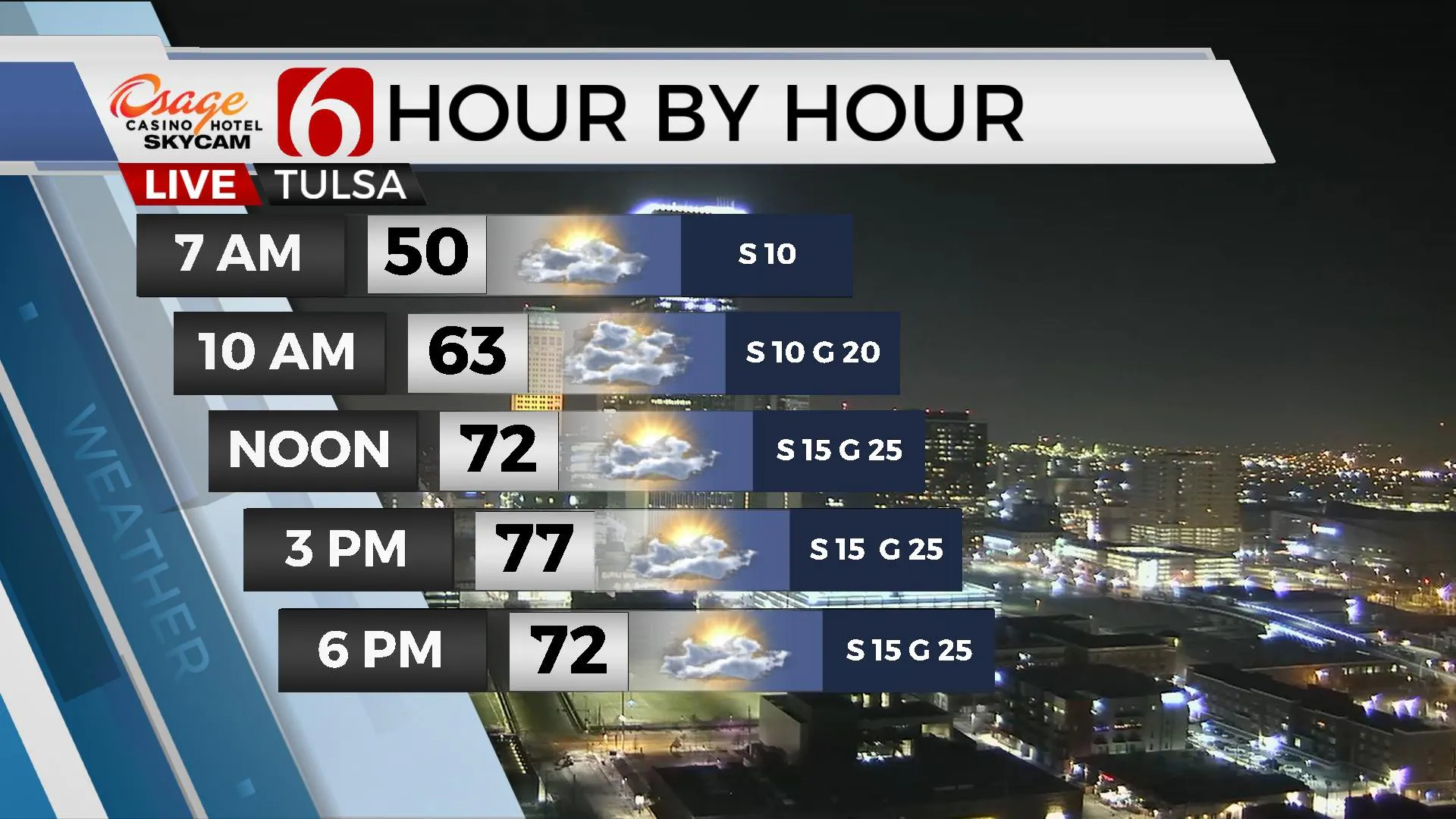
Things look on track for a storm system to impact the state through the weekend. Gusty south winds return Friday from 15 to 30 mph along with more clouds at times than sun. Afternoon highs will reach the mid-70s and low-level moisture will return with dew points in the 50s and 60s nearing the state over the next 24 hours. The main trough remains west of the area Friday but a strong disturbance rounds the base of this trough and ejects across the central plains Saturday. A dry line will quickly develop across western OK and move eastward near the Tulsa metro Saturday afternoon. Locations east of the metro will keep a low chance for a few storms, with higher chances along the OK-Arkansas state line region. The areas west of the dry line will experience a very high fire danger issue with low humidity, strong winds and dormant vegetation. The dry line will quickly return west overnight as the main upper-level trough nears the four-corners region bringing rain and storm chances into the area Sunday midday to afternoon. Most data support a cold front entering northern OK Sunday morning and moving southeast by late afternoon and evening. The timing of the system should keep northern OK highs in the lower 50s and a few upper 40s with warmer air across southeastern OK for the afternoon where a few strong to severe storms will remain possible. The cold front clears the state late Sunday, but the main trough will not pass until Monday morning. As colder air arrives, the potential for some light snow showers unfolds across southern Kansas. We’ll continue to monitor this possibility and update when needed.

Colder weather will remain Sunday through Tuesday before moderating Wednesday. Another significant cold front is likely to arrive by the end of next week.
Thanks for reading the Friday morning weather discussion and blog.
Have a super great day!
Alan Crone
KOTV
If you’re into podcasts, check out my daily weather update below. Search for NewsOn6 and ‘Weather Out The Door’ on most podcast providers, including Spotify, Stitcher, Tune-In and down below on Apple.

More Like This
March 4th, 2022
June 21st, 2023
June 19th, 2023
June 13th, 2023
Top Headlines
December 13th, 2024
December 13th, 2024
December 13th, 2024
December 13th, 2024


