Tracking A Winter Weather System; Advisory To Begin Overnight
Warmer temperatures and mostly sunny skies are expected before another arctic front rolls into the state this week.Thursday, March 10th 2022, 11:05 pm
TULSA, Oklahoma -
Warmer temperatures and mostly sunny skies are expected before another arctic front rolls into the state this week.
Here are the details from News On 6 Meteorologist Alan Crone:
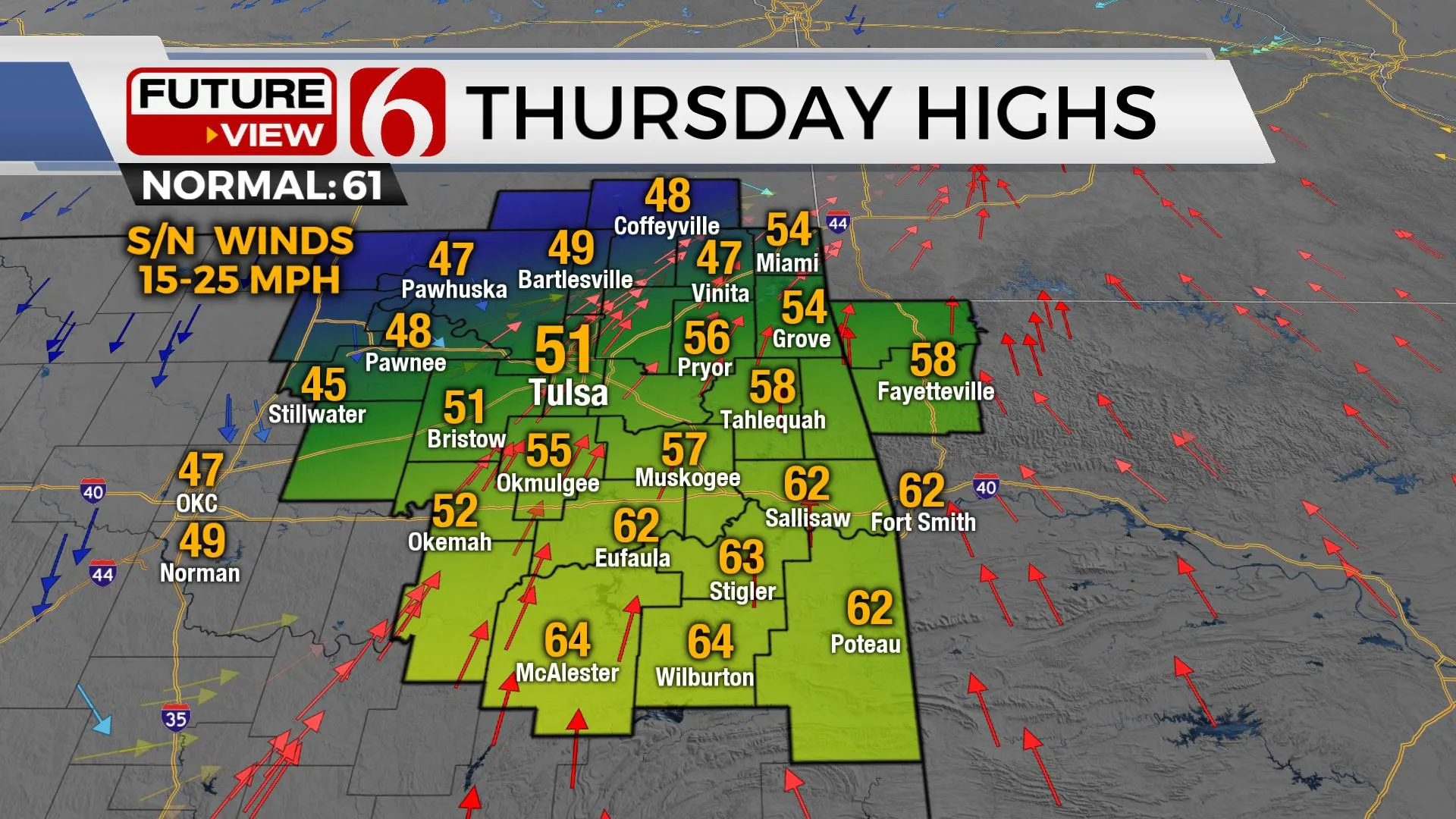
Clearing sky with the return of southerly winds will bring highs into the upper 50s and lower 60s on Wednesday before our next strong arctic front rolls across the state Thursday. This brings the potential for some accumulating snowfall Friday morning. Cold weather is likely to remain Friday and Saturday before quickly modifying Sunday into Monday. A system may quickly move across the area Monday with shower and storm chances, but the probability currently remains low.

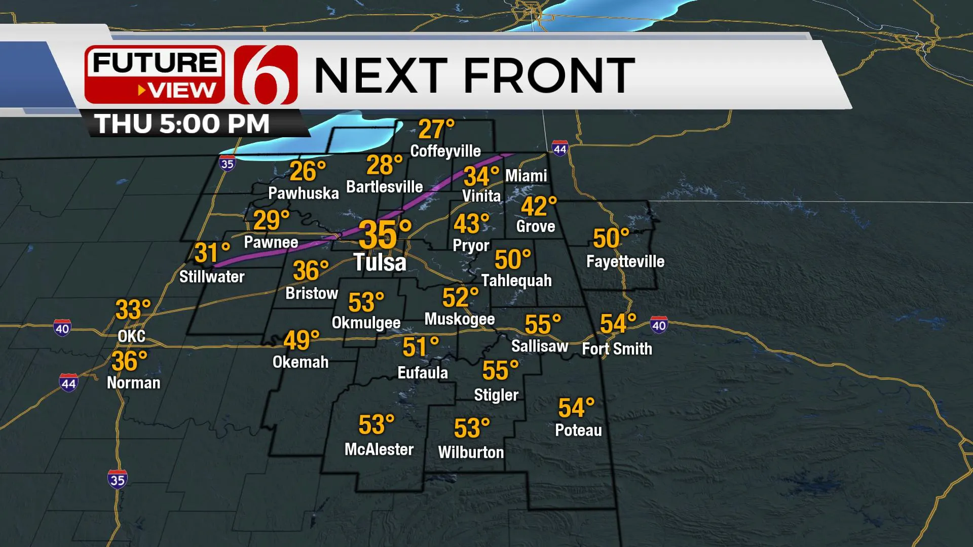
Thursday morning a strong arctic front enters northwestern OK and surges southward. Most data support a surface low developing on the front that may briefly slow the southeastern progression until later Thursday afternoon. Regardless, falling temps are likely by Thursday afternoon across northern OK with many locations dropping below freezing by early evening across northeastern OK.
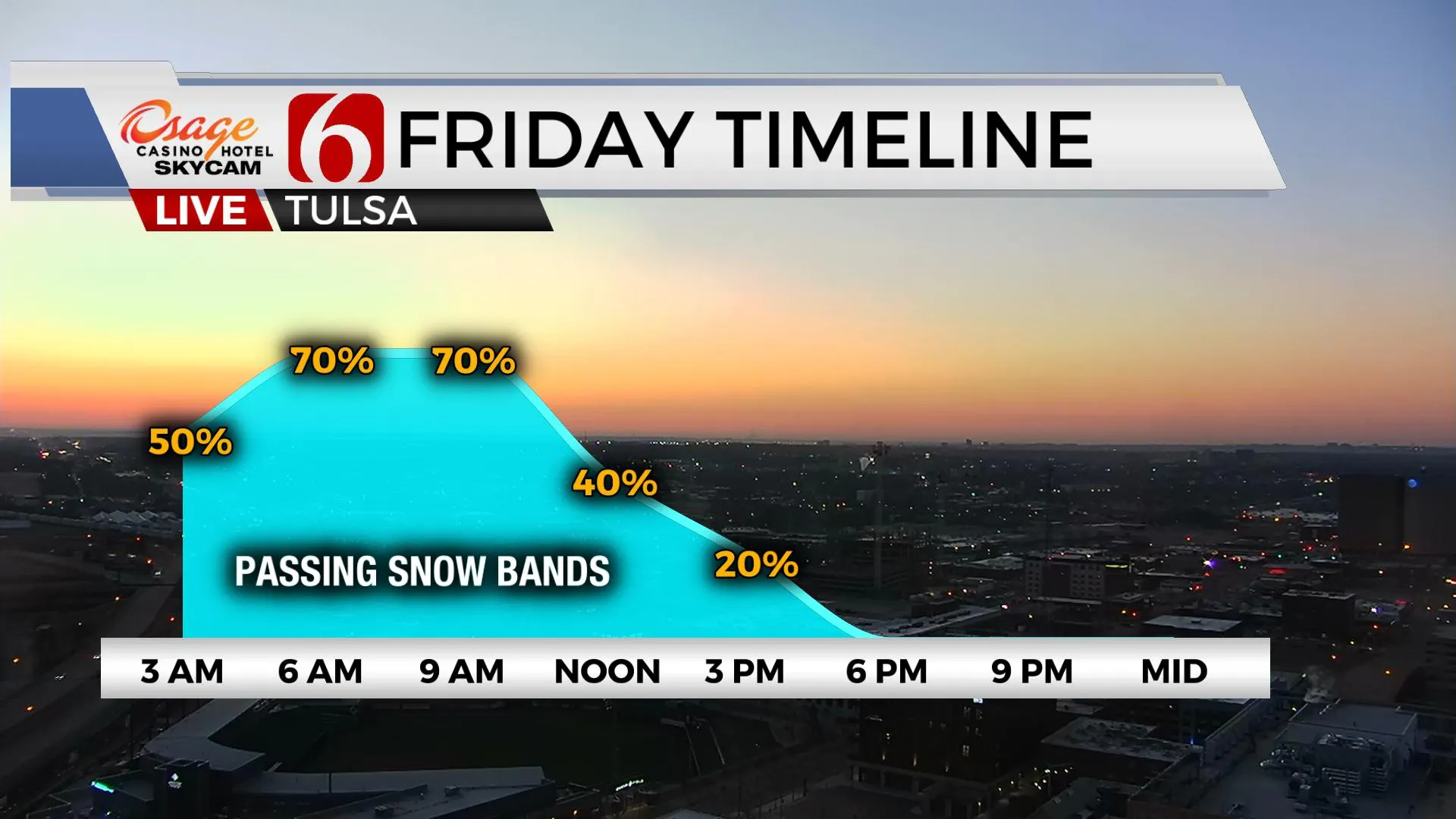
As the colder air sinks southward, a small window for freezing drizzle or sleet may develop directly behind the front. Our main window for wintry precip continues to be early Friday morning through early afternoon. Most data support a column of air cold enough for an all-snow event, including the potential for winter advisory criteria snow, from one to three inches of accumulation across northeastern OK. The system should exit the region early Friday afternoon. Friday temps will start in the 20s and finish near freezing with gusty north winds.

Clearing sky is likely overnight into Saturday morning with temps dropping into the teens over the snowpack regions. Saturday afternoon highs will quickly modify due to the increasing March sun angle with highs in the mid-40s. We're anticipating highs reaching the lower to mid-60s Sunday with gusty south winds from 20 to 30 mph.

The data continues to be highly problematic resolving the next upper-level trough. But this morning, both EURO and GFS seem to be closer with the trajectory for Monday. We’ll add a slight chance for showers Monday with a system moving across the state. This delays the warm-up slightly, with Monday highs in the 60s. Temps Tuesday through Thursday should move into the upper 60s and lower 70s.
Another system should near the state by the end of next week with increasing thunderstorm chances.
Thanks for reading the Wednesday morning weather discussion and blog.
Have a super great day!
Alan Crone
KOTV
If you’re into podcasts, check out my daily weather update below. Search for NewsOn6 and ‘Weather Out The Door’ on most podcast providers, including Spotify, Stitcher, Tune-In and down below on Apple.

More Like This
March 10th, 2022
June 21st, 2023
June 19th, 2023
June 13th, 2023
Top Headlines
December 14th, 2024
December 14th, 2024
December 14th, 2024
December 14th, 2024


