Tracking Severe Storms Overnight Across Oklahoma
A warm and windy day is expected before storm chances return to the state on Thursday night.Friday, March 18th 2022, 12:33 am
TULSA, Oklahoma -
A storm centered in eastern New Mexico will be in SW Oklahoma by late Thursday afternoon and firing up several severe storms that will move from Central OK to the east by 8-10 PM.
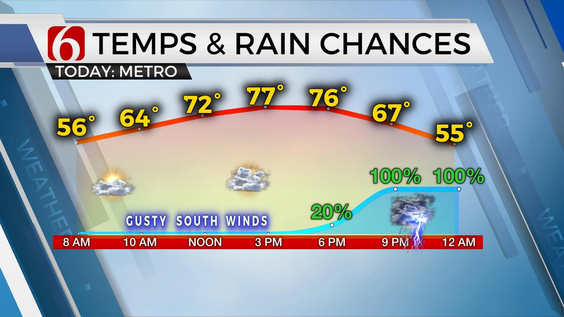
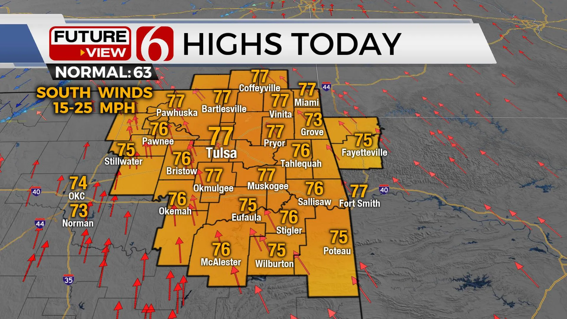
Afternoon highs into the mid to upper 70s before our next storm system moves into the area. This system brings increasing rain and thunder chances to northern and eastern Oklahoma, including a threat of a few strong to severe storms near or south of our immediate area.
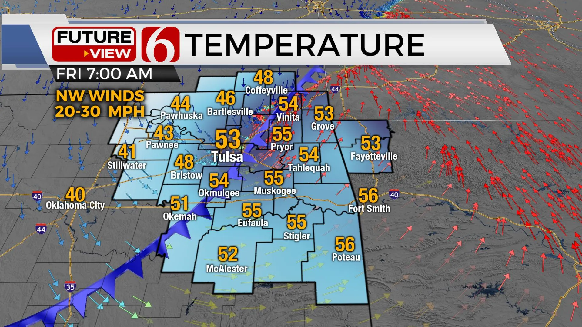
As the cold front progresses over the area later tonight and early Friday morning, showers and storms will quickly move eastward with chilly, blustery weather remaining. Temperatures tomorrow morning will drop from the lower 50s into the 40s by midday to the afternoon with a gusty northwest wind at 20 to 30 mph.

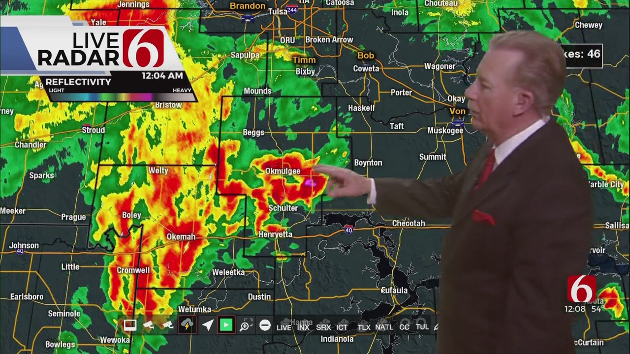
A strong upper-level trough will move into the area later tonight with strong winds aloft moving across central OK. A surface low along the Red River Valley will eject northeast with a dry line extending southward. Storms are likely to develop across southcentral OK along the advancing dry line by 7 p.m. and move eastward into the area tonight between 9 pm and 2 a.m. Better overlays for severe parameters will remain slightly south of the metro, but nearby. Primary threats will be hail and wind. The tornado threat, while not high, is not zero. A break may occur from 3 a.m. to 5 a.m. before the cold front and upper trough approach from the northwest bringing a few additional showers and gusty northwest winds. Temps will drop from the lower 50s into the upper 40s through the day.

The weekend looks good. Saturday feature sunshine and return of afternoon highs in the upper 60s to lower 70s. Southwest winds at 10 to 20 mph will be likely on top of a surface ridge of high pressure slightly south of the area. Our next strong upper-level system is located across the western U.S and the pressure gradient increases greatly Sunday with strong south winds from 20 to 35 mph into Monday as the storm system organizes to our west. Increasing low level flow support showers and storms developing Monday to the west and moving into the area by early afternoon and evening. Strong winds aloft could support the potential for strong to severe storms, but current threats seem to be focused near or south of the Red River at this point. This severe weather threat area could easily migrate north in subsequent forecast updates. The storm system should exit the area either Tuesday or Wednesday.

Thanks for reading the Thursday morning weather discussion and blog.
Have a super great day!
Alan Crone
KOTV

More Like This
March 18th, 2022
February 7th, 2024
October 21st, 2023
October 3rd, 2023
Top Headlines
December 13th, 2024
December 13th, 2024
December 13th, 2024
December 13th, 2024


