Gusty Winds Return Soon
Another sunny day is expected, but gusty winds and storm chances could soon be on the wayWednesday, April 27th 2022, 7:19 am
TULSA, Oklahoma -
Another sunny day is expected, but gusty winds and storm chances could soon be on the way
Here are the details from News On 6 Meteorologist Alan Crone:

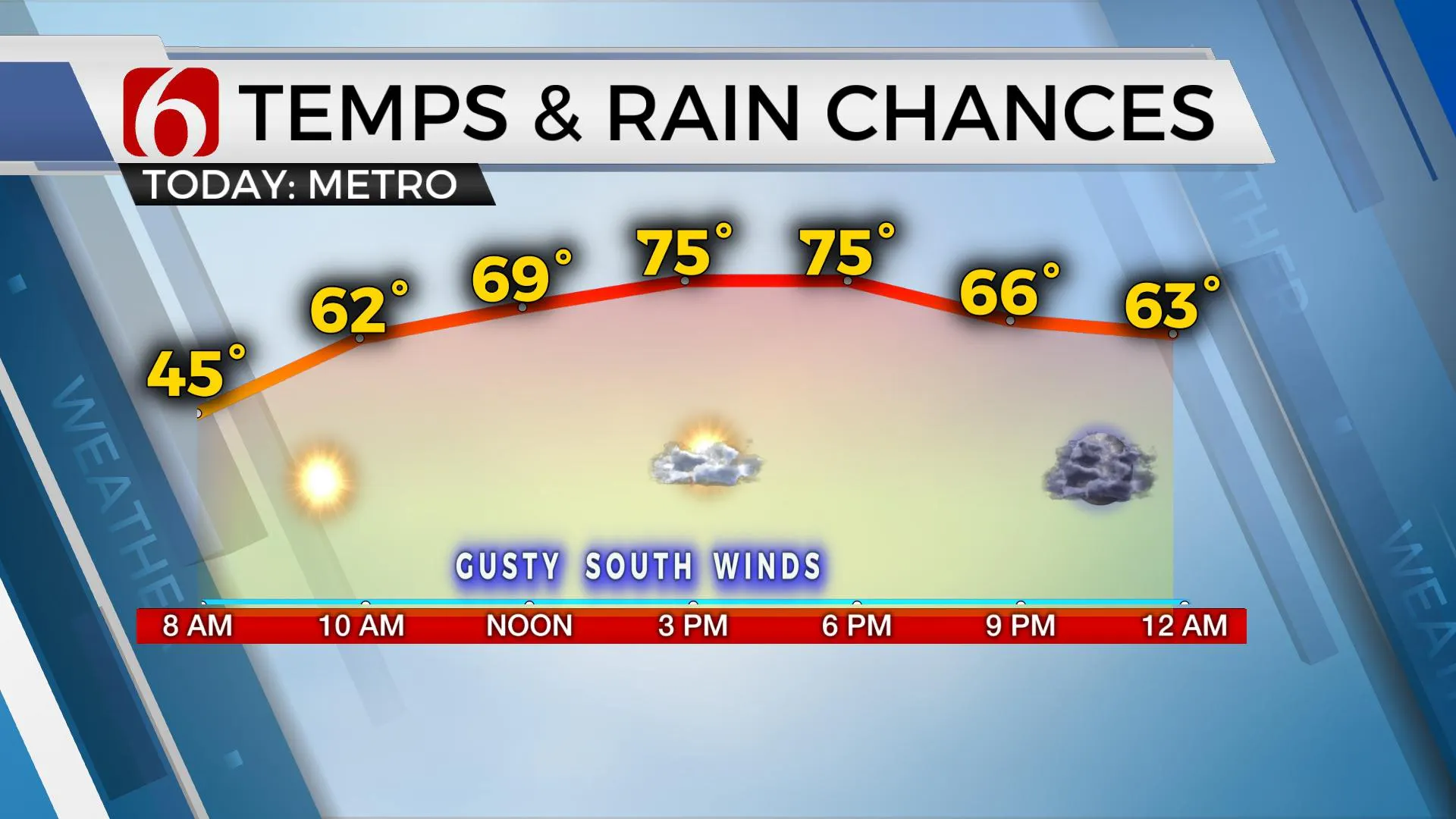
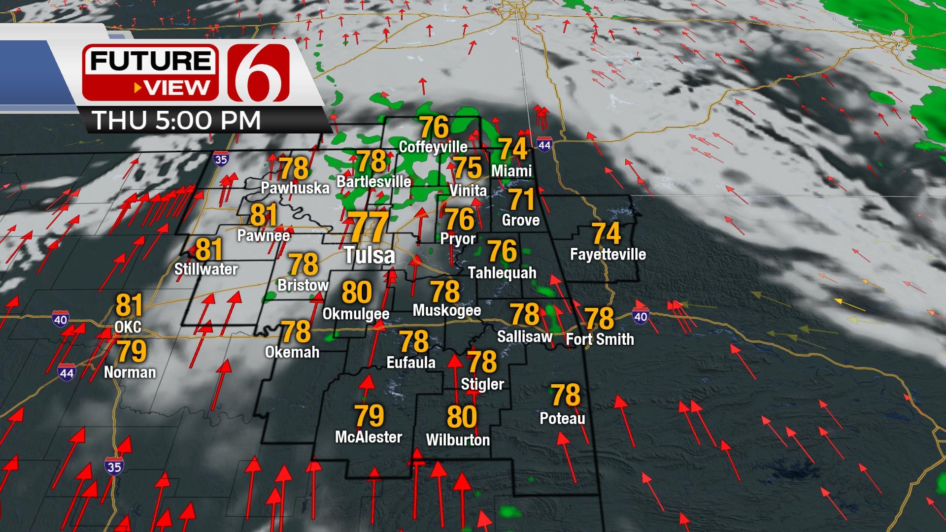
A surface ridge of high pressure will move away from the area on Wednesday with southeast winds returning from 15 to 25 mph. These gusty south winds will remain for the next few days with increasing speeds by the end of the week. High temps this afternoon will reach the mid-70s with a mostly sunny morning and increasing clouds by afternoon.

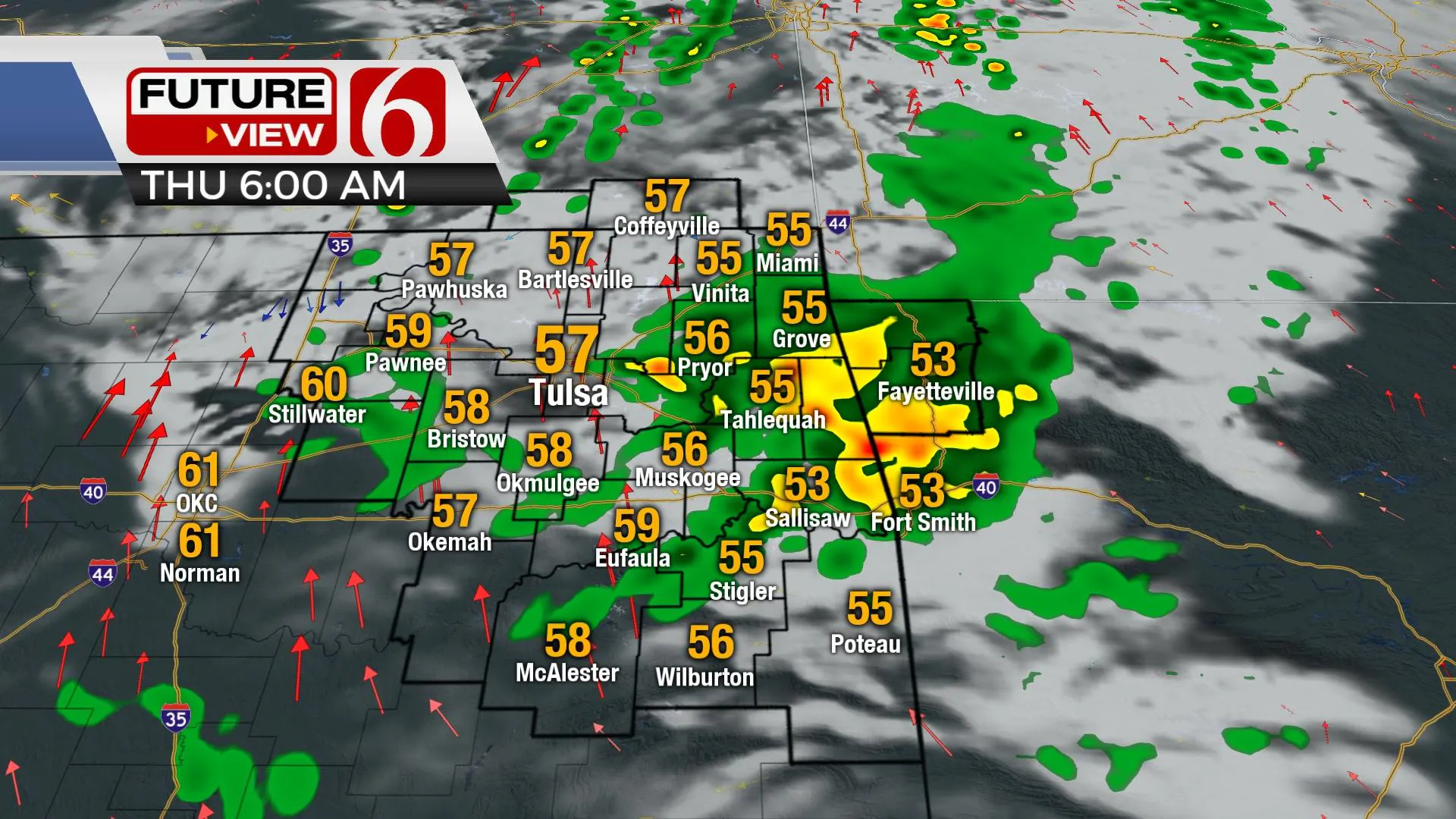
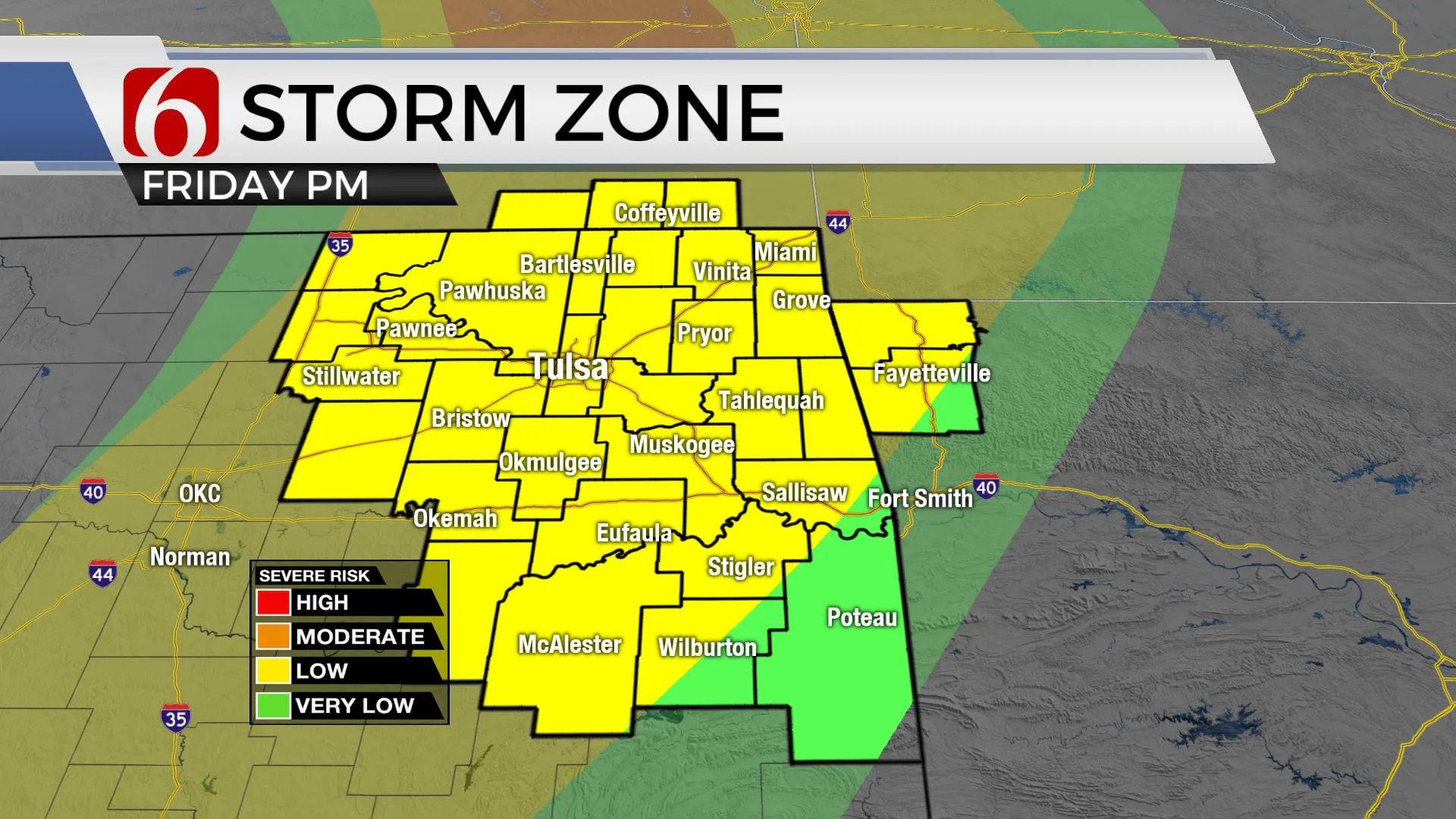
Several waves of instability will be nearing the area over the next few days bringing storm chances into the area. The first arrives overnight at early Thursday morning. The 2nd Thursday evening into early Friday, and the third Friday evening. Severe weather threats are mostly low or slightly west of the area for the early part of this active pattern. Friday afternoon and evening, severe weather threats will be increasing as stronger upper-level winds will arrive as low-level moisture flows into a developing storm system. A dry-line, frontal boundary is likely to develop near central OK Friday evening providing a focus for storm development by afternoon and evening. A layer or warm air aloft (the CAP) may suppress or limit convective development during this period. But if storms do form, the potential for significant severe weather threats will be in place, including the possibility of all modes of severe weather. The cap is stout in most but not all the data for this period. Friday evening the cold front will overtake the dry line and advance southeast. Most guidance supports some postfrontal storm development overnight as the front surges southeast. This typically results in elevated storm formation with a few storms producing hail as they move southeast weakening with time.

By Saturday morning a surface boundary should cross the metro and extend into southeastern OK where a few additional scattered storms will remain possible with pleasant conditions to the north. This same front is expected to return northward as a warm front Sunday evening into Monday morning with additional showers and storms developing Monday and possibly part of Tuesday. The data is highly inconsistent regarding specifics in the upper flow early next week and additional changes are likely for these periods from Monday evening into Tuesday.
Thanks for reading the Wednesday morning weather discussion and blog.
Have a super great day!
Alan Crone
KOTV
If you’re into podcasts, check out my daily weather update. Search for NewsOn6 and ‘Weather Out The Door’ on most podcast providers, including Spotify, Stitcher and Tune-In, or Click Here to listen on Apple Podcasts.
More Like This
April 27th, 2022
June 21st, 2023
June 19th, 2023
June 13th, 2023
Top Headlines
December 14th, 2024
December 14th, 2024
December 14th, 2024
December 14th, 2024


