Flood Watches, Severe Storm Chances
Early-morning showers and storms are underway on Tuesday.Tuesday, May 24th 2022, 5:31 am
TULSA, Oklahoma -
Early-morning showers and storms are underway on Tuesday.
Here are the details from News On 6 Meteorologist Alan Crone:

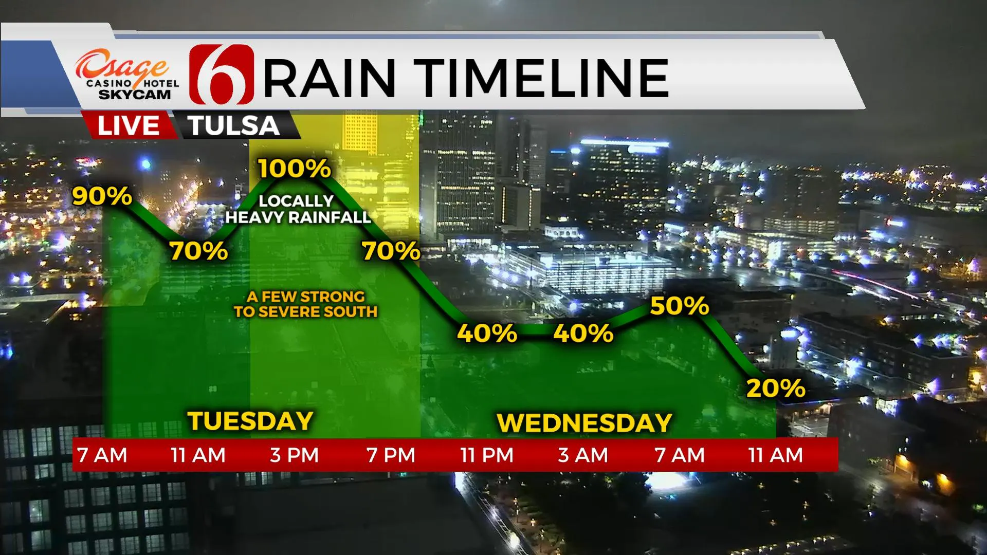
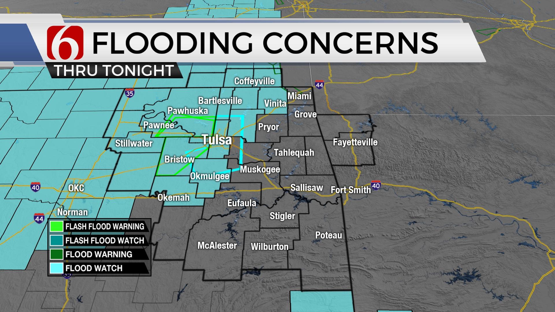
Additional storms are likely on Tuesday with at least two, possibly three separate waves impacting the area. The first is underway Tuesday morning, the second will be around midday, and the third, exiting Tuesday night. While locally heavy rainfall is likely with any of the activity today, it’s this midday to afternoon into the early evening that may bring severe weather threats into part of the area in the form of a squall line type feature from the west. The eventual severe weather threat depends upon the duration of precipitation Tuesday morning and the potential for any breaks that could allow surface instability to increase. Additional heavy rainfall is possible. A flood watch now includes the Tulsa metro and portions of northern OK. Some locations west of the metro have already received between 3 to 5 inches of rain during the last 24 hours. Severe threats will be nearing the area as early as the noon hour and moving across far southeastern OK into north TX early evening. Primary threats will be damaging wind, a low tornado threat will exist.

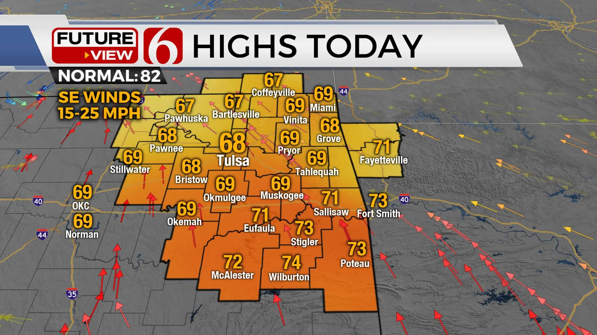
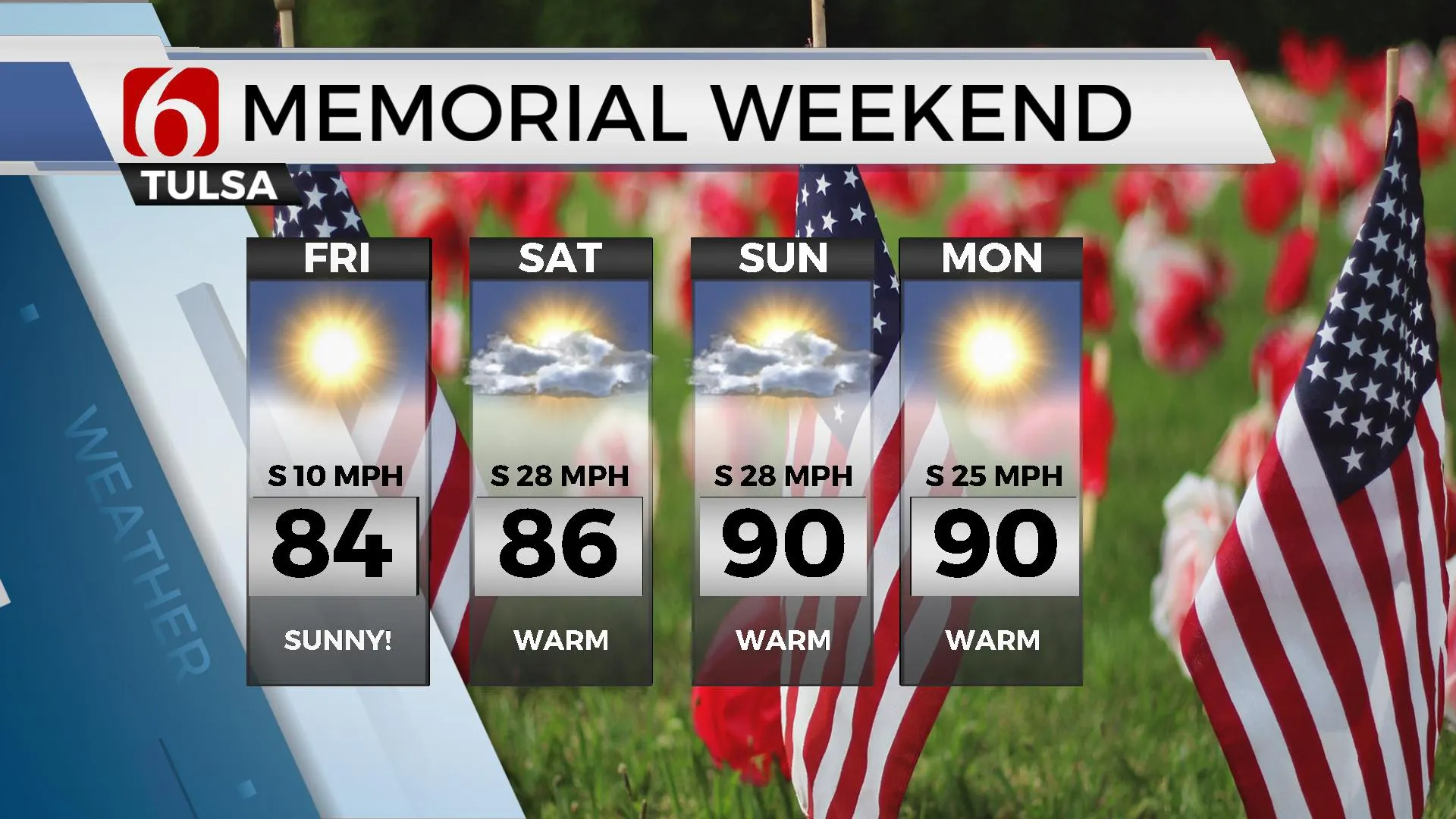
A cold front will enter northwestern Oklahoma later Tuesday and progress east. As this front clears the area later Tuesday night, the threat of heavy rainfall and severe weather should shift eastward. But the main upper-level trough will continue across northern OK and southern Kansas Wednesday before moving east Thursday. The slower speed of the system will encourage us to keep some light shower chances in the forecast for part of Wednesday. This will also keep temps on the cool side, below seasonal averages. Once this low moves east, temps are expected to respond into the 70s Thursday and mid 80s Friday. This weekend features highs in the mid to upper 80s Saturday and near 90 Sunday. Low level moisture will be streaming into the area with breezy to strong south winds from 20 to 30 mph. Heat index values will be noticeable this weekend. A weak disturbance could swing across the state Saturday capable of producing a few scattered storms, but the overall probability remains low for now.

Thanks for reading the Tuesday morning weather discussion and blog.
Have a super great day!
Alan Crone
KOTV
If you’re into podcasts, check out my daily weather update. Search for NewsOn6 and ‘Weather Out The Door’ on most podcast providers, including Spotify, Stitcher and Tune-In, or Click Here to listen on Apple Podcasts.
More Like This
May 24th, 2022
June 21st, 2023
June 19th, 2023
June 13th, 2023
Top Headlines
December 12th, 2024
December 12th, 2024
December 12th, 2024


