

Active Weather Pattern Remains
Another round of early-morning storms is possible on Wednesday, chances diminish during the afternoon.Wednesday, June 8th 2022, 5:18 am
TULSA, Oklahoma -
Another round of early-morning storms is possible on Wednesday, chances diminish during the afternoon.
Here are the details from News On 6 Meteorologist Alan Crone:

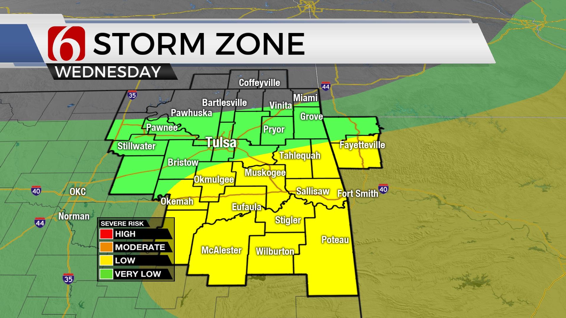
Storm chances will continue across part of northeastern and east central OK this morning. Damaging wind potential with be possible in a few severe storms along with very heavy rainfall for some, but not all locations. Please remain aware of your weather surroundings for the next few hours. Conditions will improve into early afternoon with highs rebounding into the lower 80s. A few storms may occur Thursday morning across the southern sections, but higher chances are expected to arrive again late Thursday evening into early Friday morning as another complex of storms arrives from Kansas with additional severe weather threats. A surface front is expected to move across at least northern OK Friday evening bringing slightly drier air across the state through Saturday midday. But a mid-level ridge of high pressure will build from the southwestern U.S. into part of the southern plains early next week with increasing heat and humidity. The ridge should keep most of the active storm chances to our north. Afternoon highs will reach the lower 90s early next week with heat index values near or above 100.

A boundary is pushing across southern Kansas this morning and should move south into northeastern OK later today. Several overnight clusters of storms, still underway in a few spots near the area this morning may also have some impact on additional storm development later this morning. Abundant low-level moisture remains in place and some storms will be highly effective rainfall producers this morning through midday. Any organized forcing or combination of any mesoscale convective influences may increase severe weather threats in some locations. Most of the storm activity will be exiting the area early afternoon. A few storms may redevelop overnight, mostly across the I-40 corridor into southeastern OK. Training of cells may produce some locally heavy rainfall in a few locations.

Thursday evening another complex of storms is likely to develop across the central plains and will move southeast into part of Oklahoma with severe weather threats. The exact trajectory of the system is not consistent in the data, but we continue with a decent probability for northeastern sections.
As the mid-level ridge attempts to expand this weekend, there may still be a very small window for a few storms across extreme northeastern OK Saturday night or Sunday morning, but this chance remains low.
Temps will increase Sunday into early next week with increasing heat index values.

Thanks for reading the Wednesday morning weather discussion and blog.
Have a super great day!
Alan Crone
KOTV
If you’re into podcasts, check out my daily weather update. Search for NewsOn6 and ‘Weather Out The Door’ on most podcast providers, including Spotify, Stitcher and Tune-In, or Click Here to listen on Apple Podcasts.

Get The Daily Update!
Be among the first to get breaking news, weather, and general news updates from News on 6 delivered right to your inbox!
More Like This
June 8th, 2022

June 21st, 2023

June 19th, 2023

June 13th, 2023
Top Headlines

December 11th, 2024

December 11th, 2024

December 11th, 2024

December 11th, 2024