Warmer Weather Gradually Returning
More hot weather is on the horizon as cooler temperatures exit Green Country.Tuesday, June 28th 2022, 7:01 am
TULSA, Oklahoma -
More hot weather is on the horizon as cooler temperatures exit Green Country.
Here are the details from News On 6 Meteorologist Alan Crone:

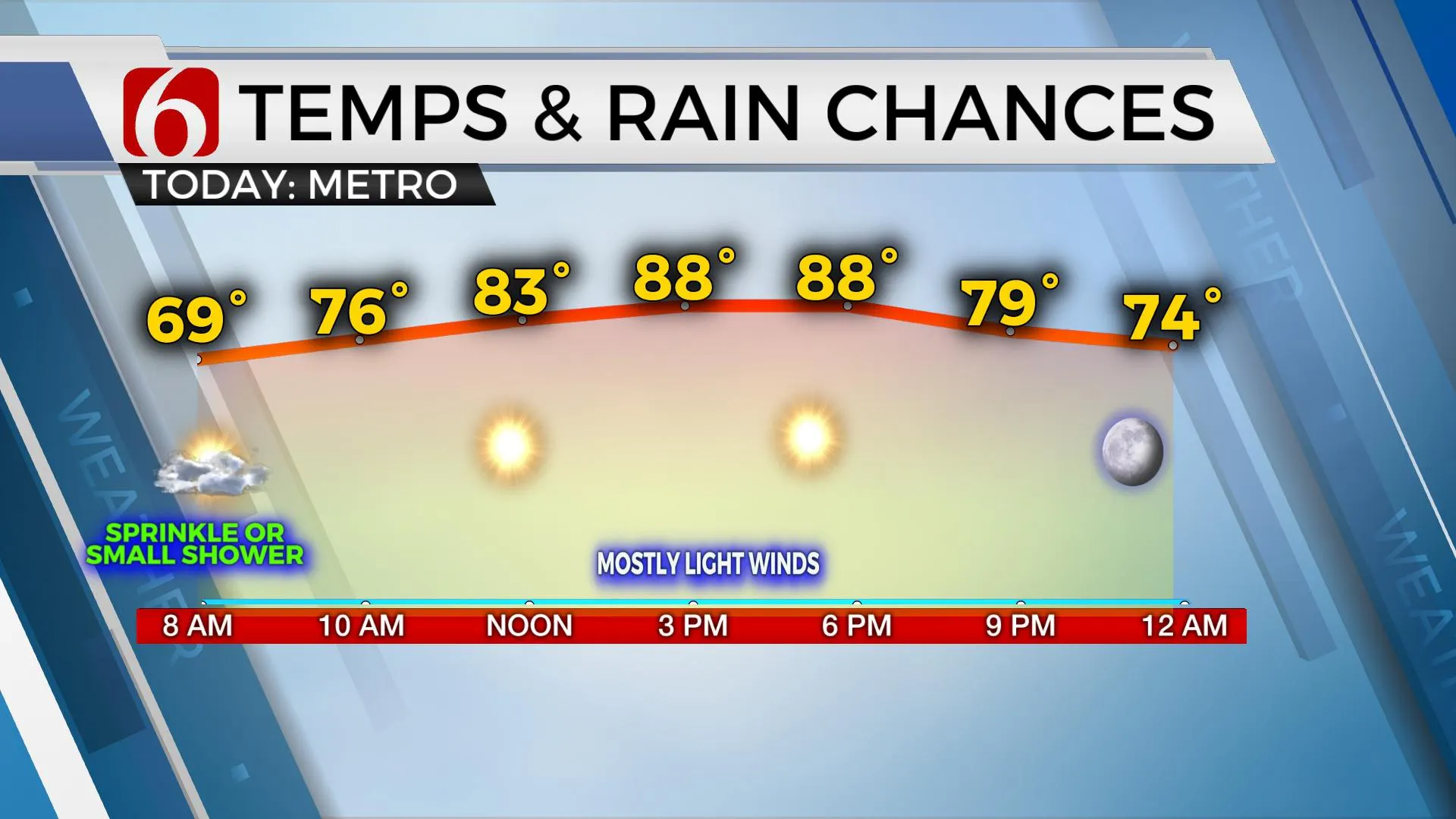
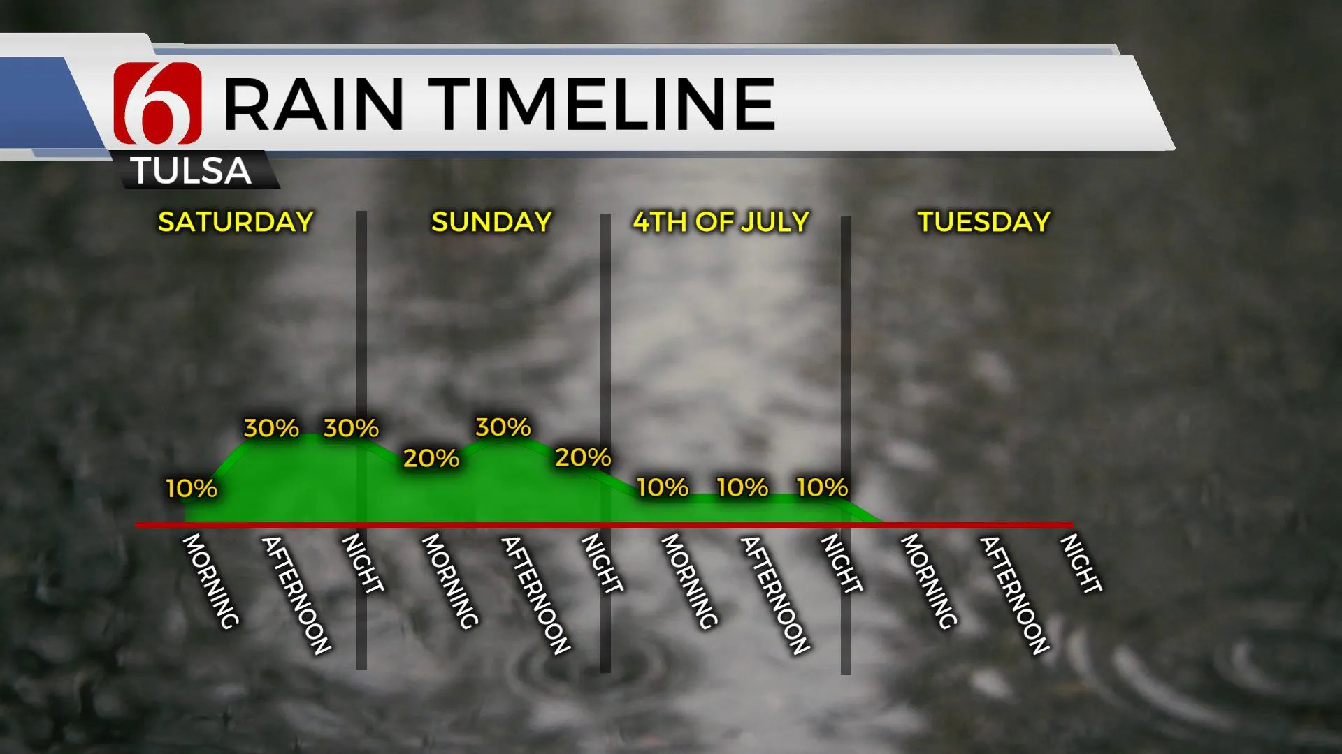
A weak upper-level wave is traversing the area from the northwest to southeast on Tuesday morning providing some clouds and even a couple of small showers and sprinkles. No measurable precipitation is expected. This will be exiting quickly with sunshine and highs in the mid to upper 80s for the day. Our next chance for scattered storms will arrive late Friday evening into the extended 4th of July weekend. Most of the activity will be exiting the area early Monday, but we'll keep a mention for a few scattered storms on the 4th. Mild weather will today before deeper moisture and warmer weather returns into the end of the week.

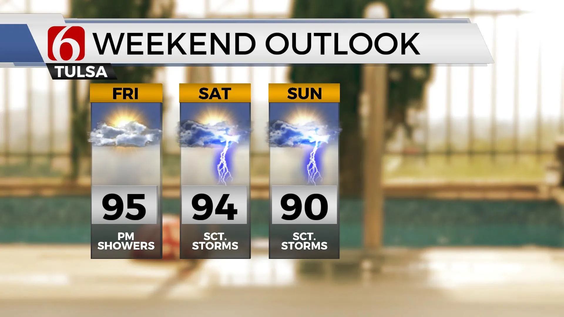
Temps are cool this morning with most locations in the mid-60s. Afternoon highs will reach the mid to upper 80s this afternoon with decreasing clouds, sunshine, and variable winds from 5 to 15 mph. South winds return later this afternoon and will continue into the latter half of the week as daytime highs reach the lower to mid-90s Thursday and Friday. Heat index values will also return near or over 100 Thursday and Friday.

A tropical like disturbance is developing upon the Texas coastal region and is expected to move north over the next few days bringing scattered storms near and east of the system. The exact trajectory is not consistent, but the overall trend in the data supports mentions for part of the weekend. The EURO is taking most of this system to our east with little impacts. The GFS is more west and would bring scattered storms into the area. Our forecast is a blend of the two until confidence on the exact track firms up. Meanwhile to our north, a strong upper-level system is forecast to move across the northern high plains into the Great Lakes and bring a weak frontal boundary south into southern Kansas and northern OK this weekend with a few scattered storms. By Sunday evening into Monday, both features should lose influence as a mid-level ridge of high pressure briefly strengths across the state with increasing heat and humidity early next week.
Thanks for reading the Tuesday morning weather discussion and blog.
Have a super great day!
Alan Crone
KOTV
If you’re into podcasts, check out my daily weather update. Search for NewsOn6 and ‘Weather Out The Door’ on most podcast providers, including Spotify, Stitcher and Tune-In, or Click Here to listen on Apple Podcasts.
More Like This
June 28th, 2022
June 21st, 2023
June 19th, 2023
June 13th, 2023
Top Headlines
December 14th, 2024
December 14th, 2024
December 14th, 2024
December 14th, 2024


