Gusty Winds Return Before The Next Cold Front
Parts of the state could see some showers on Tuesday before the next cold front arrives.Tuesday, October 11th 2022, 8:01 am
Parts of the state could see some showers on Tuesday before the next cold front arrives.
Here are the details from News On 6 Meteorologist Alan Crone:

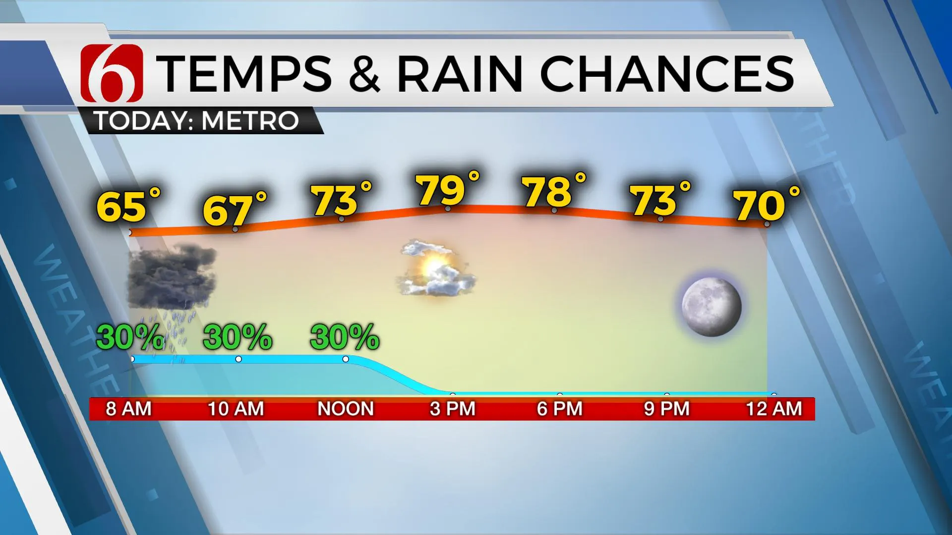
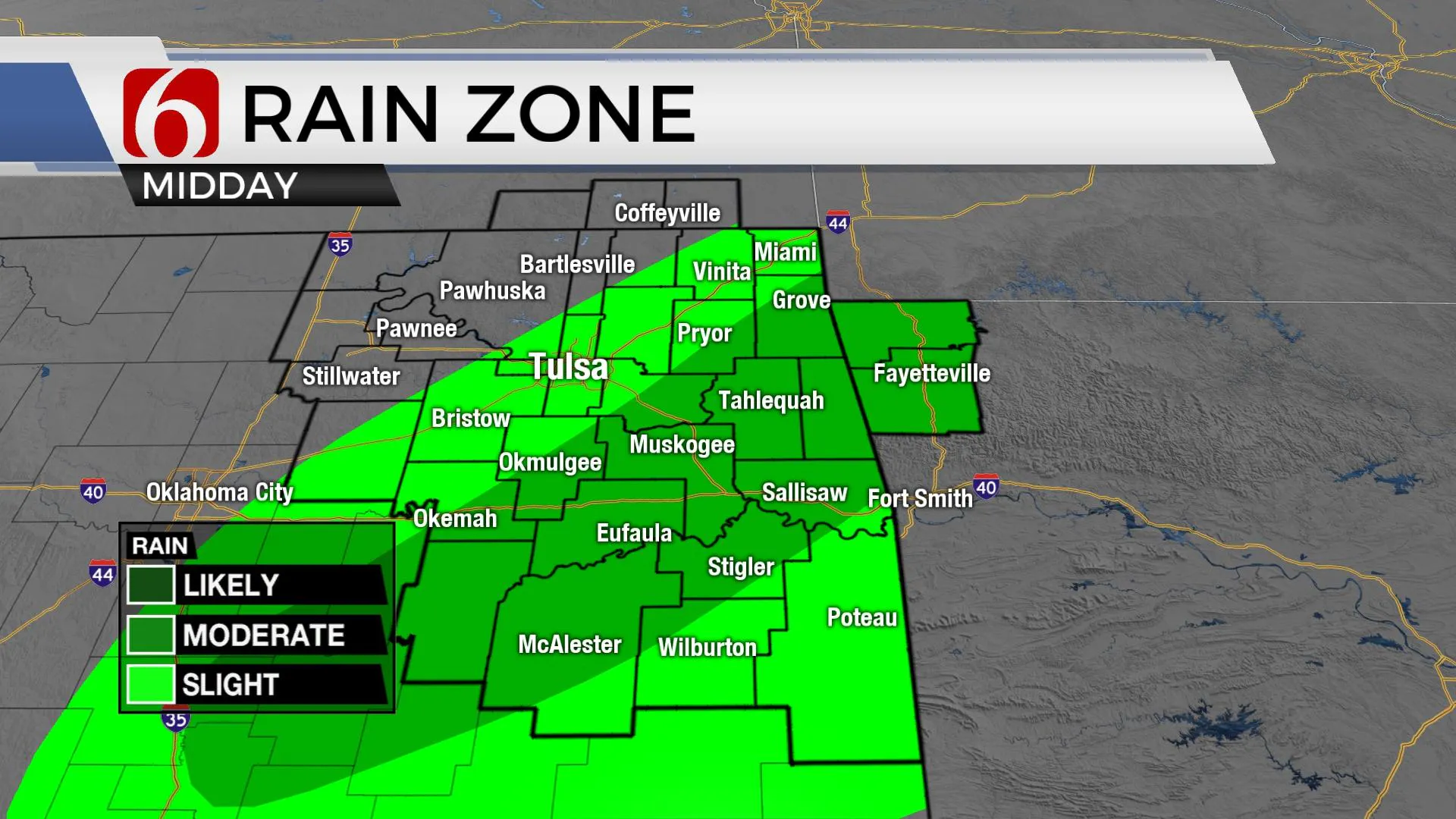
TULSA, Okla. - A weak disturbance moving across part of the area Tuesday morning will have the potential to produce some scattered showers and storms, but not for all locations. Activity that does develop should exit the area by mid-day. In the wake of this system, gusty southwest winds at 20 to 30 mph will be possible. Areas that have received little rainfall will experience increasing fire danger issues. Afternoon temperatures are expected to move into the upper 70s and lower 80s across the eastern half of the area. Another front will enter our area late tonight and sweep across Northeastern Oklahoma early Wednesday morning. A layer of warm air loft may initially limit scattered showers and storms ahead of the boundary this evening, but some thunderstorm activity seems possible near or behind the boundary across part of far northeastern Oklahoma early Wednesday morning. Latest trends support most of this activity slightly east of the metro. Any storm activity should quickly exit the area bringing gusty north winds and high temperatures Wednesday in the 70s north and 80s south. Fire spread rates will continues behind the system Wednesday with breezy north winds at 15 to 25 mph and persisting Thursday at 10 to 20 mph.

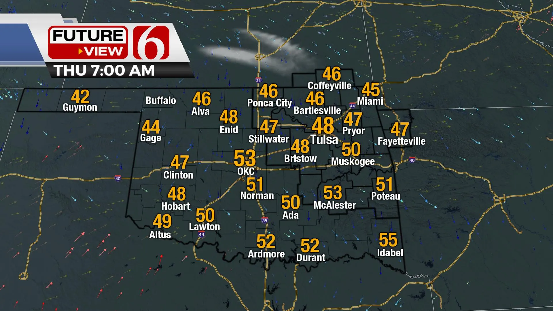
Behind the departing system, cooler weather will prevail across Eastern Oklahoma Thursday and Friday. Morning low temps in the 40s will be followed with afternoon highs Thursday in the upper 70s, and near 80 Friday. After another robust warm-up Saturday, another system quickly nears the state with a chance for storms Saturday evening and early Sunday morning. Data is inclusive, but the potential for a few strong to severe storms may be possible with the initial boundary late Saturday evening across part of Eastern Oklahoma.

Some extended data bring another shot of cooler weather across the country early next week. While most of this colder weather will remain north, the potential is growing for cooler weather across by the early part of next week which would drop highs in the 60s and morning lows, possibly in the upper 30s.
Thanks for reading the Tuesday morning weather discussion and blog.
Have a super great day!
Alan Crone
KOTV
More Like This
October 11th, 2022
June 21st, 2023
June 19th, 2023
June 13th, 2023
Top Headlines
December 15th, 2024
December 15th, 2024
December 15th, 2024
December 15th, 2024


