

Strong To Severe Thunderstorm Chances Return Friday
A windy and partly-cloudy Thursday is expected before shower and storm chances return to Green Country on Friday.Thursday, November 3rd 2022, 7:40 am
TULSA, Okla. -
If you’re into podcasts or in a rush, check out my daily weather update. Search for NewsOn6 and ‘Weather Out The Door’ on most podcast providers, including Spotify, Stitcher and Tune-In, or Click Here to listen on Apple Podcasts.
TULSA, Okla. - It is a windy and partly-cloudy Thursday before shower and storm chances return to Green Country on Friday.
Here are the details from News On 6 Meteorologist Alan Crone:

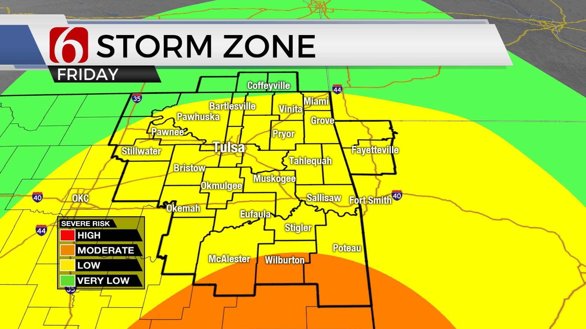
Gusty south winds will roll across the area on Thursday with speeds from 15 to 30 mph. Mostly to partly cloudy conditions will prevail with highs in the lower or mid-70s. A few small passing showers may develop across the area this evening as low-level moisture streams across Texas into Oklahoma but measurable precip is not expected. Thunderstorms will be likely Friday, including the threat of strong to severe storms in some locations. Locally heavy rainfall is also possible as the system moves across the area Friday afternoon and exiting early evening.

The strong trough is moving across the intermountain region this morning and will eject strong upper-level winds around the base of this system later tonight and Friday. A surface front and dry line to our west will be a focus for initial thunderstorm development later tonight into pre-dawn Friday, mostly across the panhandle to northwestern Oklahoma. A few of these severe storms will move east early Friday morning nearing the I-35 corridor at midday. Strong upper-level winds will continue to lift the atmosphere with additional scattered storms developing from north Central Texas into south central Oklahoma. midday to early afternoon. As the dry line and cold front surge east, additional storms are likely, mainly in the form of a squall line moving from the west to east across the area by Friday afternoon. Any storms developing ahead of the line, especially across southeastern OK and northeast Texas could become super cellular producing all modes of severe weather. The main threat from the squall line feature will be damaging winds, but strong shear along the leading edge is likely and may lead to brief spin-ups in in a few cells. These types of storms, commonly referred to as Quasi Linear Convective systems ( QLCS), can produce fast developing tornadoes. Most of these types of tornadoes are usually weak but can cause damage. If surface instability is higher than currently anticipated, severe threats may also increase as the line enters the highway 69 corridor region and along and south of I-40. Severe weather threats will extend northward, including the Tulsa metro.

The timing of the system continues to speed up compared to previous data. It’s possible this system may exit the metro around 6 p.m. to 7 p.m. and exit eastern Oklahoma. around 9 p.m. The possibility of a few leftover showers behind the system remains very low for Saturday morning and we’ve reduced these probabilities. We think most of the weekend will be dry. Saturday features highs in the 60s with gusty west to southwest winds. Sunday afternoon should reach the lower to mid-70s.

The data is not concise with a system for next week. We may need to re-insert some low probabilities for showers and storms late Monday night into Election Day as a small disturbance influences the area. The next surface cold front may still not move across the area until later next week when much cooler, even colder air arrives.
Thanks for reading the Thursday morning weather discussion and blog.
Have a super great day!
Alan Crone
KOTV

Get The Daily Update!
Be among the first to get breaking news, weather, and general news updates from News on 6 delivered right to your inbox!
More Like This
November 3rd, 2022

June 21st, 2023

June 19th, 2023

June 13th, 2023
Top Headlines

December 11th, 2024

December 11th, 2024
December 11th, 2024

December 11th, 2024