

Breezy South Wind Returns
Another warm-up is underway across Green Country on Monday.Monday, January 9th 2023, 7:04 am
If you’re into podcasts or in a rush, check out my daily weather update. Search for NewsOn6 and ‘Weather Out The Door’ on most podcast providers, including Spotify, Stitcher and Tune-In, or Click Here to listen on Apple Podcasts.
Another warm-up is underway across Green Country on Monday.
Here are the details from News On 6 Meteorologist Alan Crone:

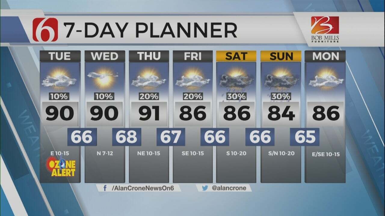
TULSA, Okla. - A series of upper-level systems will move across the central U.S. over the next several days. The lack of significant low-level moisture ahead of these features will initially keep shower and storm chances either mostly east or low in probabilities. One such system passes later Monday night, another Wednesday evening into Thursday morning, and yet another this weekend. This pattern could continue through the end of the month. Each of these systems in the short term will bring strong to severe thunderstorm threats across the southeastern U.S region while bringing some wintry weather impacts across the central plains to upper Midwest. While some occasional changes in sensible weather will occur with each system, no major cold air intrusions are likely.

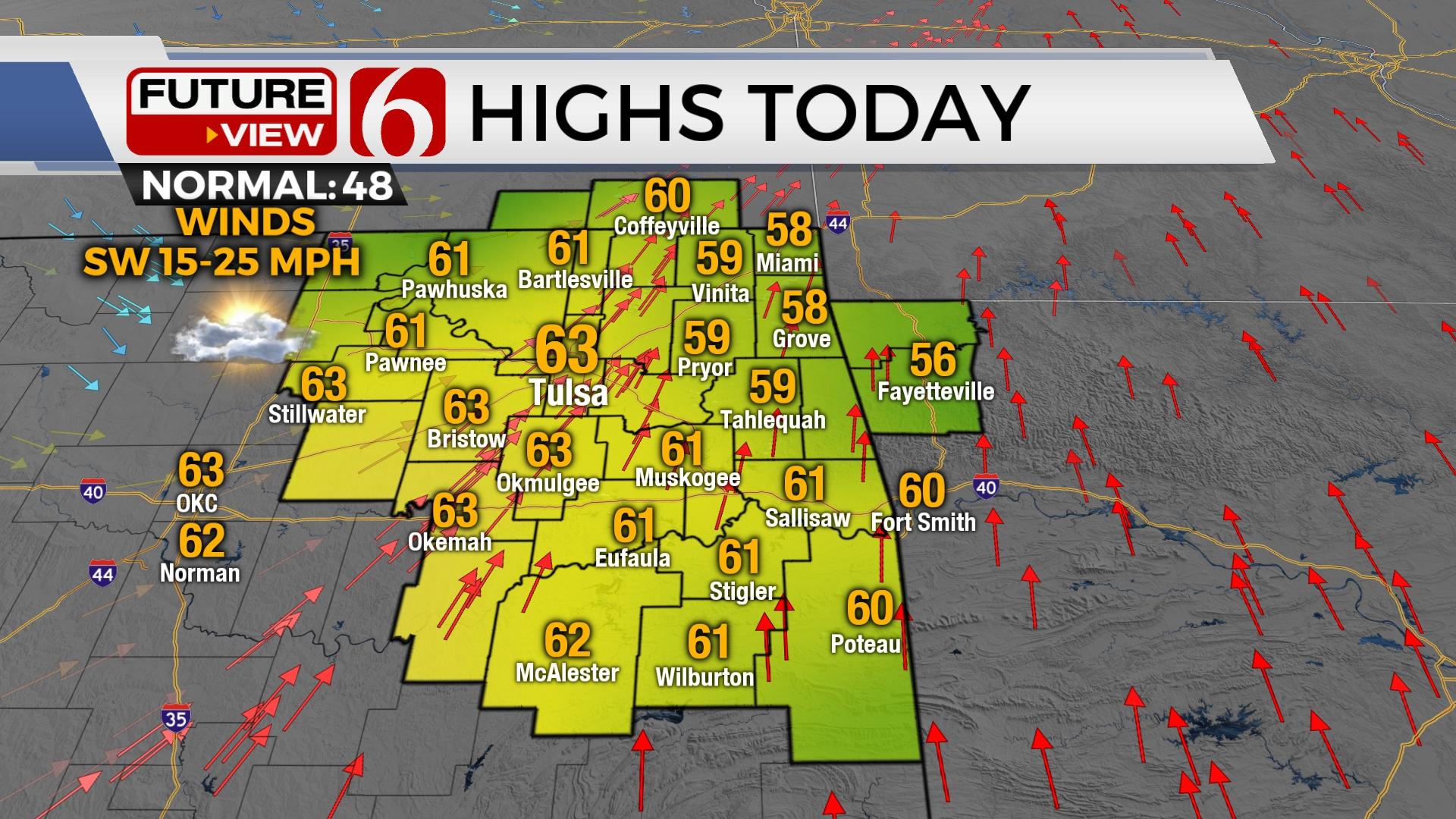
Highs today will reach the lower 60s with increasing southwest winds from 15 to 30 mph. A sunshine and cloud mix will be likely. The first system passes quickly across the northern region tonight and brings a weak cold front across the area early Tuesday before becoming diffuse. South winds will quickly return Tuesday into Wednesday as the next stronger wave approaches from the west. Low level moisture will attempt to return across the area but will be focused across extreme eastern Oklahoma where a few showers or storms may fire-up late Wednesday evening as the cold front enters the area. A few of these storms may become strong to severe across far southeastern Oklahoma into western Arkansas. Colder air will arrive across the central plains with a minor intrusion into northeastern Oklahoma. Blustery north winds and cooler weather sticks around Thursday before the next stronger system nears early next week. Before this system arrives, we’ll return to gusty south winds and above normal temperatures for the weekend.

Thanks for reading the Monday morning weather discussion and blog.
Have a super great day!
Alan Crone
KOTV

Get The Daily Update!
Be among the first to get breaking news, weather, and general news updates from News on 6 delivered right to your inbox!
More Like This
January 9th, 2023

July 3rd, 2023

June 8th, 2023
June 6th, 2023
Top Headlines

December 15th, 2024

December 15th, 2024

December 14th, 2024
