Winter Returns To Green Country
Cold and windy weather makes a return on Thursday after days of above-average temperatures.Thursday, January 12th 2023, 7:32 am
If you’re into podcasts or in a rush, check out my daily weather update. Search for NewsOn6 and ‘Weather Out The Door’ on most podcast providers, including Spotify, Stitcher and Tune-In, or Click Here to listen on Apple Podcasts.
TULSA, Okla. - Cold and windy weather makes a return on Thursday after days of above-average temperatures.
Here are the details from News On 6 Meteorologist Alan Crone:

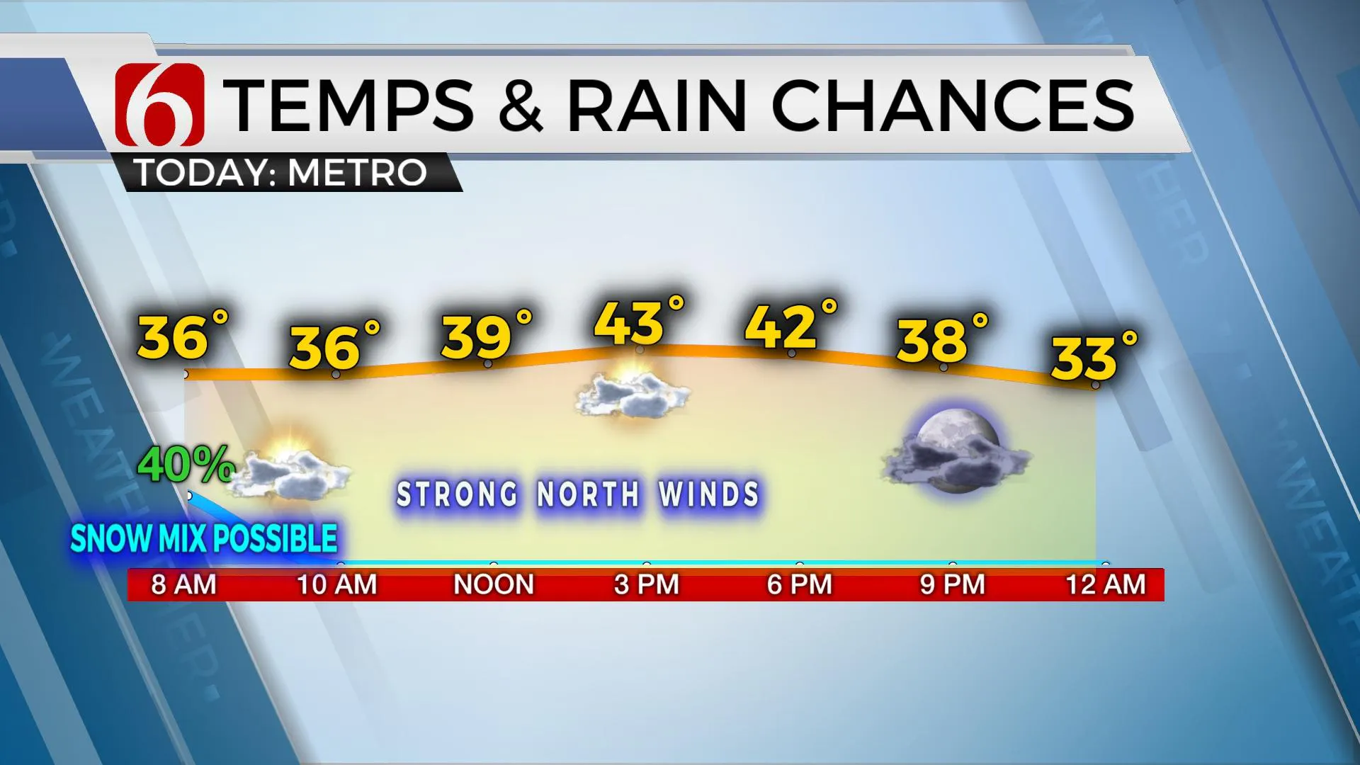
Blustery winds and below-normal temperatures will cover all the state on Thursday as a powerful storm system pulls away from the area. Some rain and snow showers may still occur early Thursday morning for a few locations, including the Tulsa metro, before quickly ending. The active upper air pattern is expected to remain across the plains for the foreseeable future.

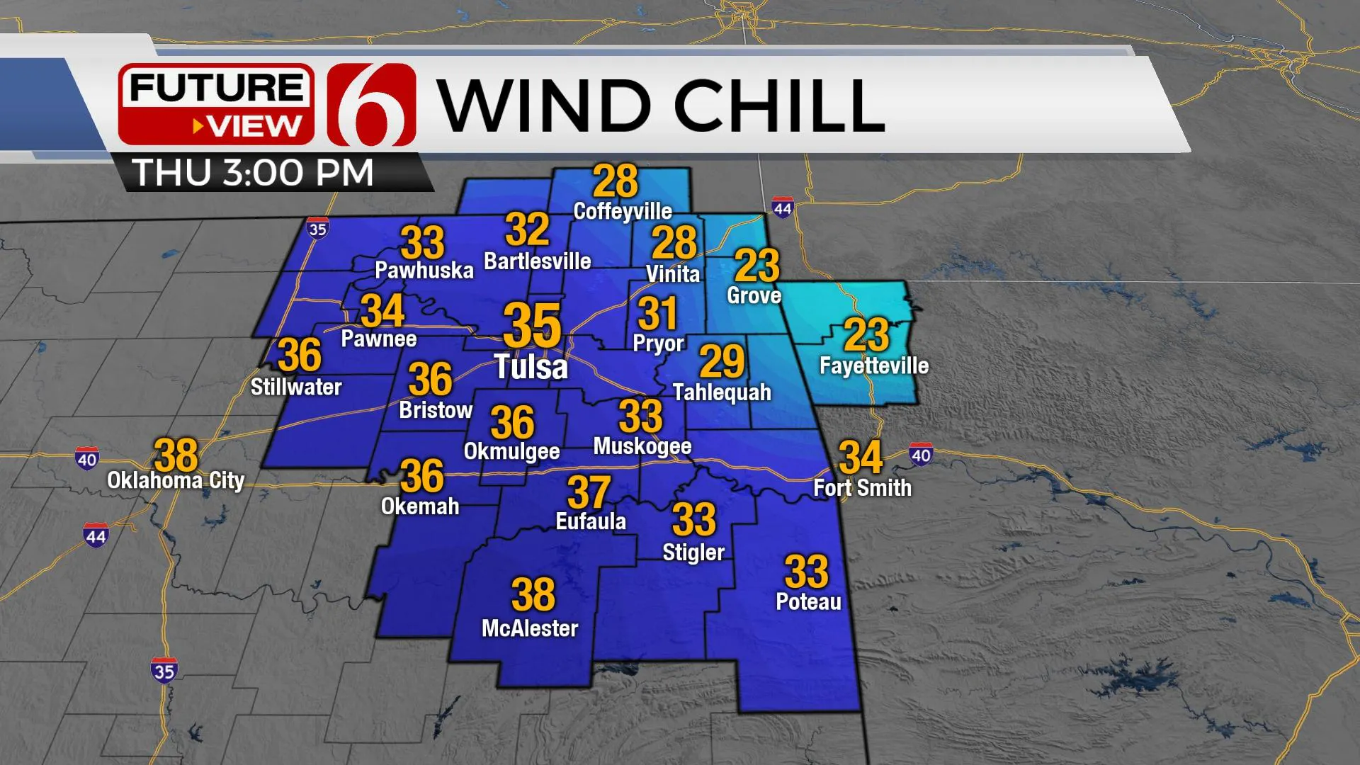
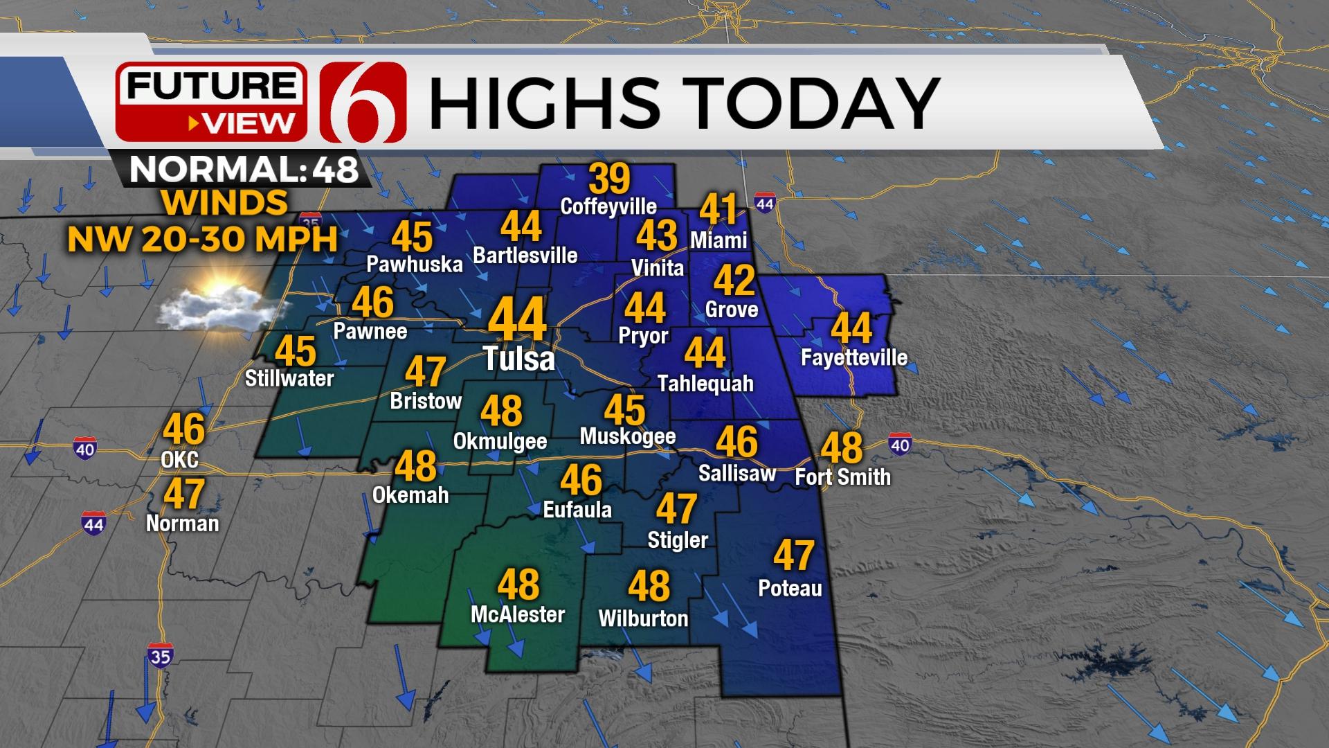
The strong cold front is exiting southeastern Oklahoma early this morning with blustery and colder weather underway across most of the state. The backside of the storm system will produce a mixture of showers changing to snow across southeastern Kansas, northern Oklahoma, northwestern Arkansas, and southern Missouri for the next few hours. The fast progression of this system should alleviate any travel impacts. But if precipitation rates increase, a very quick dusting of snow is possible with this system. By 8am to 10am, most of this will be moving out of our area with clouds clearing from the west to east by midday to afternoon. Gusty northwest winds from 20 to 30 mph remain this morning and begin to ease later this afternoon. Highs will only reach the lower to mid-40s. Wind chill values will drop into the twenties this morning. The cold snap sticks around Friday but will quickly moderate with gusty south winds returning Saturday afternoon and stronger south winds Sunday. Afternoon highs will reach the mid to upper 50s Saturday: the mid-60s Sunday and nearing the mid to upper 60s Monday as another fast-moving system brushes the state. A few showers or storms will be possible with this system, but once again, higher chances may remain across extreme eastern sections where better low-level moisture is expected. Another system nears Wednesday with increasing probabilities for showers and storms.

Thanks for reading the Thursday morning weather discussion and blog.
Have a super great day!
Alan Crone
KOTV
More Like This
January 12th, 2023
June 21st, 2023
June 19th, 2023
June 13th, 2023
Top Headlines
December 14th, 2024
December 14th, 2024
December 14th, 2024
December 14th, 2024


