Back To Colder Weather
Chilly temperatures return to Green Country on Thursday after some Wednesday showers.Thursday, January 19th 2023, 6:53 am
If you’re into podcasts or in a rush, check out my daily weather update. Search for NewsOn6 and ‘Weather Out The Door’ on most podcast providers, including Spotify, Stitcher and Tune-In, or Click Here to listen on Apple Podcasts.
TULSA, Okla. - Chilly temperatures return to Green Country on Thursday after some Wednesday showers.
Here are the details from News On 6 Meteorologist Alan Crone:
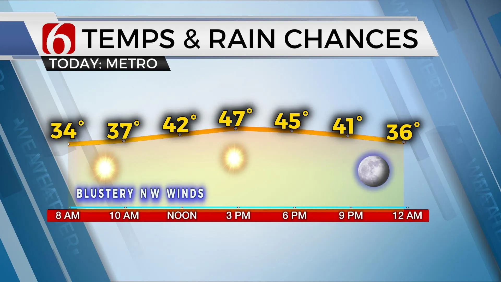
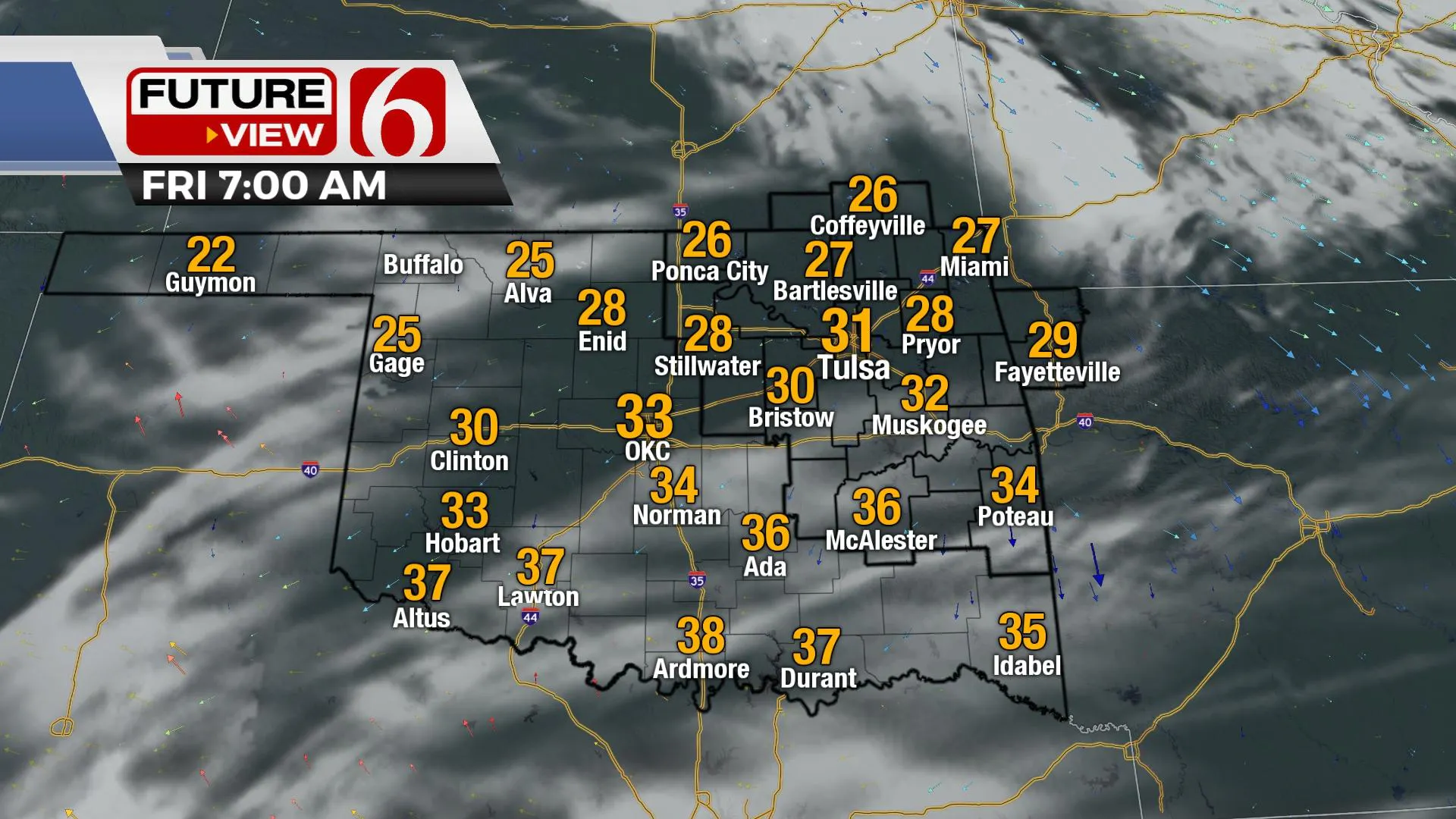
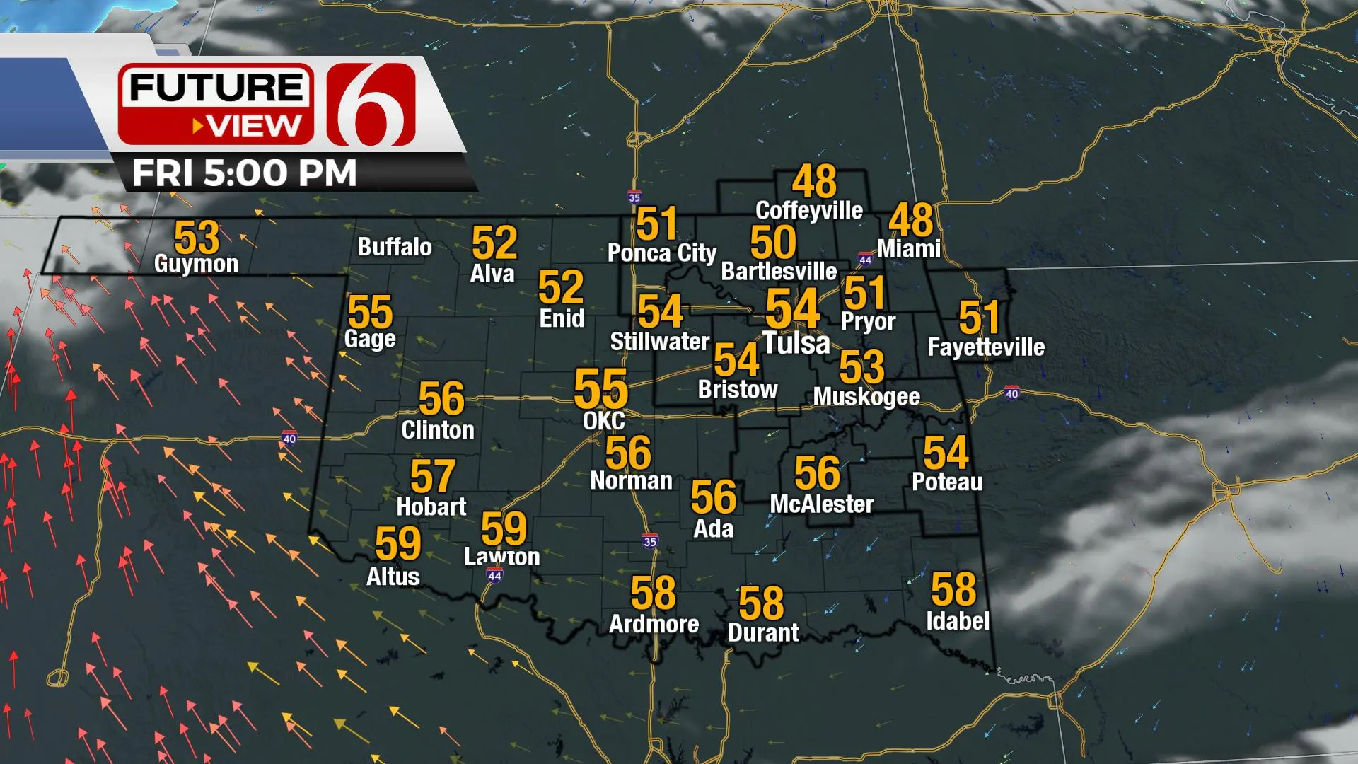
Blustery northwest winds at 15 to 25 mph will keep things on the chilly side on Thursday with afternoon highs reaching the upper 40s and lower 50s. Mostly sunny conditions are likely after a few morning clouds skirt northern sections of the state. Friday brings another mild day with frosty morning temps in the 20s before afternoon highs reach the lower to mid-50s. Colder weather returns this weekend into next week along with two storm systems impacting part of the area.
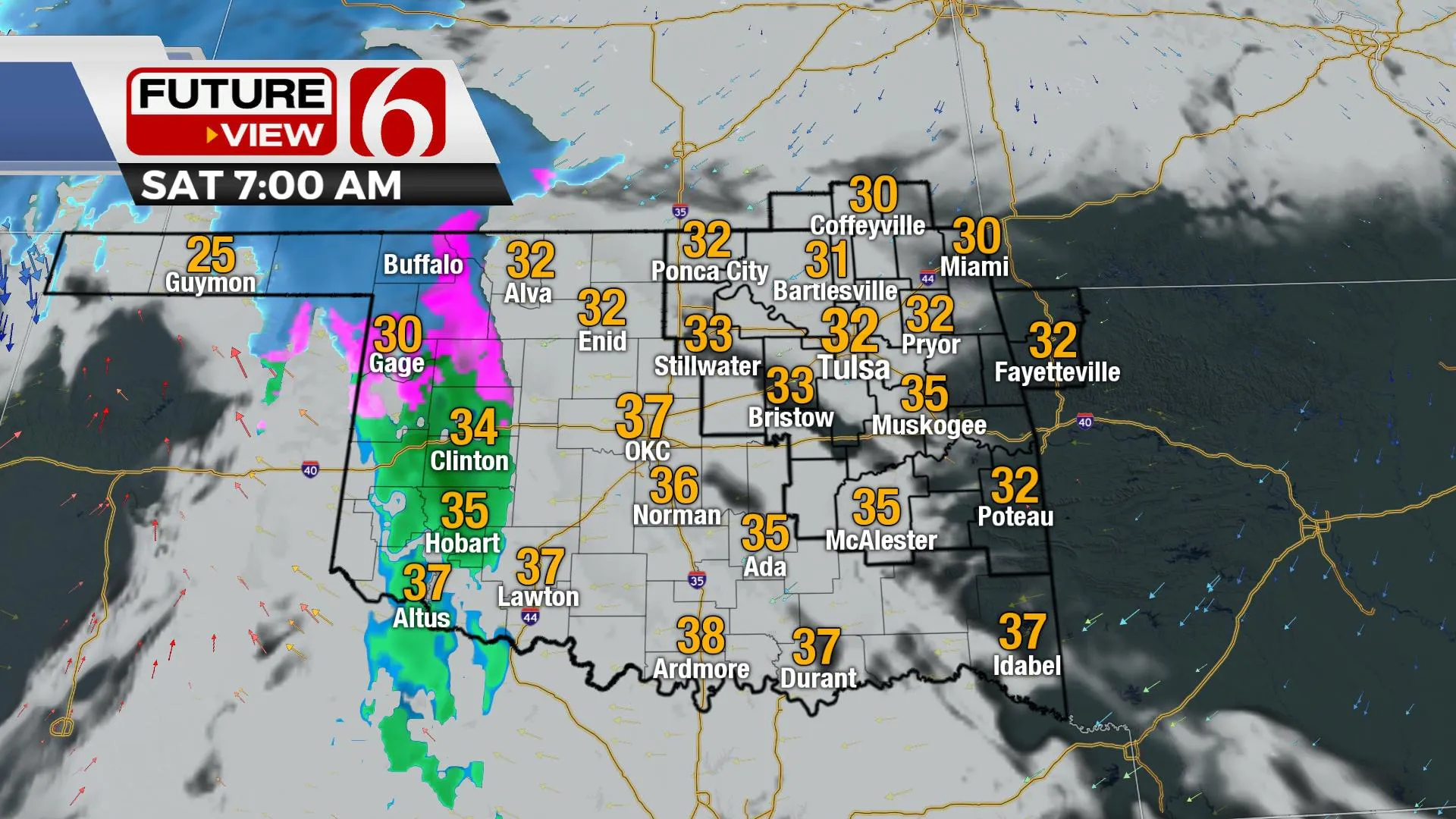
The next upper-level wave will quickly drop out of the western U.S. and move almost due east across northern OK and southern Kansas Saturday. A rather potent upper-level low is initially expected Friday just west of our area but should open or weaken slightly as it travels east Saturday evening. As evacuation of mass occurs in the mid-levels, a surface area of low pressure will develop and move eastward Saturday evening and exit our region Sunday morning to midday. Regarding northeastern OK, some showers will develop Saturday afternoon with southeast winds flowing into the system. Temps will remain in the 40s during the afternoon, but as the colder air aloft approaches, some column cooling will occur, and temps will drop. It's this period of mostly late Saturday evening that could support some light mix or snow for a very small part of the area. We'll keep some mentions near the metro and the highway 412 corridor, but this chance remains very low. Temps will drop to near freezing Sunday morning and reach afternoon highs in the mid to upper-40s. The next, and stronger storm system will quickly approach the area early next week with additional cold air and wintry weather possibilities.
The track differences in the global models for next week are significant. The overall trend is for colder weather with some wintry precipitation possibilities. A consensus supports a mention for snow with colder weather but does not lend any confidence to amounts at this point in the forecast process. As we draw closer, model and observational data will reveal the important information.
Thanks for reading the Thursday morning weather discussion and blog.
Have a super great day!
Alan Crone
KOTV
More Like This
January 19th, 2023
July 3rd, 2023
June 8th, 2023
June 6th, 2023
Top Headlines
December 15th, 2024
December 15th, 2024
December 14th, 2024


