A Windy Weekend Before Another Winter System Next Week
Windy conditions stick around on Thursday before another surge of arctic air arrives next week.Thursday, January 26th 2023, 5:49 am
If you’re into podcasts or in a rush, check out my daily weather update. Search for NewsOn6 and ‘Weather Out The Door’ on most podcast providers, including Spotify, Stitcher and Tune-In, or Click Here to listen on Apple Podcasts.
TULSA, Okla. - Windy conditions stick around on Thursday before another surge of arctic air arrives next week.
Here are the details from News On 6 Meteorologist Alan Crone:
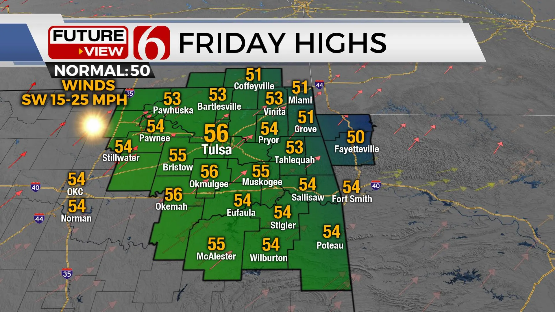
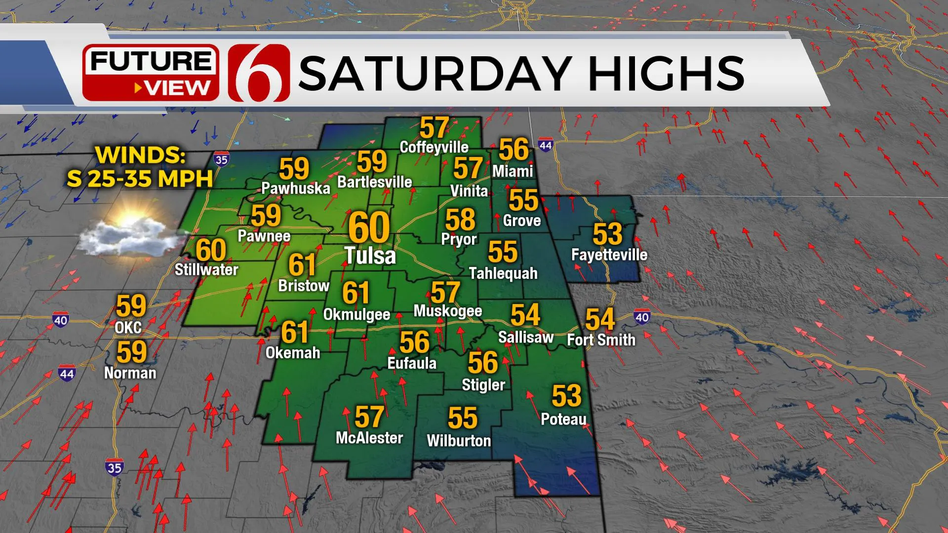
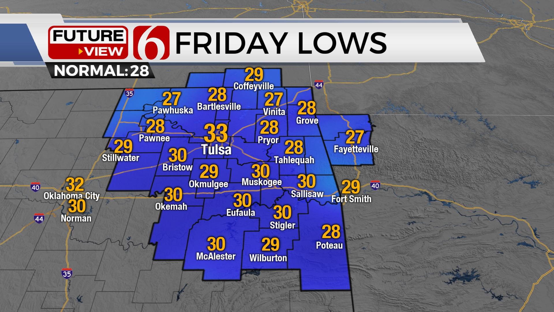
Temperatures below freezing may result in patchy ice across part of the area Thursday morning across far southeastern Oklahoma where some residual snow remains. Most of the roads are fine, but please use caution early. Highs on Thursday afternoon result with temperatures reaching the lower to mid-40s before another mini-warming trend occurs Friday and Saturday with afternoon highs reaching the mid to upper 50s. The pressure gradient responds Friday with breezy southwest winds and stronger winds Saturday at 25 to 35 mph. Despite recent precipitation, fire spread rates will increase Friday and Saturday ahead of our next strong cold front scheduled for late Saturday evening into early Sunday morning. This will bring a period of much colder air that may continue for most of next week.

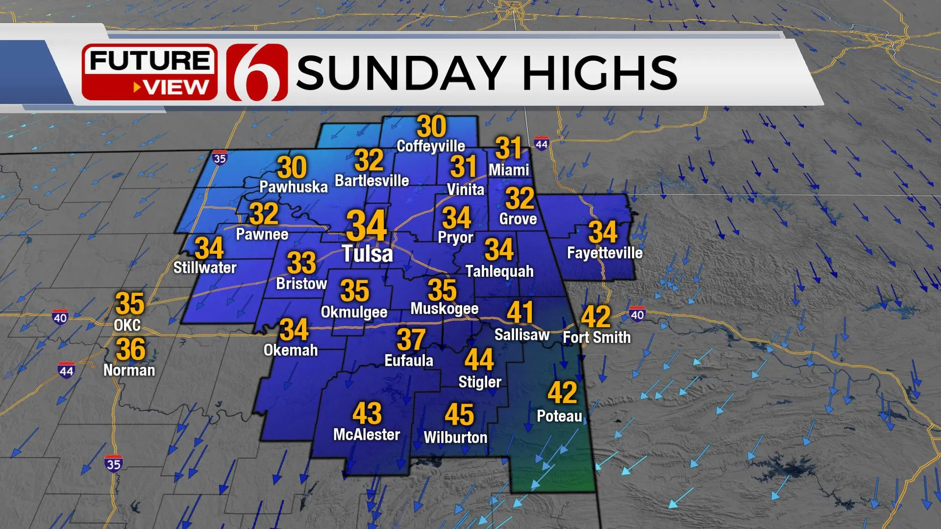
Several disturbances will arrive in the northwest upper air flow over the next 24 hours, including one on Thursday, which will continue to bring a few clouds while keeping highs in the lower to mid-40s. Northwest winds remain, but at lower wind speeds compared to yesterday. A stronger system will drive out of the northern plains Saturday and signal the return of colder weather arriving late Saturday night into early Sunday morning. The leading edge of a shallow cold air mass will bring gusty north winds and cold weather Sunday. As the front passes the area, a small window will develop for a brief period of freezing drizzle or light wintry mix across extreme northern and east-central OK pre-dawn Sunday. This will not be significant due to the fast-moving system and short duration of the possible precipitation. The upper air pattern will change Sunday into Monday as an active southwest flow develops and begins the process of bringing another upper-level wave across the area sometime early next week. This pattern can bring wintry weather issues across the state, including a mixture of rain, freezing rain, sleet and snow.

Early next week, shallow cold air is expected to be in place across most of the central and northern OK region with the possibility of another surge of arctic air arriving Wednesday. Most data support the southwest flow bringing a storm system near the state around Tuesday, and possibly another system by the end of the week. This pattern, especially in late January and early February is more prominent with icing events across the southern plains. It's too early to know specifics at this point such as the exact magnitude and depth of the cold air. This will have a major influence on the type of precipitation possibilities for early to midweek, but wintry weather impacts will be possible, beginning late Monday into Tuesday. We’re in the early stages of this developing system for early next week. Wintry weather impacts will be refined as data becomes more consistent.

Thanks for reading the Thursday morning weather discussion and blog.
Have a super great day!
Alan Crone
KOTV
More Like This
January 26th, 2023
June 21st, 2023
June 19th, 2023
June 13th, 2023
Top Headlines
December 12th, 2024
December 12th, 2024
December 12th, 2024


