Tracking Fire Hazards, Severe Storm Chances Soon
Another powerful storm system will influence the nation over the next 48 hours bringing a multi hazard weather event across part of country.Monday, April 3rd 2023, 5:50 am
TULSA, Okla. -
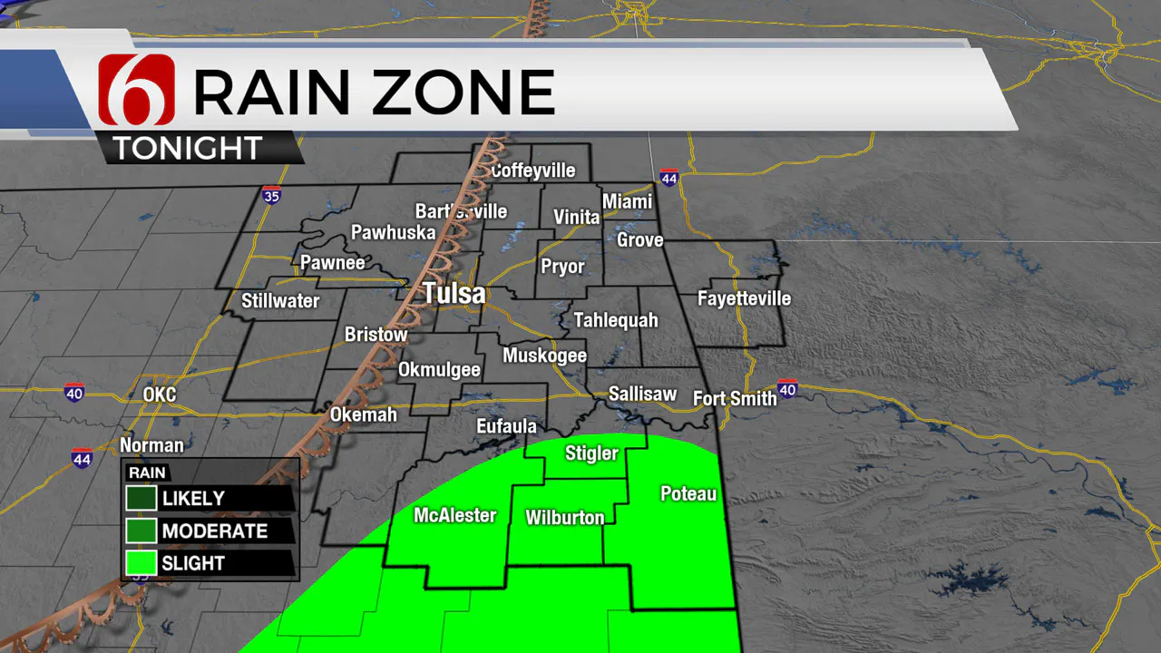
Another powerful storm system will influence the nation over the next 48 hours bringing a multi hazard weather event across part of country. A low chance for a few isolated storms will continue this afternoon and tonight across southeastern Oklahoma but this chance is every low.
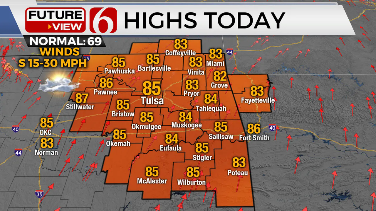
If a storm develops, it would be severe. Our focus remains Tuesday afternoon, evening, and pre-dawn Wednesday. A powerful upper-level storm system currently over the northern range of the Rockies will eject into the central and northern High Plains over the next few days.
This brings another opportunity for thunderstorms across the eastern third of the state Tuesday evening into pre-dawn Wednesday. While there remain some differences regarding exact parameters, the overall threat for strong and severe storms will remain with this system across Eastern Oklahoma. Locations slightly west of our immediate area well also face an extremely high fire danger issue Tuesday afternoon and evening. A fire weather watch is already underway near and west of the Tulsa metro for Tuesday afternoon and evening.
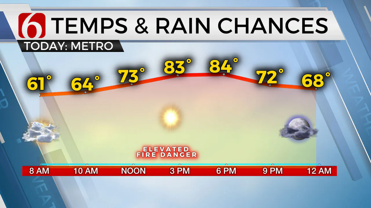
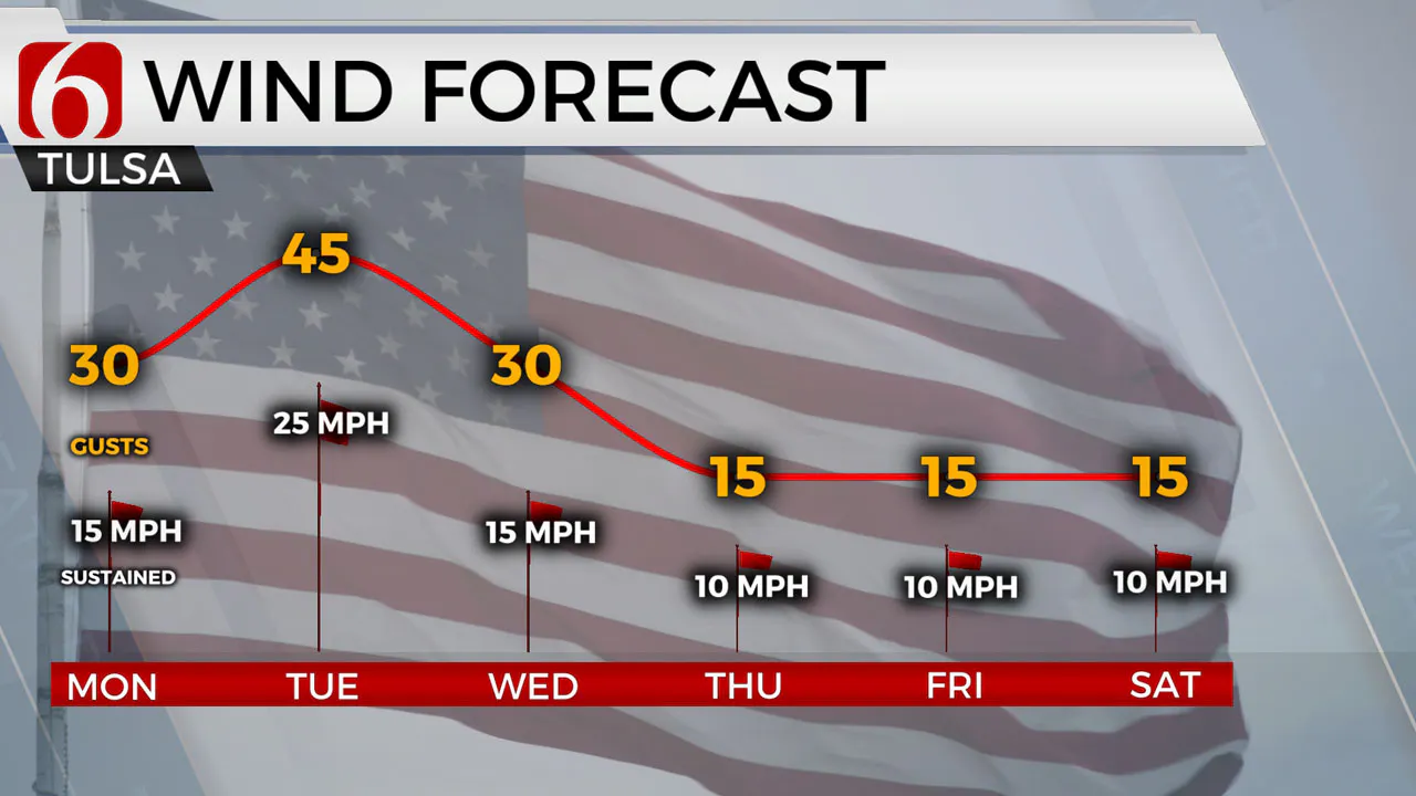
South winds return today at 15 to 30 mph with afternoon highs reaching the lower or even mid-80s. A dryline feature will be nearing northeastern OK this afternoon with increasing fire danger issues near and west of the metro. A wind advisory is posted along and west of the I-35.
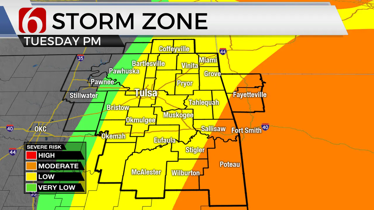
Tuesday strong south wind at 25 to 45 mph will increase low-level moisture across Eastern Oklahoma as a dry line approaches the western and central part of the state by early afternoon. The eventual position of the dry line and approaching cold front tomorrow will hold the key to the areas of severe storm possibilities. This should be near and east of Tulsa with higher fire danger issues near and west.
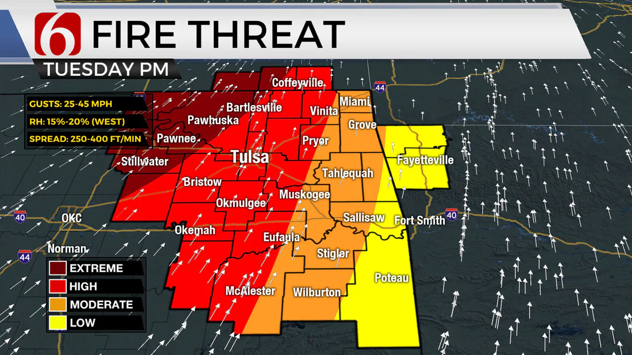
As the driveline moves east and the influence from the strong upper-level system moves closer to the state, thunderstorm chances will develop near an East of Tulsa. Severe parameters would suggest the potential for severe storms, including all modes. The layer of warm air aloft, the cap, may continue to hold Tuesday afternoon and early evening, but as the Pacific front approaches late Tuesday night into early Wednesday morning, thunderstorms may also develop along the boundary. We’ll have more on this threat tomorrow. As the system exits our area early Wednesday morning, cooler and relatively uneventful weather is likely to remain for the rest of the week. A weak storm system may be near our area this weekend, but overall chances for showers and storm will remain limited and mostly for late Sunday night into early Monday morning.
Thanks for reading the Monday morning weather discussion and blog.
More Like This
April 3rd, 2023
October 22nd, 2023
October 21st, 2023
August 3rd, 2023
Top Headlines
December 11th, 2024
December 11th, 2024
December 11th, 2024
December 11th, 2024


