Cool Temperatures Hang Around
Chilly temperatures hang around on Thursday morning before slightly warmer weather arrives for the afternoon.Thursday, April 6th 2023, 6:07 am
If you’re into podcasts or in a rush, check out my daily weather update. Search for NewsOn6 and ‘Weather Out The Door’ on most podcast providers, including Spotify, Stitcher and Tune-In, or Click Here to listen on Apple Podcasts.
TULSA, Okla. - Chilly temperatures hang around on Thursday morning before slightly warmer weather arrives for the afternoon.
Here are the details from News On 6 Meteorologist Alan Crone: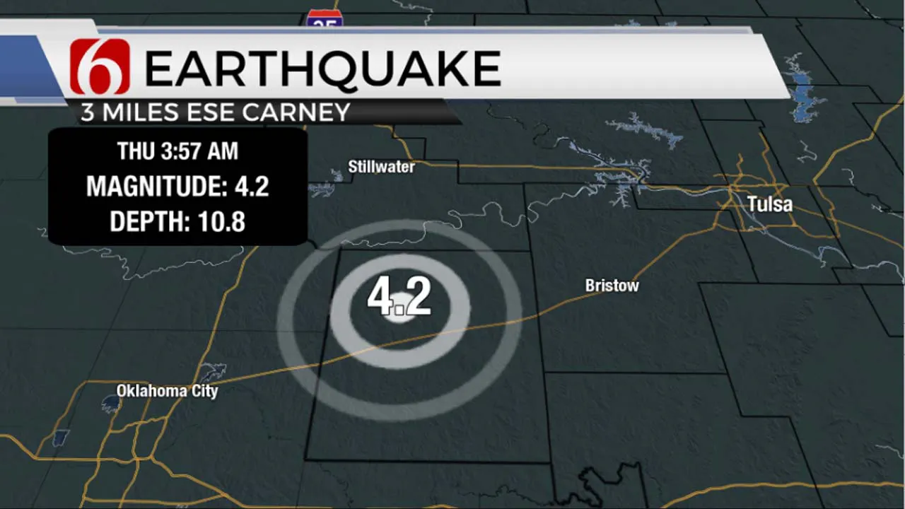
A series of earthquakes have been noted on Thursday morning across central Oklahoma, mostly clustered near Carney, in Lincoln County. The most noticeable quake was detected at 3:57 a.m. approximately three miles ESE of Carney with a preliminary 4.2 magnitude from the United States Geological Survey. Another 3.3 magnitude quake was detected at 4:16 a.m. near the same area.
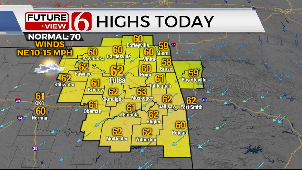
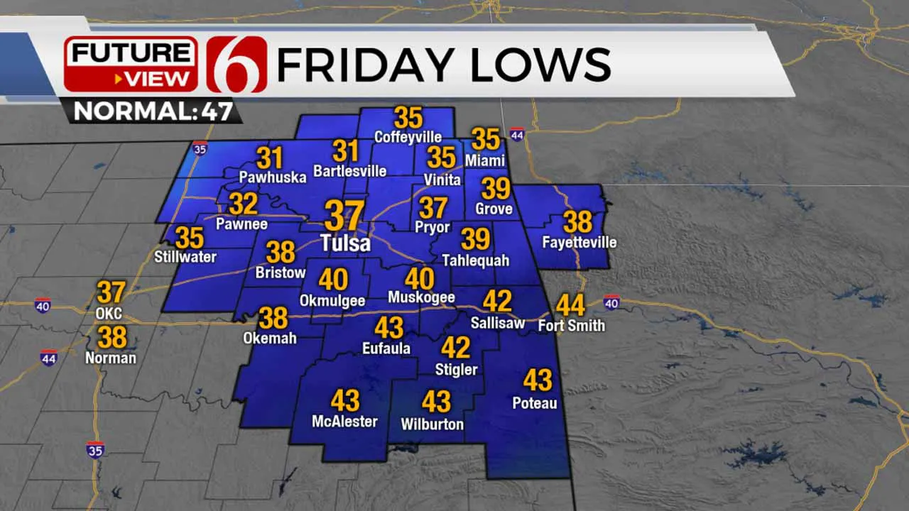
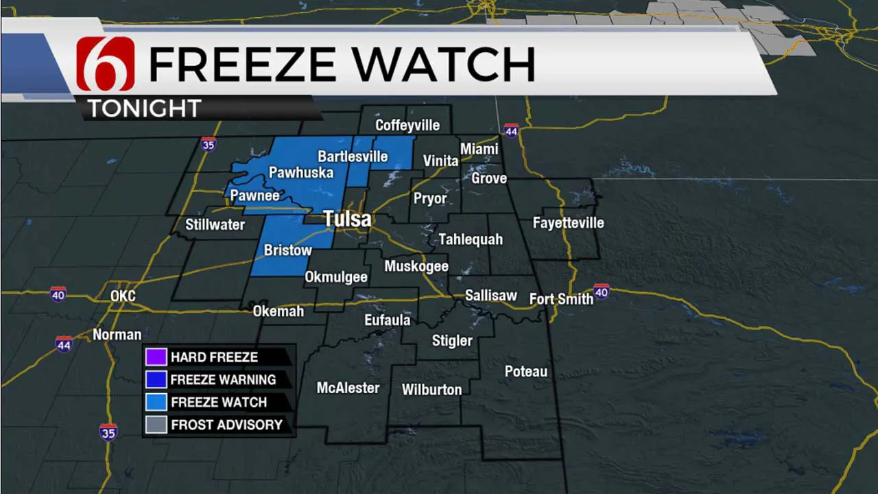
Chilly and dry air remains across northern Oklahoma on Thursday morning with locations along the OK-KS state line region near or slightly below freezing. Elsewhere, temps will be in the mid to upper 30s for the early morning hours before rebounding this afternoon into the lower and mid-60s. Sunny conditions are likely across the northern third of the state along with occasional high clouds. Southeastern OK will see slightly more clouds both today and tomorrow. Temps Friday morning will also start in the 30s and 40s with afternoon highs in the mid to upper 60s with mostly sunny conditions. A freeze watch is posted along and northwest of the I-44 tonight into early Friday. Tulsa county is currently not included in this freeze watch. The rest of the Easter Holiday weekend looks mostly pleasant: lows in the 40s will be followed by Saturday with highs in the upper 60s and lower 70s and Easter Sunday in the mid to upper 70s. A few weak systems will be nearby, but most locations will remain dry for the next several days.
A storm system is likely to remain well south of the region for the next 48 hours but will spread some clouds across at least southern OK later today and for part of tomorrow. It's possible that a few showers may also populate the Red River Valley and could sneak into southeastern sections of the state, but this probability remains very low. Another wave will be near the northern sections of the state later Sunday evening into early Monday morning. This system is rather anemic in most data but continues to offer some potential for a few scattered showers or storms. This will be represented with a 10 to 20% chance during this period, mostly Monday into early Tuesday morning.
The data this morning has changed some compared to previous runs and introduces a weak mid-level low developing near the state early next week. This should bring a few more clouds for the Monday through Wednesday period and may hamper the potential warm-up a few degrees compared to yesterday’s suggestions. I’ll make a few adjustments to these periods for slightly lower temps (upper 70s vs lower 80s) and may ease-up the wind speeds slightly.
Fire danger spread rate issues will be returning early next week through at least Wednesday before low level moisture brings higher humidity values for the latter half of the week as a stronger upper-level trough nears the plains. Strong to severe storm chances will return as this trough nears around April 14th or 15th.
Thanks for reading the Thursday morning weather discussion and blog.
Have a super great day!
Alan Crone
KOTV
More Like This
April 6th, 2023
July 12th, 2023
July 7th, 2023
June 26th, 2023
Top Headlines
December 14th, 2024
December 14th, 2024
December 14th, 2024
December 14th, 2024


