Summer Weather Pattern Takes Hold
Our hot and humid weekend has come to a close, but the muggy weather is here to stay. The week ahead is a classic summer pattern. With the jet stream and storm track well to our north, any hope of much relief from the heat is very limited. That could change down the road, but for now, get ready to sweat it out when you step outside. Heat index values will be steadily on the rise as gusty south ...Sunday, June 11th 2017, 10:50 pm
Our hot and humid weekend has come to a close, but the muggy weather is here to stay. The week ahead is a classic summer pattern. With the jet stream and storm track well to our north, any hope of much relief from the heat is very limited. That could change down the road, but for now, get ready to sweat it out when you step outside.
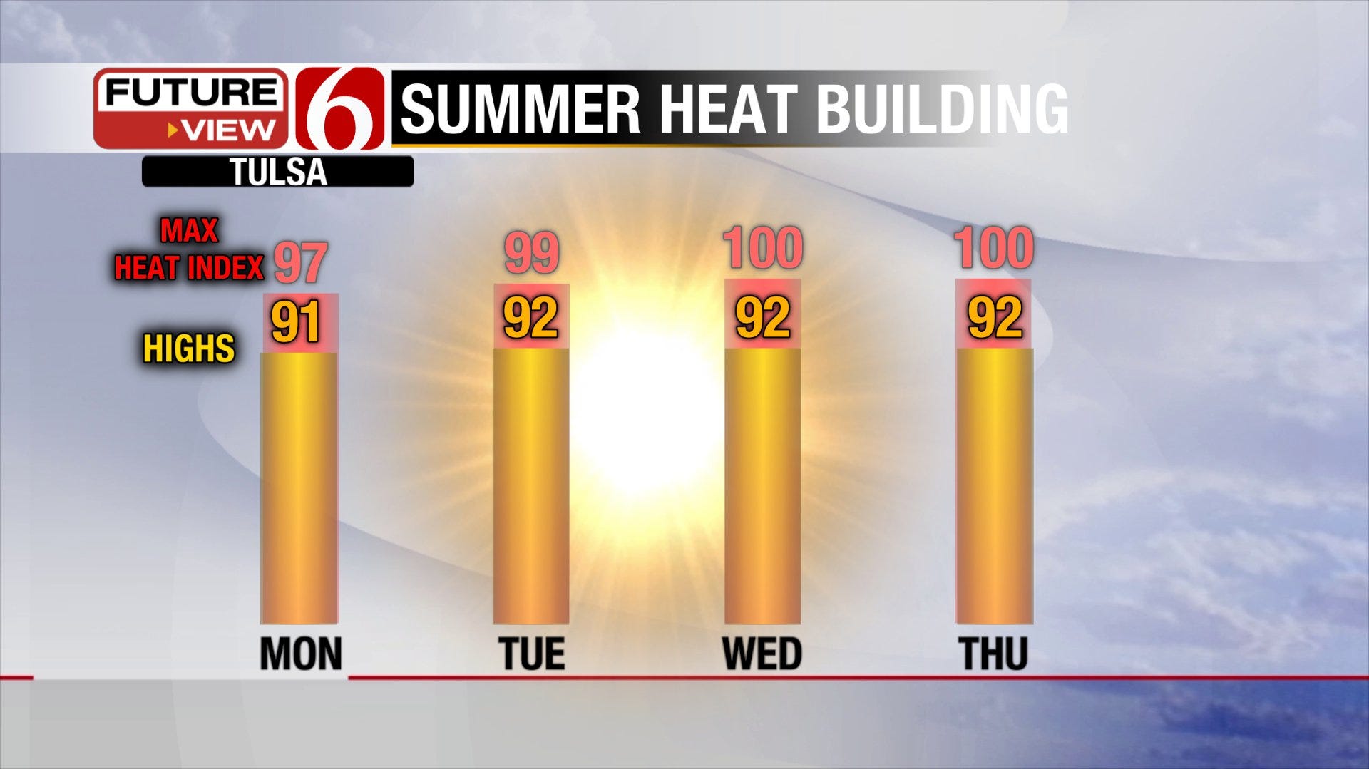
Heat index values will be steadily on the rise as gusty south winds continue to transport richer Gulf moisture into our area. Eventually, the ridge of high pressure overhead will break down and upper-level energy can tap into that heat and humidity allowing storms to fire nearby midweek. The high temperatures and heat index values shown below are more typical of July. I suppose we could call this our first summer heat wave, although it’s certainly at the more tolerable end of the spectrum.
[img]
More clouds and storms will take the edge off the heat by Thursday, but won’t make it any less muggy. The first round of storms for our immediate area is possible starting Wednesday evening. A trailing frontal boundary drifting south will interact with that hot, humid air and trigger storms to our north that may move south into at least parts of northeast Oklahoma. By Thursday, a reinforcing wave from the northwest may fire a more substantial area of storms, and that complex could race across Green Country that evening and night. Storms may continue to bubble up on Friday in the wake of that storm complex before ridging aloft gets stronger and suppresses storm development again. Below is the upper-level air pattern supporting storms in the area even though the jet stream is well to our north at this point in the season.
[img]
In that late Wednesday through Friday timeframe, the greatest severe weather risk will be strong winds and possibly some flash flooding. For the Tulsa area, this rain will be welcome news after over 3 weeks of less than a quarter-inch of rain on a given day (shown below). Tulsa still has a healthy surplus of rain on the year, but if we continue to close out our “wet” season with little rainfall, we may fall quickly behind come the dog days of summer. The longer-range outlook doesn’t look too promising in the rain department either. Come next week, a much drier than normal pattern is forecast. Basically, if we don’t see this rain come to fruition by the end of the week, it may be awhile before we see a good soaking.
[img]
There is a possible cold front on the horizon. Late in the weekend or early next week, our computer models try to bring this frontal boundary south past the area. This time of year, with the jet stream displaced so far north, it’s hard to get a sweeping change with the storm systems centered well to our north. I don’t hold my breath for cold fronts after mid-June, but should this one make it, we’ll see a drop in humidity and high temperatures back in the 80s for a few days. Any relief would be temporary as the dominant upper-level ridge takes control and shifts our surface winds southerly again.
[img]
All in all, summer weather is here. Aside from a reprieve from the heat here and there and the occasional bout of rain, we’re likely in this for the long haul until August wraps up. Enjoy and take care of yourself in the heat – it’s the number one weather killer in the U.S. each year.
Be sure to follow me on Twitter: @GroganontheGO and on my Facebook Page for more weather updates!
More Like This
June 11th, 2017
September 29th, 2024
September 17th, 2024
Top Headlines
December 12th, 2024
December 12th, 2024
December 12th, 2024


