Widespread Rain Expected In Green Country
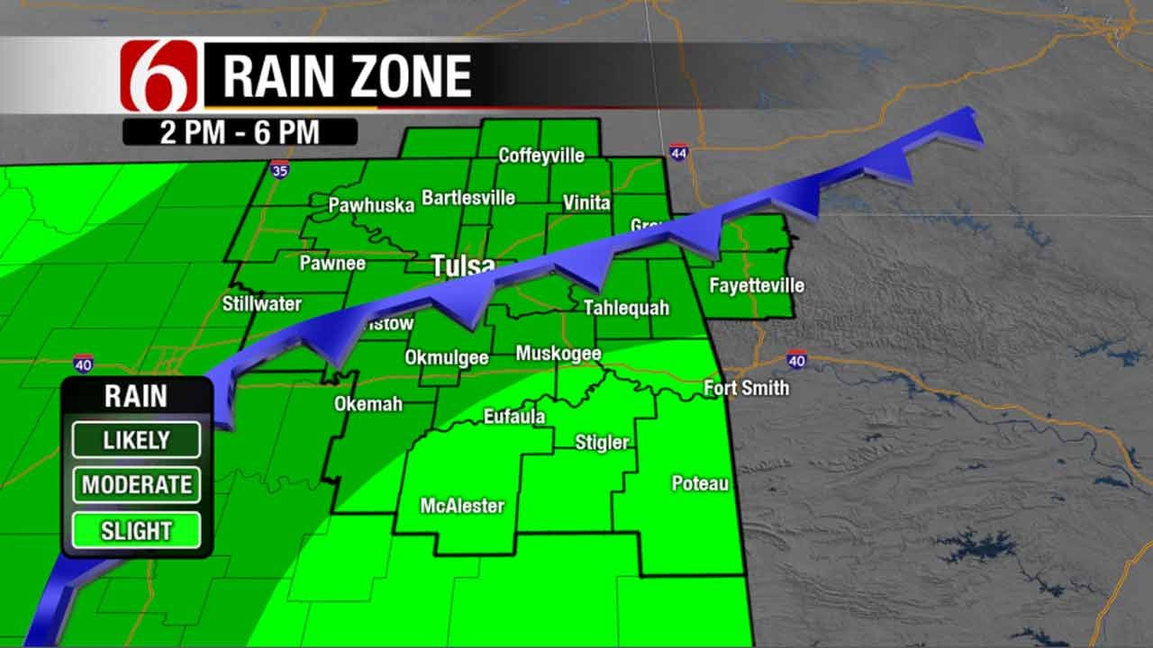
<p>Widespread rain is expected for much of Sunday mainly west of Highway 69. Heavy rain will be likely at times with rainfall amounts around 1” or higher in a few locations. </p>Sunday, September 25th 2016, 10:38 am
Parts of Green Country are catching rain today. Widespread rain expected for much of today mainly west of Highway 69. Heavy rain will be likely at times with rainfall amounts around 1” or higher in a few locations.
Highs should only top out in the mid to upper 70s. Areas to the south and east of Tulsa will be warmer due to lower rain chances. A cold front is moving through the area today and will cause temperatures to start cooling off earlier than usually. Areas around Tulsa could see cooling mid-afternoon temperatures once the frontal passage occurs.
Rain should taper off from north to south this evening. Latest guidance has been indicating that a few additional showers could hold on into the overnight hours, so we’ll keep a chance for rain in the forecast tonight. Most likely drier air will be starting to filter in and that should really lessen chances for overnight showers especially around Tulsa. Locations southeast of Tulsa have a slightly better chance of seeing showers linger tonight.
We have a beautiful fall week ahead. Morning lows will be cool this week. In the upper 50s for tomorrow morning. Mostly sunny tomorrow with highs in the mid-70s. Winds will remain out of the north until Tuesday.
Highs will slowly warm back to above normal, and by mid-week we should be seeing afternoon temperatures in the mid-80s. Humidity will remain low with is always a blessing. Another shift in the winds back to the north mid-week will keep that warming trend from getting too warm. Low 80s for afternoon highs and dry conditions are expected for the start of the state fair and into next weekend.
Enjoy this weather!
More Like This
September 25th, 2016
September 29th, 2024
September 17th, 2024
Top Headlines
December 10th, 2024
December 10th, 2024
December 10th, 2024
December 10th, 2024


