Hot Temperatures Returning To Eastern Oklahoma
<p>Scattered storms should develop Saturday afternoon and evening across Green Country ahead of hot temperatures next week. </p>Saturday, July 16th 2016, 12:07 pm
Scattered storms should develop Saturday afternoon and evening across Green Country ahead of hot temperatures next week.
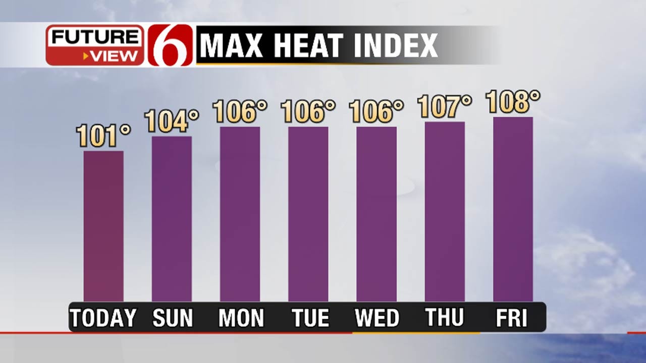
The better chances for seeing shower and storms will be across southeastern Oklahoma. Highs Saturday afternoon will top out in the low to mid 90s. Heat index values will top out around 101 along with light southeast winds.
As we head into this next week, heat will start to build and highs back into the upper 90s by Sunday afternoon. Rain chances will remain slim to none over the next week as well.
Dangerous heat returns as heat index values will range from 105 to 110 in the afternoons. Any relief from showers or storms could be on Tuesday but only for a select few in far southeastern Oklahoma.
Also it is important to practice heat safety for the next week.
More Like This
July 16th, 2016
September 29th, 2024
September 17th, 2024
Top Headlines
December 13th, 2024
December 13th, 2024
December 13th, 2024
December 13th, 2024


