Tulsa Area Red Cross, River Commission Prepare For Possible Flooding
The Tulsa Area Red Cross is already making plans for the flooding that is threatening to swamp eastern Oklahoma over the next two days.Monday, March 19th 2012, 12:22 pm
The Tulsa Area Red Cross is already making plans for the flooding that is threatening to swamp eastern Oklahoma over the next two days.
"The Red Cross is monitoring the weather and maintaining communication lines with area emergency management officials and other agencies," said Communications Director Donita Quesnel.
3/19/2012 Related Story: Severe Storms Advancing On Northeastern Oklahoma
"We also are alerting our volunteers to the situation and the possibility of deployment should the situation warrant."
The local Red Cross serves a 31-county region when disaster strikes.
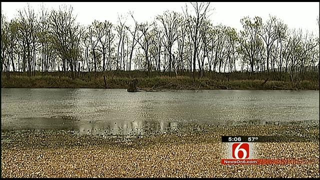
The Oklahoma Scenic Rivers Commission is also warning about flooding on the Illinois River.
Folks at Peyton's Place are preparing.
"We've been here long enough to know, to get out here and get it done before it happens," said Casey Peyton.
They're pulling breakers and receptacles from dozens of electric boxes at their campsites. With much of Eastern Oklahoma under a flash flood watch, the river will rise and so will Casey Peyton's level of concern.
"We have to deal with floods every spring, we just hope that they're not destructive like last year," Peyton said.
The float business along the river has reason to be wary of the weather. They took a hit last spring.
"We make our living based on Mother Nature and sometimes she throws us curveballs," Peyton said.
It was a nasty curveball. The river crested at 26 feet in April, 23 feet in May.
"The April flood was so bad; we had to use metal detectors to find our electrical boxes. That's how much gravel it put on us," Peyton said.
Now, with a slow moving storm on the way, the Peytons hope the river doesn't reach those high water marks.
"I think everybody is still a little shocked over last year," he said.
Based on computer modeling, the following flooding conditions are forecast:
WATTS/US59 Bridge Gage (Adair County) – ILLINOIS RIVER:
On Tuesday, March 20th approximately 12 noon water levels rise to the minimum flood stage of 13 feet. It is expected the Watts Gage will crest/peak on Wednesday, March 21st approximately 6 a.m. at Major Flooding Level of 23-25 feet.
TAHLEQUAH/US62 Bridge Gage (Cherokee County) – ILLINOIS RIVER:
On Tuesday, March 20th approximately 12 noon water levels rise to the minimum flood stage of 11 feet. It is expected the Tahlequah Gage will crest/peak on Thursday, March 22nd approximately 6 a.m. at Major Flooding Level of 23 feet.
ELDON/SH51 Eldon Bridge Gage (Cherokee County) – BARREN FORK CREEK:
On Tuesday, March 20th at approximately noon water levels rise to the minimum flood stage of 18 feet. It is expected the Eldon Gage will crest/peak on Wednesday, March 21st approximately 1 a.m. at Major Flooding Level of 23 feet.
KANSAS/US412 Bridge Gage (Delaware County) – FLINT CREEK:
On Tuesday, March 20th water levels will rise to action stage of 8 feet. It is expected the Kansas Gage will crest/peak Wednesday, March 21st approximately 6 a.m. at Moderate Flooding Level of 12 feet.
Note these advanced forecasted levels were modeled based on 4 -7 inches rainfall. If additional rainfall should occur in excess of this advanced warning, higher flooding levels and damage is a possibility.
It is encouraged that they immediately begin flood preparations in relocating equipment, trash barrels, picnic tables and vehicles to higher ground along with removing furniture and appliances from cabins and other facilities that were subject of flooding in Spring 2011.
Get flooding and other Spring Weather Safety Tips from News On 6 Chief Meteorologist Travis Meyer.
More Like This
March 19th, 2012
September 29th, 2024
September 17th, 2024
Top Headlines
December 11th, 2024
December 11th, 2024
December 10th, 2024


