Sunday Rain Chances For Green Country
Once again, break the umbrellas back out. Rain will eventually return to much of Green Country to wrap up the weekend.<br/>Sunday, February 23rd 2020, 10:43 am
Once again, break the umbrellas back out. Rain will eventually return to much of Green Country to wrap up the weekend.
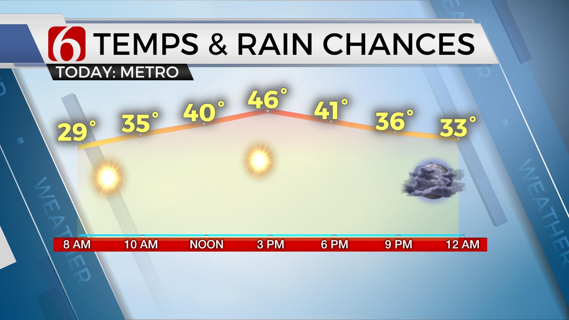
Scattered light showers are expected from morning through early afternoon, mainly just enough to get the pavement damp. We’ll keep cloud cover around with highs generally in the 50s. We may have some dry hours to work with during the day, but rain will increase as we head into late in the day.
Steadier rains will pick up by mid to late afternoon into the evening hours, near and especially north of the I-44 corridor. However, areas south of Tulsa, particularly near and south of I-40, don’t look to see nearly as much rain as our northern counties.
A few isolated heavier storms may rumble through northeastern Oklahoma late Sunday evening and Sunday night. Any severe weather threats will remain very low, but some pockets of hail aren’t out of the question into the overnight hours.
The steadier rains will be tapering off Monday morning, with winds switching from southerly to northerly as an area of low-pressure swings through. Clouds should keep us in the upper 40s and lower 50s for much of Monday, with some additional light showers possible.
Seasonably chilly air will settle in by the middle of the week as additional quick-moving cold fronts swing through the area. Drier weather should also take hold from Wednesday to the end of the week.
I hope you have a great Sunday, Green Country! You can follow me on Twitter @StephenNehrenz as well as my Facebook page Meteorologist Stephen Nehrenz to stay up to date with the very latest!
","affiliate":{"_id":"5c784a0c4961cb23ad330098","callSign":"kotv","origin":"https://www.newson6.com"},"contentClass":"news","createdAt":"2020-03-16T18:29:12.425Z","updatedAt":"2020-03-31T17:28:15.367Z","__v":1,"breakingNews":[],"show":true,"link":"/story/5e6fc578f86011d4820c339c/sunday-rain-chances-for-green-country","hasSchedule":false,"id":"5e6fc578f86011d4820c339c"};
More Like This
February 23rd, 2020
November 30th, 2022
November 1st, 2022
August 26th, 2022
Top Headlines
December 12th, 2024
December 12th, 2024
December 12th, 2024
December 12th, 2024


