Frigid Friday Before Warmer Temperatures Arrive In Northeastern Oklahoma
Frigid weather is once again across northeastern OK this morning with a few clouds, mostly dry air and mostly light winds allowing temperatures dropping into the teens.Friday, February 14th 2020, 8:25 am
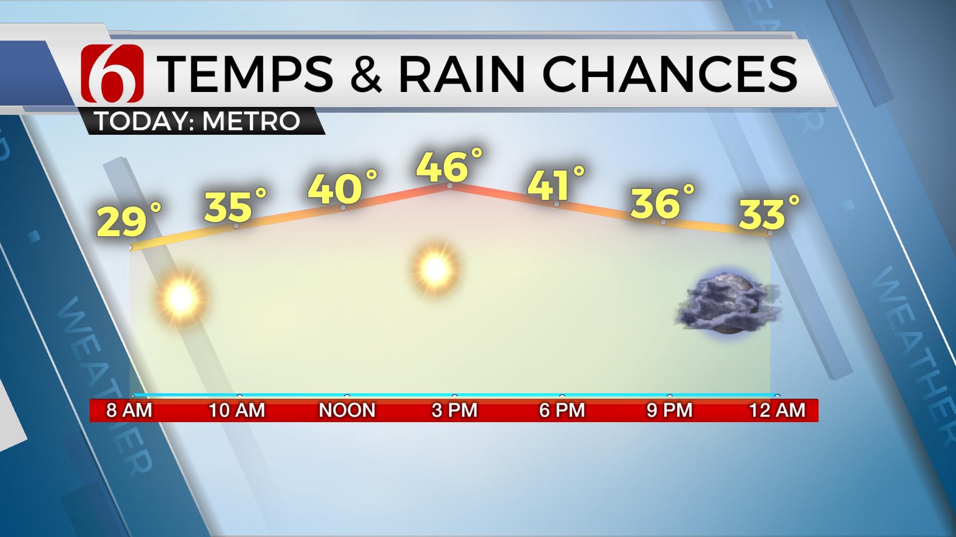
Frigid weather is once again across northeastern OK this morning with a few clouds, mostly dry air and mostly light winds allowing temperatures dropping into the teens. A few readings near 10 will briefly be possible in a few valley locations before south winds return along with highs reaching the mid-40s later this afternoon. A weak disturbance is producing some snow showers and flurries across west central OK this morning. This wave will move eastward into our region for the morning hours with some clouds occasionally in the mix. The dry air should take care of any flurries, but I suppose a few could survive. Most of us will not see any.

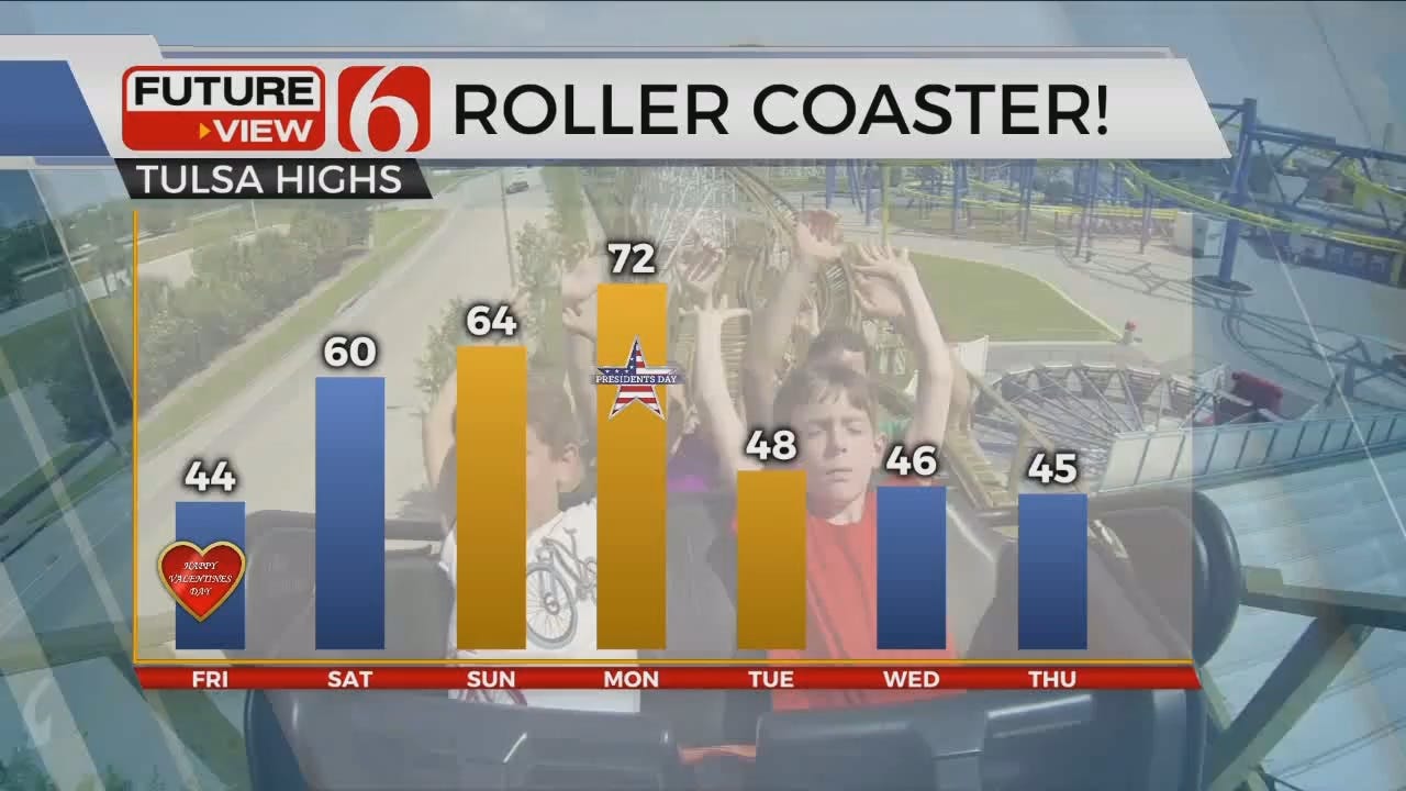
A relatively robust pattern change will be underway this weekend with highs reaching the upper 50s along with gusty south winds Saturday and warmer weather Sunday into Monday. Another cold front arrives early next week bringing seasonally colder weather back to the state along with some low chances for showers.

The upper air flow remains quite active for the next few days with one upper wave passing across the area this morning. We’ve been tracking some overnight and early morning clouds, but a sunshine-cloud mix will again be likely as the day progresses with south winds returning near 10 mph by afternoon. Temperatures will rebound today into the lower 40s, but dry air remains tonight for Valentines evening and temps will drop quickly into the 30s this evening with steady south winds keeping the wind chill near freezing.
The next upper level system will quickly drop from the Rockies into the southern plains Saturday evening. Before this arrives, south to southwest winds return Saturday with speeds nearing the 15 to 25 mph range. Warmer air will arrive with highs reaching the upper 50s and a few lower 60s before the upper wave brings some clouds Saturday evening or early Sunday that could provide a small sprinkle across southeastern OK during the period.
Sunday a stronger upper levels system is scheduled to drop from the northern flow and become cut-off from the flow for a few days before moving eastward by the middle of next week, very similar to the upper pattern we’ve been experiencing last week. In response, warmer weather quickly invades Oklahoma Monday with highs reaching the upper 60s to lower 70s before our next cold front drops across the state by late afternoon or evening along with a slight chance for a few showers or storms. The chances will remain low due the volume of dry air currently in place across the region, but a few showers or storms will remain possible. Colder air, with highs in the lower to mid-40s seems likely Tuesday into Wednesday.
The above-mentioned upper level low will begin moving eastward Tuesday into Wednesday bringing colder air aloft and possibly some precipitation aback to at least southwestern OK and the Red River Valley Tuesday into Wednesday. The data is highly inconsistent with the placement of highest moisture and coldest air aloft and consequently the better location for showers or even some wintry precipitation chances. As of this time, I have continued a low mention of showers Tuesday and Wednesday, but mostly well to our south.
Thanks for reading the Friday morning weather discussion and blog.
Have a super great day!
Alan Crone
More Like This
February 14th, 2020
November 30th, 2022
November 1st, 2022
August 26th, 2022
Top Headlines
December 13th, 2024
December 13th, 2024
December 13th, 2024
December 13th, 2024


