Cooler Weekend Weather For Northeastern Oklahoma
Cooler Weekend Weather For Northeastern OklahomaFriday, May 8th 2020, 6:30 am
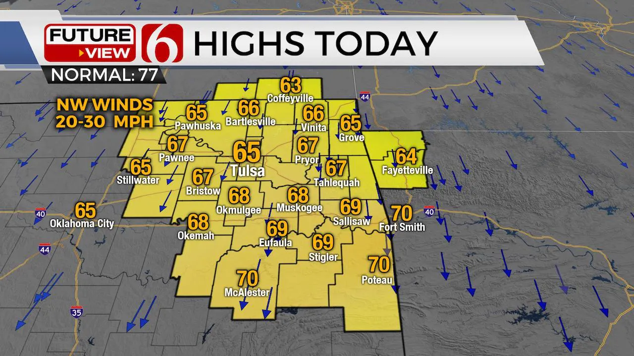
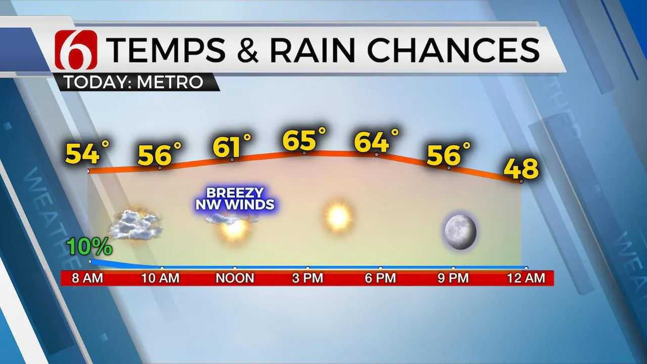
Another bumpy night is about the end. Thankfully. It’s been rough in a few spots. We had significant thunderstorm winds that ripped across southcentral and southeastern OK earlier this morning, anywhere from 50 to 75 mph. We’re getting some reports of tree damage, some powerlines down and some minor structural damage in spots. Power outages will be common this morning across these areas, mostly south of I-40 across southcentral to southeastern OK. The main storm system is now exiting our region and thunderstorm activity has already moved across the Red River into North Texas a few hours ago. The surface pressure gradient behind this system will bring gusty northwest winds from 20 to 30 mph for while along with a few clouds rotating around the backside of the departing mid-level wave. Later today, dry air at both the lower and mid-levels will scour the atmosphere bringing sunshine by midday to afternoon and much cooler conditions into the state by this evening and early Saturday morning when a few record lows will be possible. Highs today should reach the mid-60s.

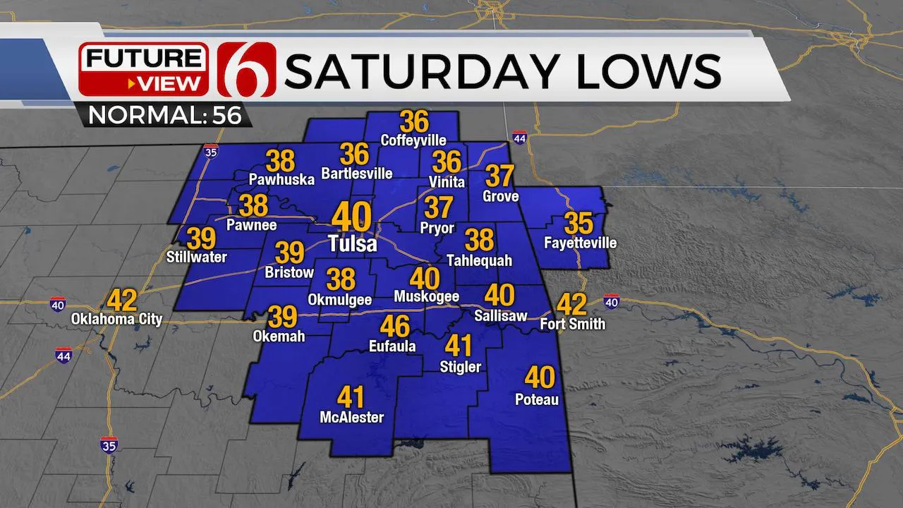
A surface ridge of high pressure will build across southern Kansas and northeastern OK this evening allowing clear sky and light winds across most of the region. Temps will drop into the upper 30s and lower 40s before south winds return early Saturday morning. A few valleys may be closer to the mid-30s, but no freezing temps are expected. The deep flow across the upper Midwest and northeastern U.S. will bring record lows across the eastern third of the nation this weekend before moderating early next week. The upper air flow, currently from the northwest, will revert to southwesterly flow by the middle of the approaching week. This will bring more typical May weather back into the southern plains, including chances for severe weather later next week with warmer weather.
Before this happens, we're tracing a few items of interest.

The first will be another fast-upper level disturbance diving down the central plains this weekend and bringing yet another cold front across the area Sunday. The moisture will be absent, and we’ll not include any pops with this system, but it will basically reinforce some chilly weather for early next week. At the same times, a minor disturbance will approach from the west with increasing rain chances either Monday or Tuesday. And with the cooler weather in place, some data suggest Monday afternoon highs may stay in the upper 40s or lower 50s. I have been keeping the Monday high near 55 for the past few days and may need to drop this a few more degrees later, but for now, will stay at 55.

Wednesday into Thursday, the upper flow will return to the southwest and will bring much warmer weather at the surface by Wednesday into later next week. Based on the expected pattern, strong to severe storm chances will not be too far behind. Stay tuned.
Thanks for reading the Friday morning weather discussion and blog.
Have a super great weekend.
Alan Crone
More Like This
May 8th, 2020
August 8th, 2023
July 4th, 2023
May 8th, 2023
Top Headlines
December 11th, 2024
December 11th, 2024
December 11th, 2024


