Showers, Storms Continue Before Sunshine Returns To Green Country
Showers, Storms Continue Before Sunshine Returns To Green CountryTuesday, May 26th 2020, 6:10 am
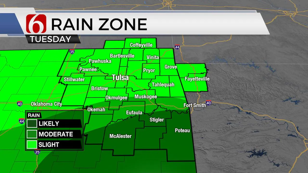
Spotty showers and storms will remain in the forecast for the next few days before a pattern change finally allows for a drying trend and the return of sunshine into the weekend. This will be a slow process with additional storm chances remaining for most of the week, but fewer showers and storms are likely today compared to yesterday.

The main belt of westerlies continues lifting northward and a mid-level trough across the western third of the state will become separated from the main flow for the next few days. This feature will be near the Red River northward into part of Oklahoma through at least Thursday, maybe Friday supporting showers and storms for portions of eastern OK through the end of the week.

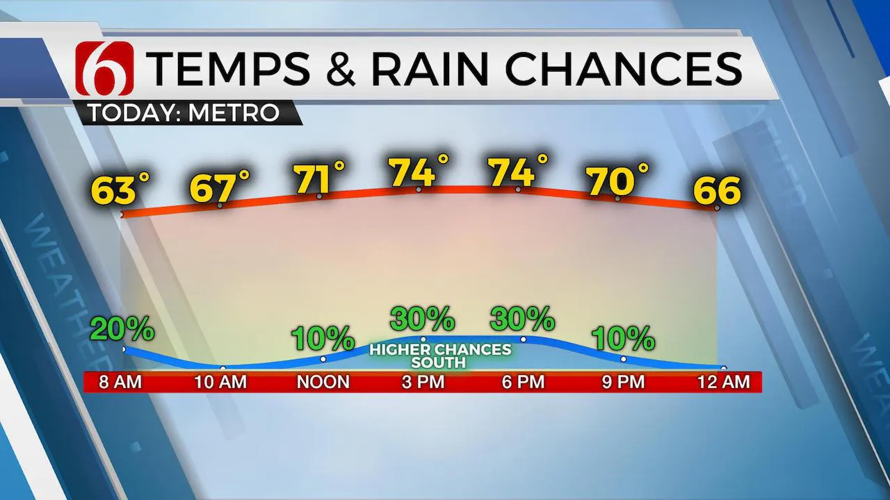
The MCV responsible for the active weather yesterday is exiting northeastern OK early this morning and our atmosphere will be mostly stable for most of the day. But locations near or south of the metro this afternoon will see a few additional showers and storms as the mid-level cut-off nears the region. Some locations will remain dry. Severe weather threats are much lower today and should not be expected for most of the area. Any stronger storms will be confined to the areas along or south of I-40.

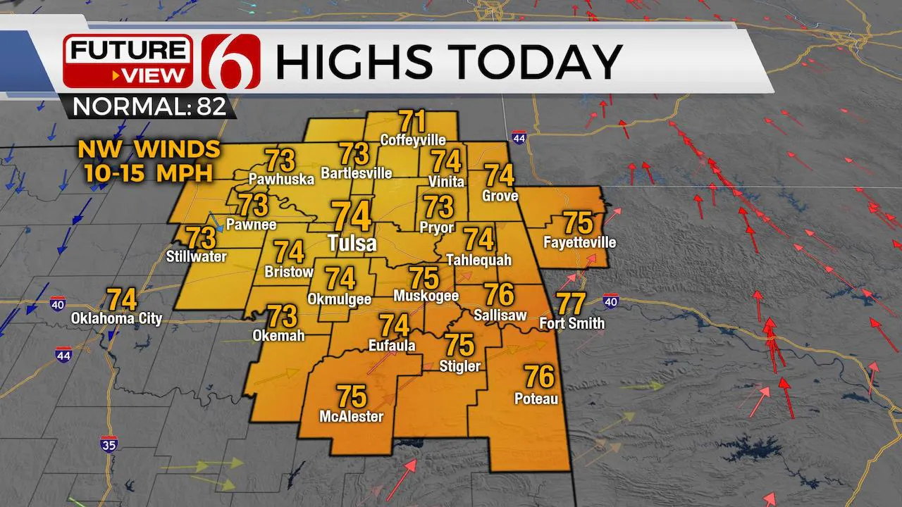
Highs this afternoon will reach the lower to mid-70s with northwest winds around 10 to 15 mph. By Thursday into Friday, most data support the upper low finally moving east as a mid-level ridge of high pressure begins building into the central plains and across part of northern OK this weekend. We’ll continue with some rain and storm chances Wednesday and Thursday, and even some pockets of moderate to heavy downpours in a few locations, but this should end by early Friday morning. By Friday afternoon, we should see a sunshine and cloud mix with highs nearing 80. This drying trend continues into the weekend with highs reaching the upper 70s Saturday and the lower 80s Sunday. A minor reduction in low level moisture is also expected this weekend which will aide in keeping humidity values lower than we’re experiencing in this current pattern.
We’ll encourage you to remain aware of creeks, streams and rivers nearby for the next few days. The heavy rainfall from yesterday and last night will add to increasing levels quickly this morning. Numerous flood warnings and advisories are posted for local streams and rivers.
Thanks for reading the Tuesday morning weather discussion and blog.
Have a super great day!
Alan Crone
More Like This
August 8th, 2023
July 4th, 2023
May 8th, 2023
Top Headlines
December 13th, 2024
December 13th, 2024
December 13th, 2024
December 13th, 2024


