Warm, Muggy Thursday For Northeastern Oklahoma
Warm, Muggy Thursday For Northeastern OklahomaThursday, June 4th 2020, 6:47 am
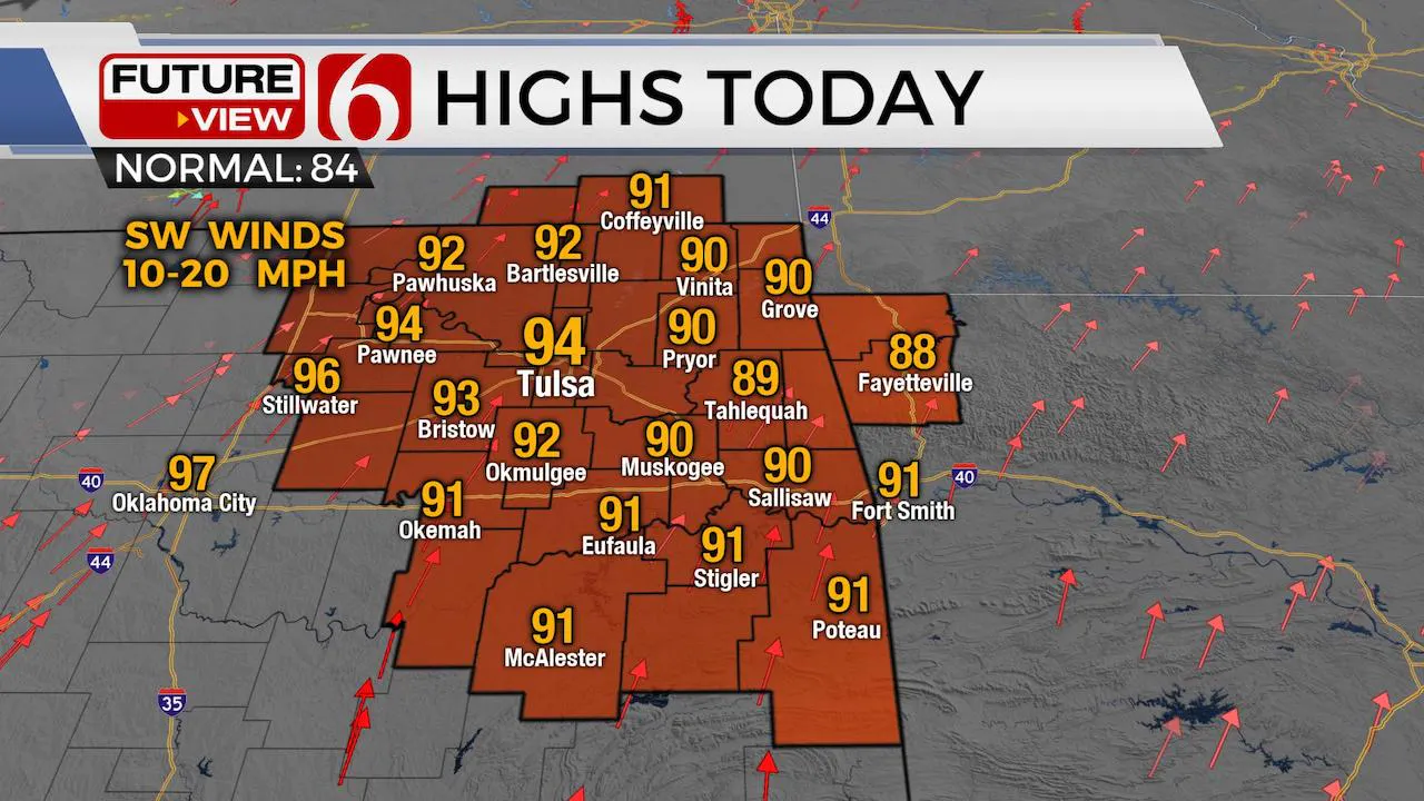
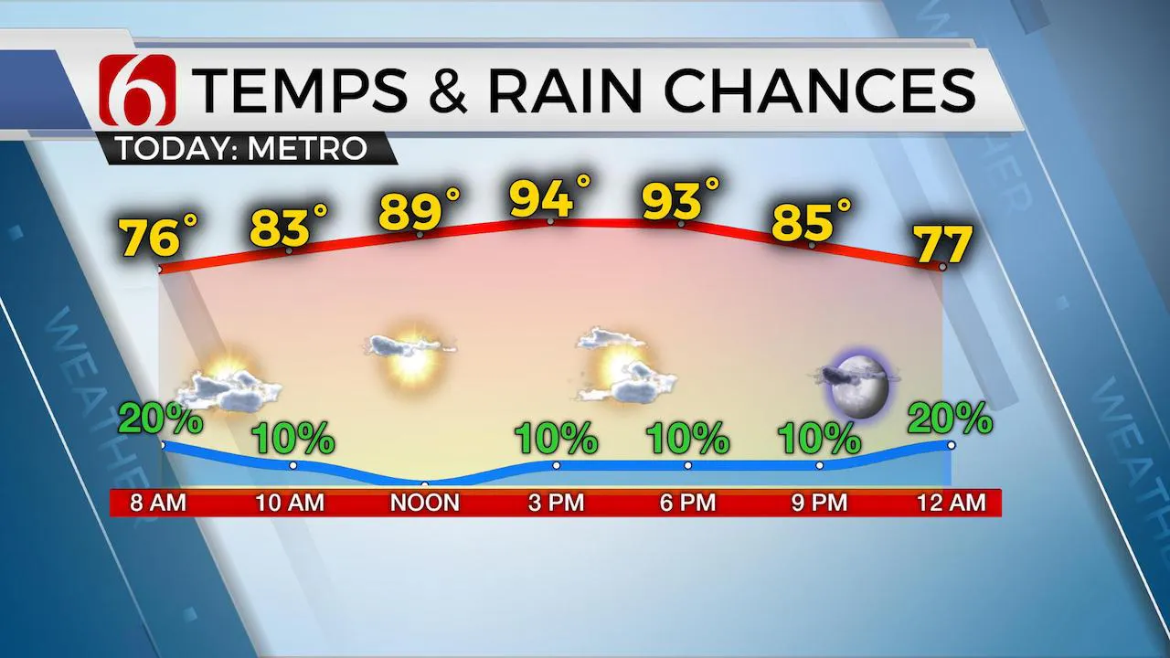
We’re tracking a complex of storms across far southeastern Kansas that may impact part of far northeastern OK early this morning. A weakening trend should continue but some additional storms may develop along and behind a southward moving outflow boundary across the region midday. Our chances for the metro and most of northeastern OK will remain low today but not zero. Any mature storm could produce some damaging wind gusts. Regardless of any storm coverage this morning, humidity and temperatures will rebound with afternoon highs reaching the lower to mid-90s and heat index values nearing 100 to 104. There will also remain potential for a few additional storms nearing the region later this evening with much higher chances both to our west and east. Some hi-res data support a small complex of storms moving from northwestern Arkansas into east-central OK later tonight, but higher chances for storms will remain across western OK later this afternoon and evening. Some of these will track southeast. One or two could survive into part of northeastern OK later this evening into pre-dawn Friday, but once again, the chances will remain rather low. The ridge of high pressure, currently centered and positioned to our west, will eventually expand into northern OK this weekend.

This weekend should feature morning lows in the lower to mid-70s and highs reaching the lower to mid-90s. Heat index values should be anywhere from 100 to 104 across eastern OK along with south winds near 10 to 15 mph.

Early next week our main issue will be tracking the exact trajectory of Tropical Storm Cristóbal. The currently trajectories will keep most of the impact well east of our area, but its frankly too early to know for sure. Some data bring the remnant low across eastern OK but the consensus with most will be to our east across Arkansas. We’ll still have a slight chance of showers or storms Monday evening into Tuesday as both the tropical system and a strong front will arrive during this period. North winds will return Tuesday afternoon with much drier dew points for several days next week. This should bring very pleasant conditions Wednesday through Friday with lower humidity.
Thanks for reading the Thursday morning weather discussion and blog.
Have a super great day!
Alan Crone
More Like This
June 4th, 2020
August 8th, 2023
July 4th, 2023
May 8th, 2023
Top Headlines
December 13th, 2024
December 13th, 2024
December 13th, 2024
December 13th, 2024


