Unseasonably Warm Weather Continues For Green Country
Unseasonably Warm Weather Continues For Green CountryMonday, June 8th 2020, 7:21 am
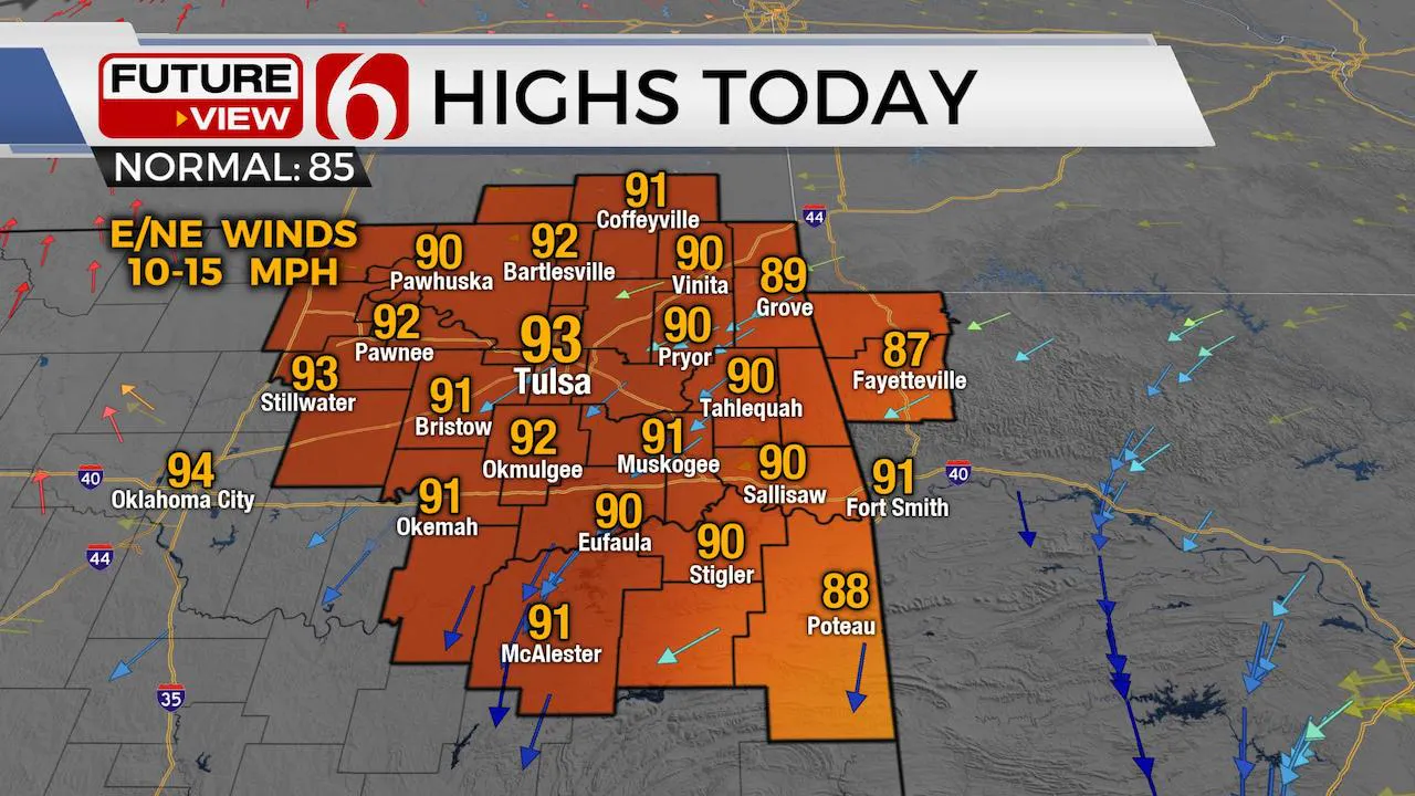
Another two days of unseasonably warm weather before some relief arrives for the middle of the week. We’re tracking a tropical system that may bring some rain across extreme eastern OK. Gusty winds are likely Tuesday afternoon behind a strong upper level trough that will bring a cold front across the state.

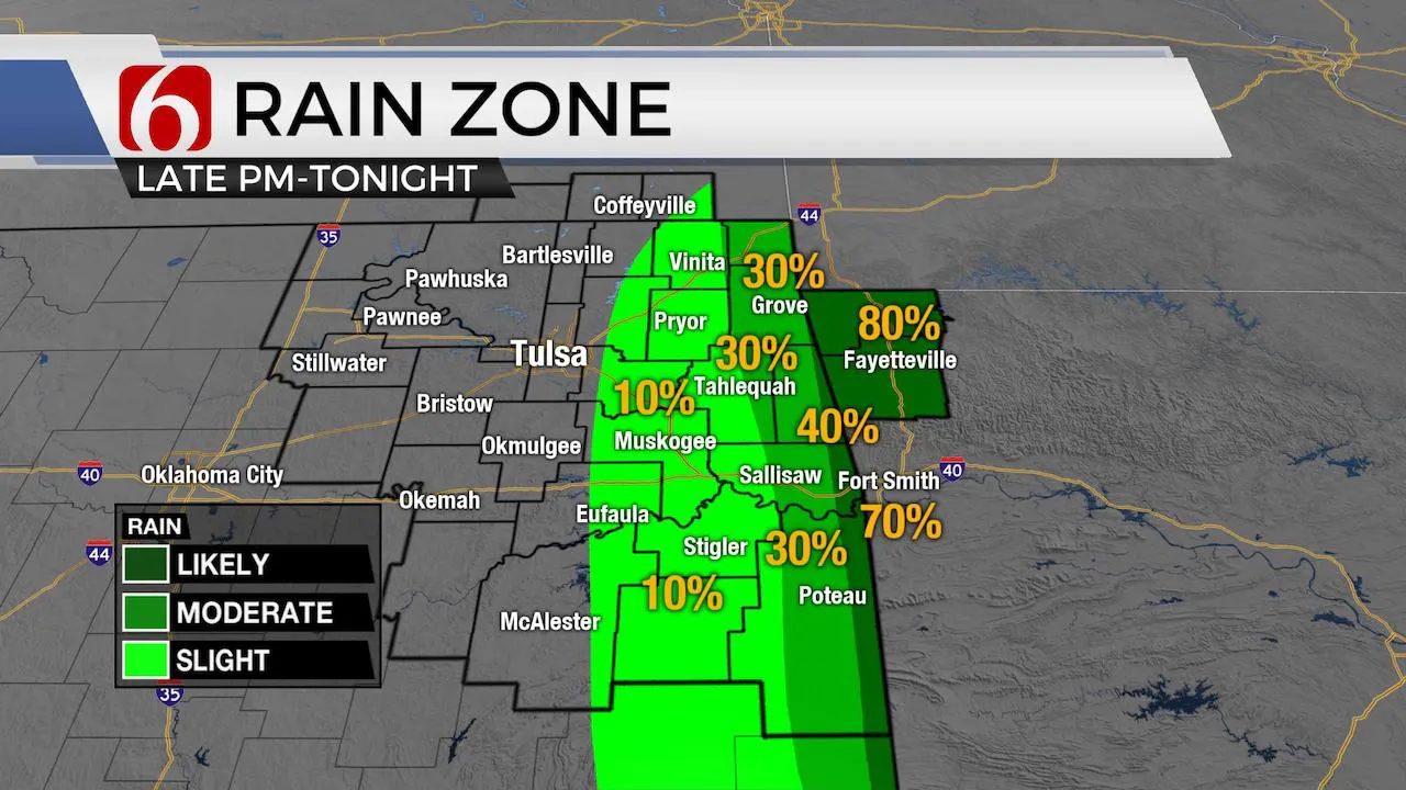
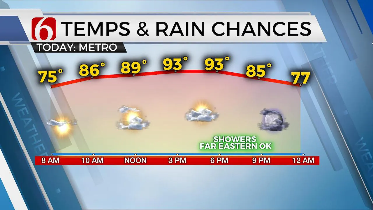
The trajectory and movement of TS Cristobal suggests most impacts will remain east of our immediate areas, but some precipitation will still be possible, and even likely for some far eastern Oklahoma locations late this afternoon and evening. The probability for the Tulsa metro remains near or less than 5%, while locations along and east of highway 69 should remain near 20%. Locations along the OK-Arkansas state line region will have the best chance tonight, but heaviest rainfall will also remain across Arkansas. The severe weather threats associated with landfalling tropical systems usually occur to the right or northeast quadrant and this will hold true for Cristobal with some tornadic activity possibilities across part eastern Mississippi and western Alabama. A strong upper air trough moving through the central plains today into Tuesday will bring strong to severe weather threats to part of NE Kansas and the upper Midwest through Wednesday.

This same upper trough will also bring a strong cold front across the state Tuesday afternoon and evening with a very slight chance for storms, mostly along and east of highway 69-75. Gusty northwest winds are likely behind the boundary Tuesday afternoon and evening and may approach advisory levels speeds. Our forecast will keep northwest winds from 20 to 35 mph for this period. Enough moisture and instability will remain for a few storms Tuesday, but mostly across NW Arkansas for our immediate areas of concern. More importantly, this boundary will usher in much drier air Tuesday night into Wednesday bringing a temporary respite of muggy weather across the state. EURO dew point projections indicate dews in the 40s and 50s for the rest of the week, while some data is still in the 50s and 60s. Regardless, we think this change will be noticeable with Wednesday and Thursday morning lows in the 50s and 60s. Remember, dry air also heats efficiently, but the thickness projections support highs staying only in the mid to upper 80s Wednesday and Thursday before moving back into the 90s Friday into the weekend.

The remainder of the mid to late week forecast should be mostly dry for the area. Friday into the weekend, some signals for weak disturbance riding the top of the ridge will remain and may bring a few isolated showers or storms, but these chances remain low.
Thanks for reading the Monday morning weather discussion and blog.
Have a super great day!
Alan Crone
More Like This
June 8th, 2020
August 8th, 2023
July 4th, 2023
May 8th, 2023
Top Headlines
December 13th, 2024
December 13th, 2024
December 13th, 2024
December 13th, 2024


