Storm Chances Return For The Weekend Across Eastern Oklahoma
Storm Chances Return For The Weekend Across Eastern OklahomaFriday, June 19th 2020, 7:50 am
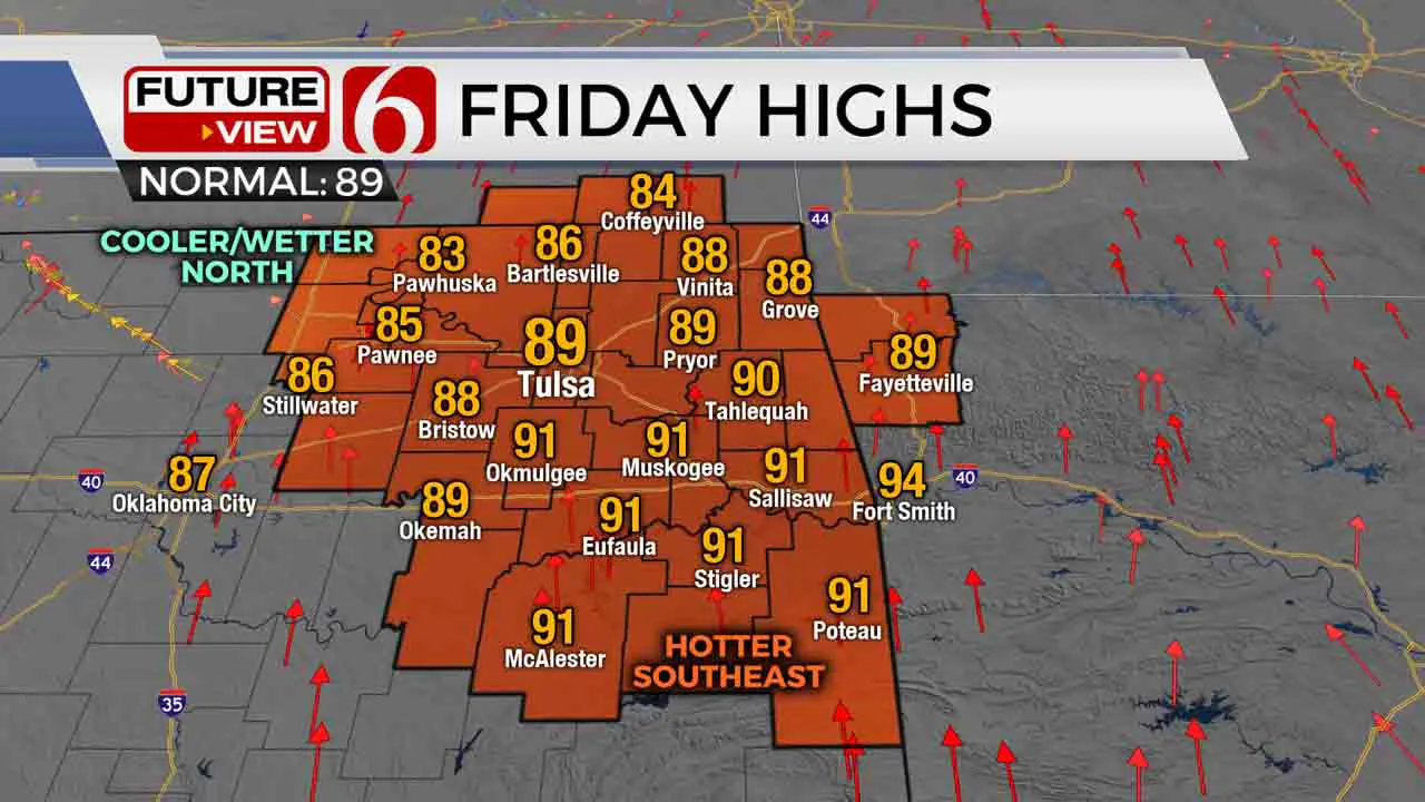
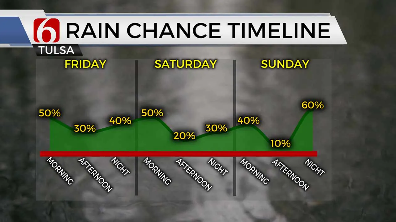
For pretty much the first time all month, rain and storm chances are returning to eastern Oklahoma ahead of a very busy weekend. Scattered rain and storms will impact parts of northeastern Oklahoma during our Friday morning, especially north and west of Tulsa. Severe weather threats are very low, but some locally heavy rains are possible. Additional redevelopment of storms is expected generally near and north/west of the I-44 corridor through the morning and into much of the afternoon as well, which will keep temperatures north and west of Tulsa noticeably cooler today. If you’re planning to commemorate Juneteenth in the Greenwood District or other areas, keep an umbrella handy for those rain and storm chances.

Areas further east and south/southeast of Tulsa will see lower rain chances and more of the familiar summer heat today, with highs back into the lower 90s. Areas north and northwest of Tulsa look to be noticeably cooler with rain and clouds holding highs in the 80s.

Off-and-on areas of rain and storms will continue to flare up across parts of eastern Oklahoma Friday night and into Saturday morning. Once again, severe weather threats should remain fairly low. Of course we are watching the weather very closely on Saturday for President Trump’s visit. Right now any storms during the afternoon Saturday look to be fairly isolated, but can’t be ruled out. And a few strong to marginally severe storms are a possibility Saturday with plenty of instability in place. If you’re planning to be in downtown Tulsa Saturday for President Trump’s visit, be prepared for the chance of a storm or two. Otherwise it’ll be very warm and humid Saturday with temperatures in the upper 80s and heat index values into the 90s.
The unsettled pattern continues into Father’s Day Sunday. Once again it’ll be far from a washout, but some widely scattered storms are possible Father’s Day Sunday, mainly in the morning hours with lower chances for Father’s Day afternoon. A more widespread round of heavier storms is lining up to impact Green Country Sunday night into Monday morning, as well as Monday night into Tuesday morning. These should provide some good drinks of water for areas that have dried out significantly over the past month.
I hope you have a great Friday, Green Country! You can follow me on Twitter @StephenNehrenz as well as my Facebook page Meteorologist Stephen Nehrenz to stay up to date with the very latest!
More Like This
June 19th, 2020
August 8th, 2023
July 4th, 2023
May 8th, 2023
Top Headlines
December 12th, 2024
December 12th, 2024
December 12th, 2024


