Tracking Storms Nearby Tulsa Viewing Area
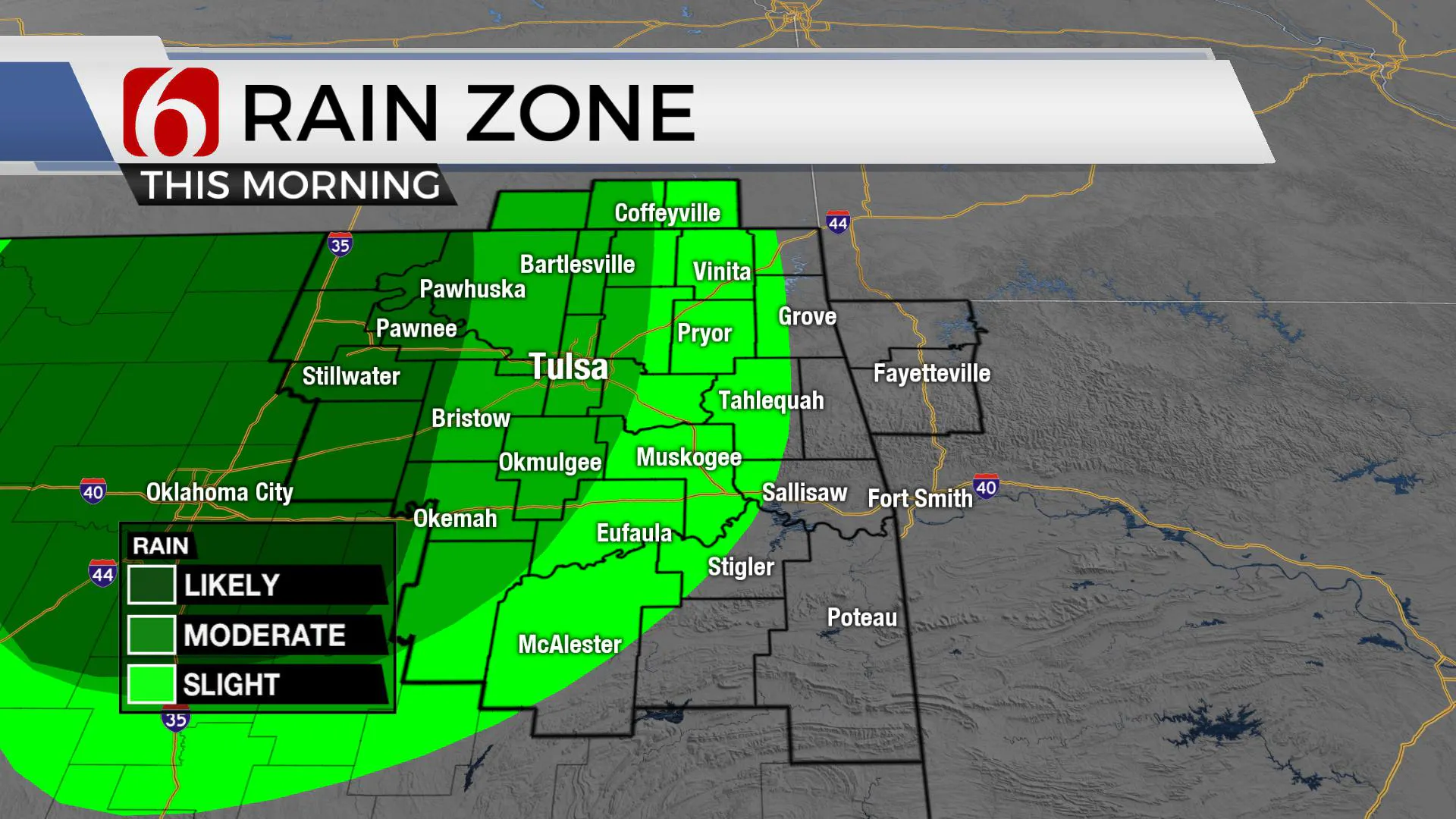
A disturbance near I-35 is stronger than modeled and storms are up and running this morning with this feature moving east to southeast.Monday, July 13th 2020, 7:20 am
TULSA, Okla. -
A disturbance near I-35 is stronger than modeled and storms are up and running this morning with this feature moving east to southeast.
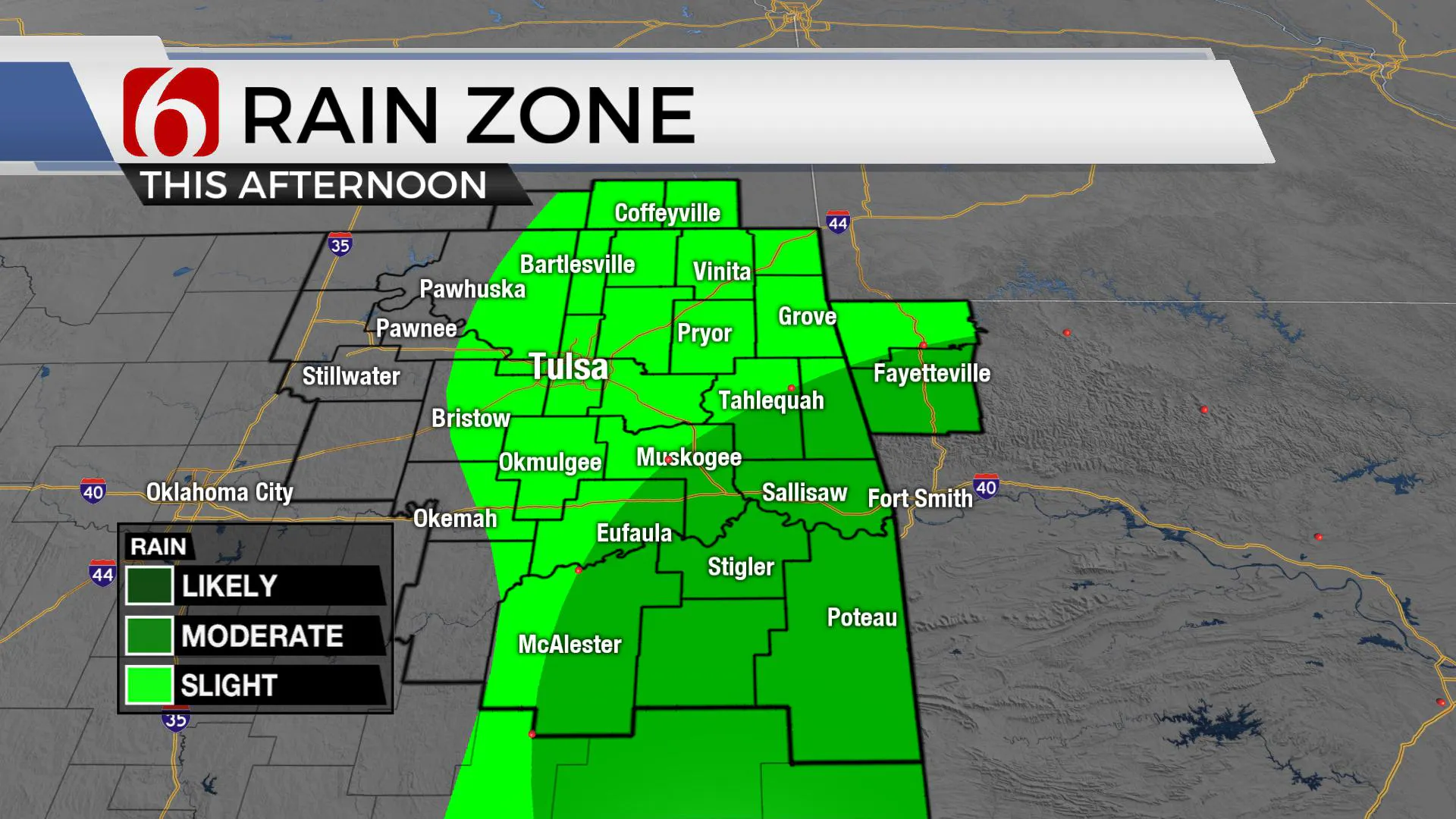
A few severe storms are also noted near and west of I-35 where instability and moisture are greater compared to most of eastern OK. While this activity will weaken some in the next few hours, the potential for some activity to reach northeastern OK is increasing for the morning hours. Additionally, the MCV associated with this feature may travel across eastern OK through the day activating a few more storms during the midday to afternoon period.
Clouds associated with this feature will keep temps across northeastern OK down a little with the metro high near 92. Some locations to the south of I-40 could see highs today in the upper 90s. Heat index values will be near the upper 90s across NE OK and from 100 to 107 across southeastern OK. Locations across extreme southeastern OK will remain in a heat advisory for the afternoon.

The mid-level ridge of high pressure we’ve been tracking for the past week continues to stay slightly southwest of the state. Even though the ridge has expanded some in the past few days, the northern extent of the ridge remains to our south.
The active northwest flow pattern from last week is now to our east, but a zonal flow (west to east) pattern is now positioned across extreme northern OK and southern Kansas.This flow will remain close enough to our area for the next three days to change some things to our forecast.
We’ll keep a slight chance of storms during the early morning hours across far northern OK and southern Kansas and lower the daytime highs a few degrees from previous forecasts.Some data suggest a weak boundary may slip into northern OK Wednesday for a few hours before lifting northward Thursday morning.

I have included this wind shift for Wednesday and lowered the temps a few degrees, now mid 90s instead of upper 90s, but the heat index will remain from 103 to 107. The ridge will slowly begin expanding northward for the middle to end of the week and we should see slowly increasing temps daily into the end of the week near 100. Heat advisories will more than likely be returning.
In summary, we will be tracking a disturbance across the area today. A few strong to severe storms may still develop in a few spots.
Thanks for reading the Monday morning weather discussion and blog.
Have a super great day!
More Like This
July 13th, 2020
August 8th, 2023
July 4th, 2023
May 8th, 2023
Top Headlines
December 13th, 2024
December 13th, 2024
December 13th, 2024
December 13th, 2024


