Pleasant Weather Continues Across Northeastern Oklahoma
Day 4 of great weather. The mid-level ridge remains well west and the trough is positioned across the Midwest.Thursday, August 20th 2020, 6:41 am
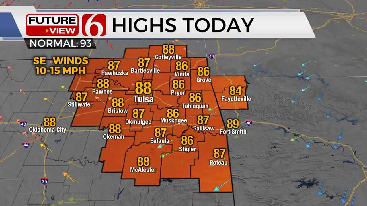
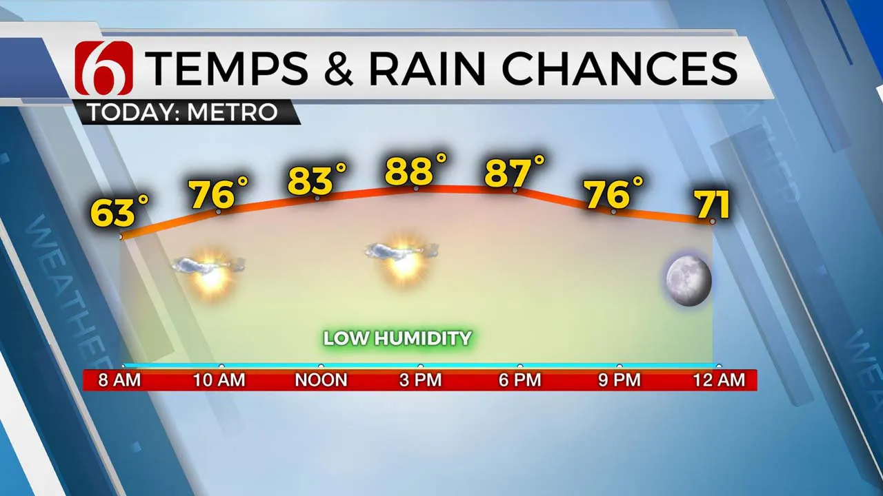
Day 4 of great weather. The mid-level ridge remains well west and the trough is positioned across the Midwest. Eastern Oklahoma is situated between these two features and will continue benefitting from relatively dry and mild conditions for the next two days before a slight increase in heat and humidity this weekend into early next week. The upper air flow remains from the north and northwest today and tomorrow and may bring a small chance for a few showers or storms near the region for the next day or two before the ridge expands eastward. Temps will remain cool this morning, mostly in the lower 60s in the metro before reaching the mid-80s at noon and the upper 80s this afternoon. Northeast winds this morning should back from the southeast later today but remain around 10 to 20 mph in speeds. Another pleasant day for most of eastern sections of the state.

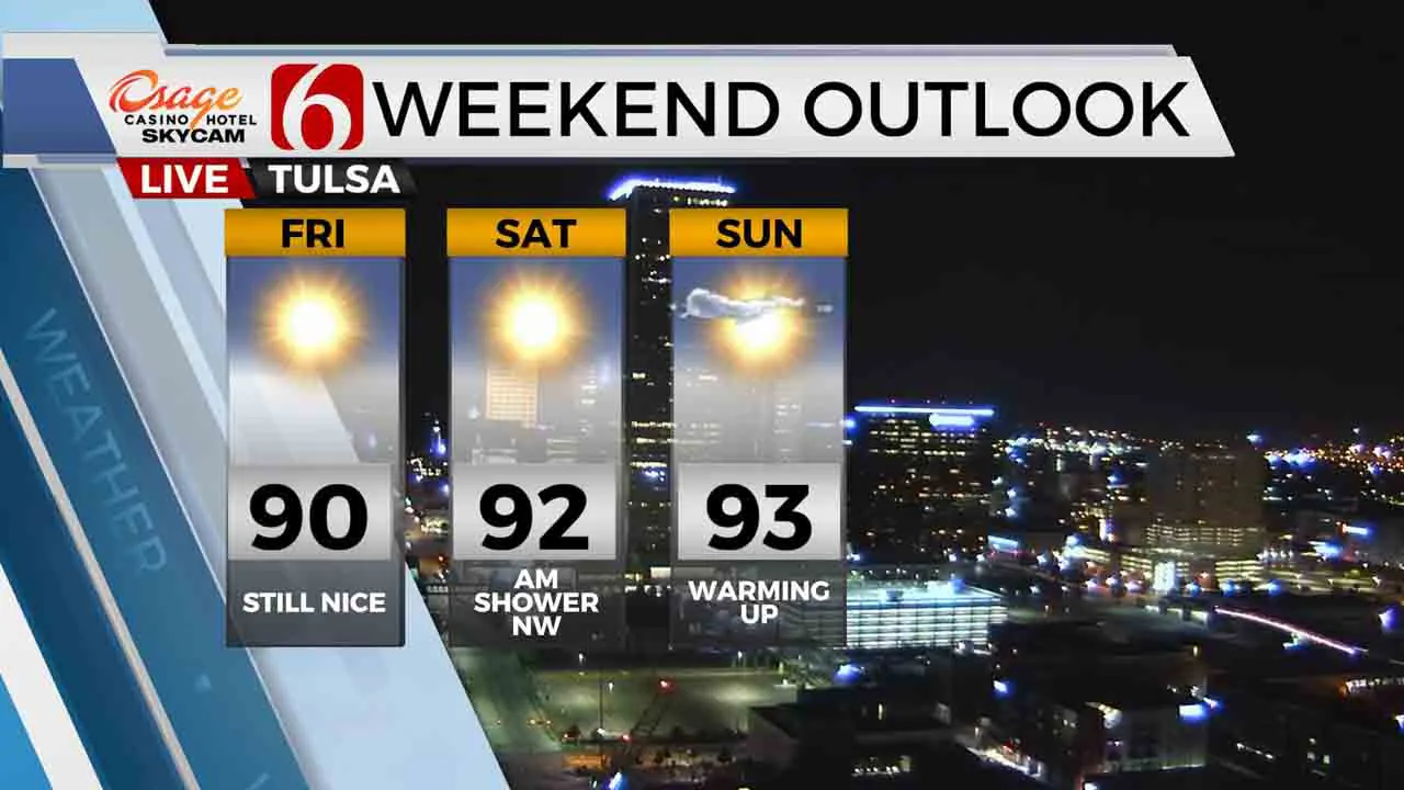
As I have been posting earlier this week, the upper air flow can be a little tricky in this pattern. It can easily bring a disturbance or even a storm complex across the area despite little support in model data. But at this point, we see no major signals in either observational or model data encouraging us to add any big chance of precipitation. There will be a small window Saturday morning across part of the area near Osage Co westward, but this chance will also remain extremely low at this point in the forecast cycle.

Temps are cool this morning, but not as low as yesterday with most locations in the upper 50s and lower 60s. The 54 at Bristow yesterday morning was one degree away from its record low of 53, set back in 1950. Not too bad.

Highs this afternoon will remain below seasonal norms, with highs nearing the upper 80s. Our normal high has just maxed out for the year and now begins is slow drop into fall. By Sept 1st, our normal high is 90 but by the end of the month, will be down to 78. Fall is not too far away.
Until we see a big sign of a major pattern change, our weather will remain rather benign for now.
As posted earlier in the week, we continue to watch the development of at least two tropical systems in the Atlantic Basin. You’ll be seeing and hearing more about these storms in the near future.
Thanks for reading the Thursday morning weather discussion and blog.
Have a super great day!
Alan Crone
More Like This
August 20th, 2020
August 8th, 2023
July 4th, 2023
May 8th, 2023
Top Headlines
April 26th, 2024
April 26th, 2024
April 26th, 2024


