Severe Storms Possible Monday For Northeastern Oklahoma
A period of active weather continues through the next few days as a storm system approaches the state bringing numerous rounds of thunderstorms across the region. Storms are ongoing this morning near and south of the metro.Monday, August 31st 2020, 9:42 am
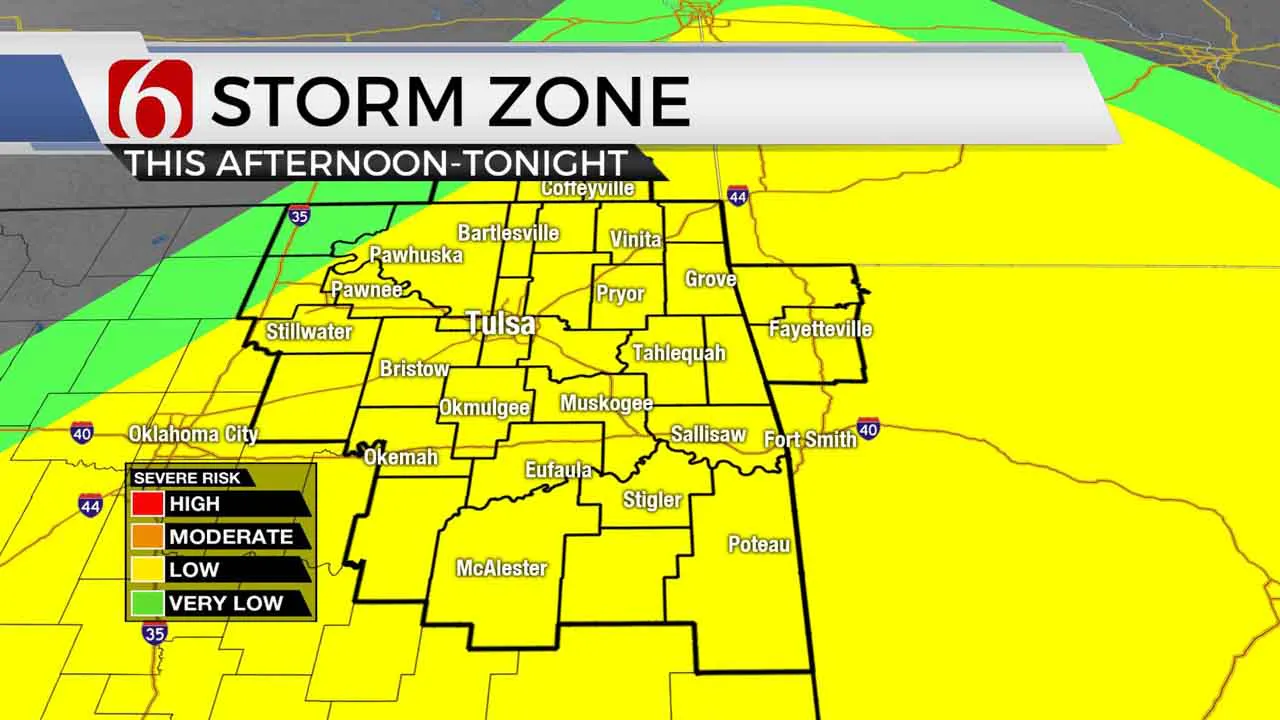
A period of active weather continues through the next few days as a storm system approaches the state bringing numerous rounds of thunderstorms across the region. Storms are ongoing this morning near and south of the metro. A few have been strong to severe overnight producing 60 to 70 mph wind gusts along with some hail and heavy rainfall. A few storms will linger for the next several hours before additional storms develop later this afternoon as a boundary approaches from the north along with a strong upper level disturbance from the west. This afternoon and early evening chance will support severe weather threats including with large hail and damaging winds. A very small window will remain during the early part of the event for a tornado warning. High temperatures this afternoon will still reach the upper 80s or lower 90s but should begin moderating due Tuesday and Wednesday with highs either in the upper 70s or lower 80s. Active weather should remain at least Tuesday and part of Wednesday.

The main upper level system currently across the pacific northwest will slowly drop southeast and should be slowly exiting the state Wednesday or early Thursday. A surface boundary currently positioned across northwestern OK should move southward before stalling later tonight or Tuesday morning. Until this boundary and upper feature exits the area, active weather will remain. The threat for additional heavy thunderstorms will return Tuesday night into Wednesday as the main upper level system nears the body of the state. The combination of the front and upper system should keep some storms across far southern or extreme eastern sections of the state Wednesday night or Thursday morning, but most of northeastern OK should be finished with rain chances by Thursday morning. We do have some conflicting solutions with the evolution of the low, but for now will taper the pops down by into Thursday. A quick look at the approaching weekend looks dry with temps rebounding into the mid-80s for afternoon highs.
The pattern appears to be changing across the nation. The stronger belt of westerlies is already slowly migrating southward, which is a normal feature this time of year ushering in the return of fall. We’ll anticipate increasing frequency of cold fronts and storm systems over the next few weeks. This is also the time of year we typically enter our secondary severe weather season for a few weeks. Usually, this is mid to late September into October, but we may be getting an early kick-off to the season.
Thanks for reading the Monday morning weather discussion and blog.
Have a super great day!
Alan Crone
More Like This
August 31st, 2020
August 8th, 2023
July 4th, 2023
May 8th, 2023
Top Headlines
December 11th, 2024
December 11th, 2024
December 11th, 2024
December 11th, 2024


