Morning Fog, Then Drier Weather Returns To Green Country
After several days of off-and-on storms, a drier weather pattern is starting to set up for eastern Oklahoma.Thursday, September 3rd 2020, 8:02 am
After several days of off-and-on storms, a drier weather pattern is starting to set up for eastern Oklahoma.
Areas of dense fog will impact parts of northeastern Oklahoma through the mid-morning hours. Drive carefully! By mid to late morning, much of the fog should thin out.

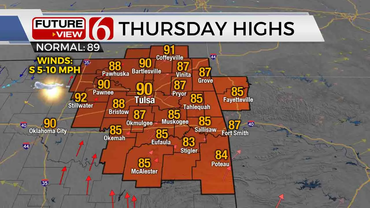
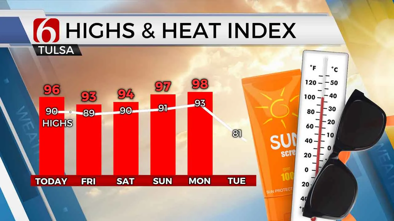
The long-lingering upper level system that brought us persistent rain chances is moving off to our east. A few isolated showers are still possible across southeastern Oklahoma, but the large majority of us will stay dry. Otherwise some sunnier skies return for our Thursday afternoon, and it’ll be quite warm and muggy with highs in the upper 80s to around 90. Heat index values will climb to the mid 90s or above.

A very weak cold front will drop into northeast Oklahoma tonight into early Friday morning. This could spark a couple showers. Areas north of Tulsa should get to enjoy some lower humidity Friday thanks to that front, though if you’re south of Tulsa you’re likely to stay much muggier. Despite the front, we’ll still be very warm Friday afternoon with highs back in the upper 80s.
We’re setting up for toasty, but overall calm weather to be outside for Labor Day weekend! Lows in the upper 60s and highs around 90 look common for both Saturday and Sunday, with generally dry conditions. The late summer heat will build a bit more for Labor Day, with highs up into the lower 90s.
You’ve probably already heard some chatter about our first possible fall cold front coming in next week. But just a slight word of caution: It’s not a totally done deal yet. An upper level pattern change does look favorable in bringing us a strong cold front by either Tuesday or Wednesday next week, but forecast models are still getting a handle on this setup, and there’s still a chance that cold front fails to make it here. If that happens, we would end up a lot warmer than currently forecast. The next couple days should give us a much clearer picture, so stay tuned on that!
I hope you have a great Thursday, Green Country! You can follow me on Twitter @StephenNehrenz as well as my Facebook page Meteorologist Stephen Nehrenz to stay up to date with the very latest.
More Like This
September 3rd, 2020
August 8th, 2023
July 4th, 2023
May 8th, 2023
Top Headlines
December 13th, 2024
December 13th, 2024
December 13th, 2024
December 13th, 2024


