Mild and Warm Weather Expected For Wednesday
Mild and Warm Weather Expexted For WednesdayWednesday, September 16th 2020, 5:01 am
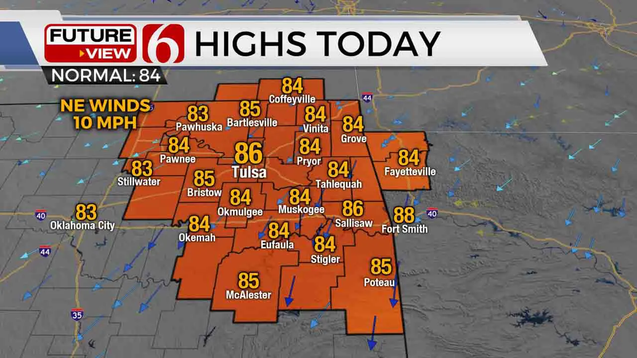
Mild and warm weather is expected today before another great taste of fall arrives Friday into the weekend.
A weak shear-axis is situated across part of central and eastern Oklahoma this morning and will provide for a few showers or sprinkles across the southern and eastern sections of the state today. Thursday any shower or storm activity should remain across far southeastern Oklahoma. The result for the Tulsa metro will be only slight mentions for a passing shower or sprinkle today with the chance at 10% or less. A weak boundary will move across the area late Thursday night into Friday morning bringing dew points down into the 50s marking the beginning of a pleasant weekend pattern. This will drop the morning lows into the 50s and afternoon highs in the upper 70s to lower 80s. A ridge of high pressure will also be positioned nearby this weekend keeping the sunshine and pleasant weather statewide.
 Image Provided By: Alan Crone
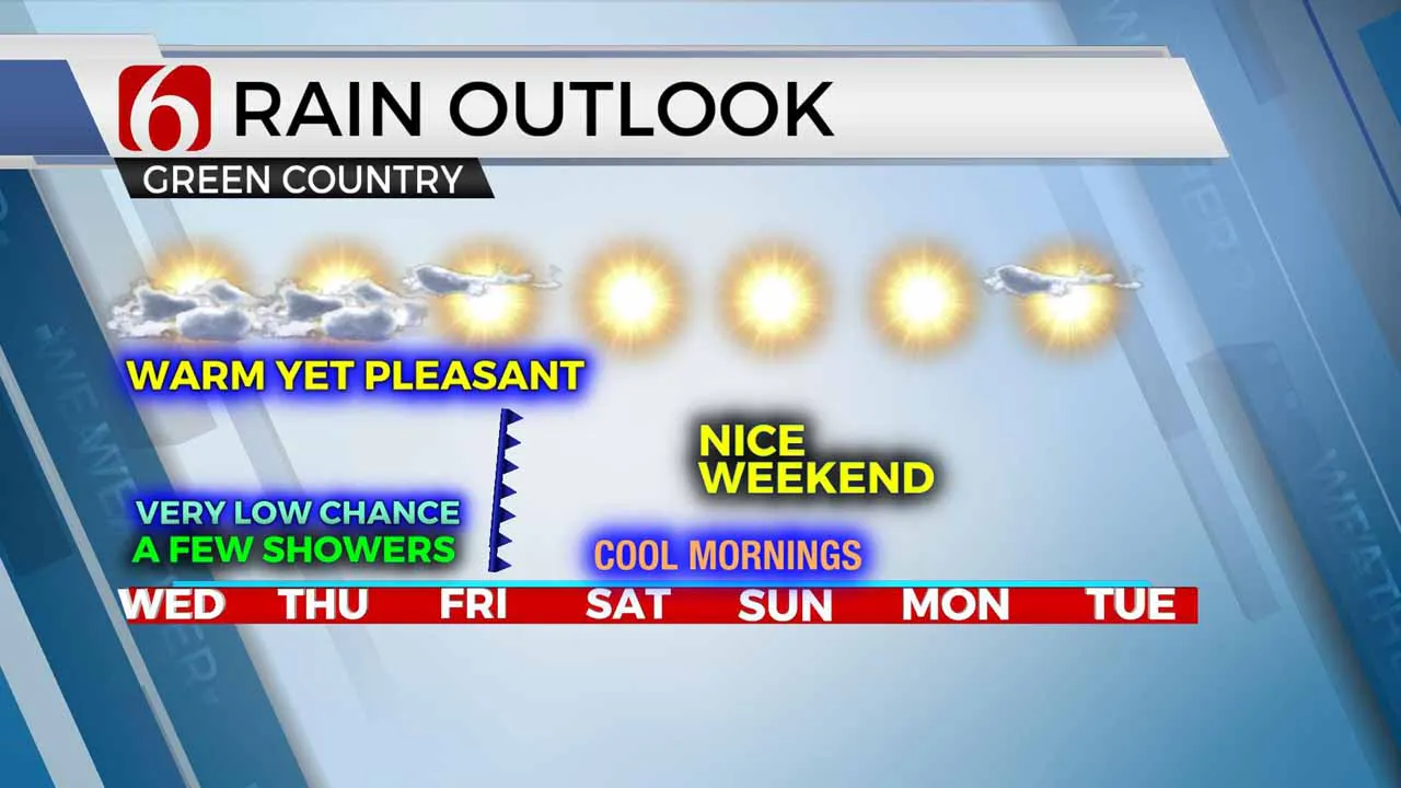
The next 36 hours should feature a few sprinkles or showers somewhere across part of southeastern or eastern Oklahoma, but most data continue trending dry. With a weak disturbance nearby along with at least some low-level moisture present, I’ll keep a low mention for a sprinkle or passing shower, including very low mentions for the Tulsa metro. Slightly better chances will occur across extreme southeastern Oklahoma and north Texas Thursday evening before the drier air arrives from the Missouri Valley bringing the Five-Star weather across the state Friday into the weekend. Dew points will drop from the mid-60s into the lower 50s this weekend setting the stage for a nice stretch of weekend weather. A quick look into next week also supports relatively mild weather but the upper pattern will bring a stronger looking disturbance across the central and northern plains for the middle of next week.
 Image Provided By: Alan Crone
Sally strengthened overnight into a strong category 2 hurricane with sustained winds reaching at least 105 mph along with higher gusts near 125 mph. Historic flooding is underway across part of extreme southern Alabama and the northern Florida panhandle region due to the slow movement of the hurricane, which is currently northeast at 3 mph. After making landfall this morning, Sally will slowly spin-down but will continue as a significant flooding threat for the next 24 hours before picking up forward speed Friday.
 Image Provided By: Alan Crone
Thanks for reading the Wednesday morning weather discussion and blog.
Have a super great day!
Alan Crone
More Like This
September 16th, 2020
August 8th, 2023
July 4th, 2023
May 8th, 2023
Top Headlines
December 12th, 2024
December 12th, 2024
December 12th, 2024
December 12th, 2024


