Overcast Conditions, Highs In The Mid-50s
The pattern will present another rollercoaster ride for the next few days, but today we are at the bottom of the ride with damp and raw fall morning underway.Monday, October 19th 2020, 5:52 am
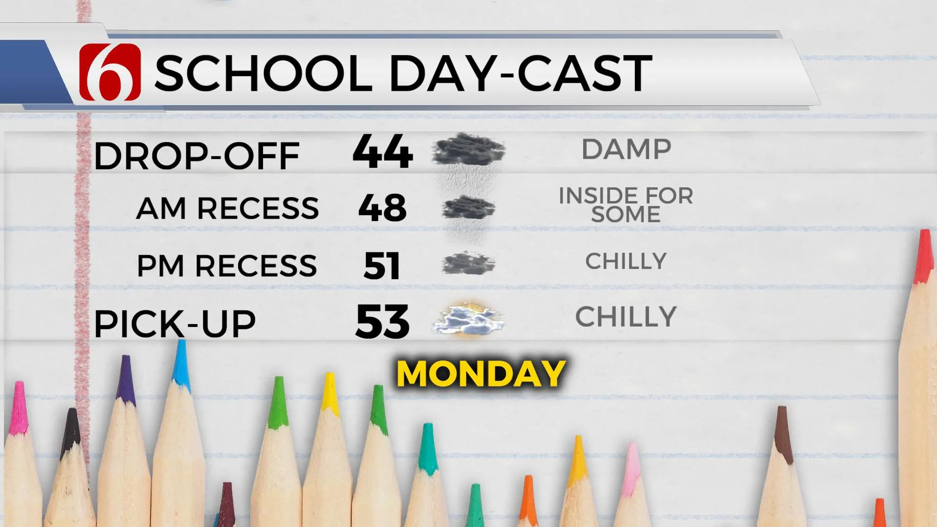
The pattern will present another rollercoaster ride for the next few days, but today we are at the bottom of the ride with damp and raw fall morning underway. Temps are in the mid-40s with pockets of showers and some drizzle for the next few hours before this precipitation moves east of the area. The overcast conditions should prevail for the day across most of NE OK, but some clearing is likely along and south of I-40 late this afternoon. Afternoon temps will top-out in the lower to mid-50s north with overcast for the day and mostly upper 50s south across extreme southeastern OK where some late day sun seems possible. Winds should remain from the north today around 10 mph. But our next system will quickly develop across the pacific northwest and drop down the northwest flow Tuesday night into Wednesday bringing some changes to the state.

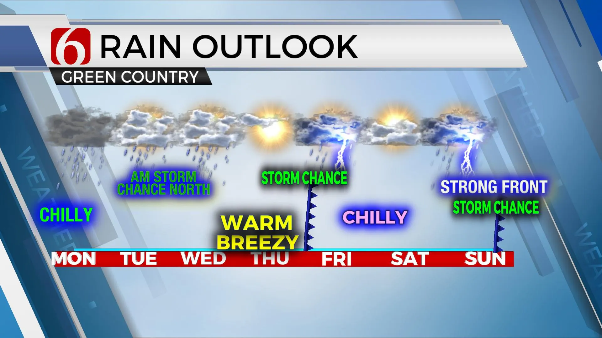
The front, currently to our south will retreat northward as a warm front once pressure begins to fall across and east of the Rockies later tonight into Tuesday. As this boundary lifts northward tomorrow, we may experience a few spotty showers or some pockets of drizzle, but amounts will be light, if any at all for some locations. Highs Tuesday will reach the mid-70s with south winds returning around 10 to 25 mph. This boundary will be positioned near the OK-KS state line region late Tuesday night with a few storms developing as the front continues lifting northward into early Wednesday. By Wednesday into Thursday our region will be positioned in the warm sector of the developing mid-level cyclone with gusty south winds and highs reaching the lower 80s Wednesday and the mid-80s Thursday before the next front moves across the region late Thursday night into Friday morning bringing another chance for a few storms. The data suggest another robust cool-down Friday with temps falling from the upper 60s into the lower 50s by afternoon with stout north winds. Saturday also looks cool with lows in the 40s and highs in the 50s before south winds return late Saturday night into Sunday morning ahead of a strong front that brings another chance of storms and another cool-down sometime Sunday into early next week. Data this morning suggest this weekend upper level system will be strong and could produce some severe weather threats near or east of the state Sunday night into Monday while the strongest cold front of the fall season so far brings cold weather into the southern plains. The air mass behind this front may be polar with significant cold air for the central plains, and we could get the leading edge of this colder air early next week. Stay tuned.

Thanks for reading the Monday morning weather discussion and blog.
Have a super great day!
Alan Crone
Check our my podcast “Weather Out The Door” on most podcast providers, or you can listen on SoundCloud here.
More Like This
October 19th, 2020
February 14th, 2022
January 26th, 2022
January 25th, 2022
Top Headlines
December 11th, 2024
December 11th, 2024
December 11th, 2024
December 11th, 2024


