Friday Weather Whiplash As Much Colder Air Returns
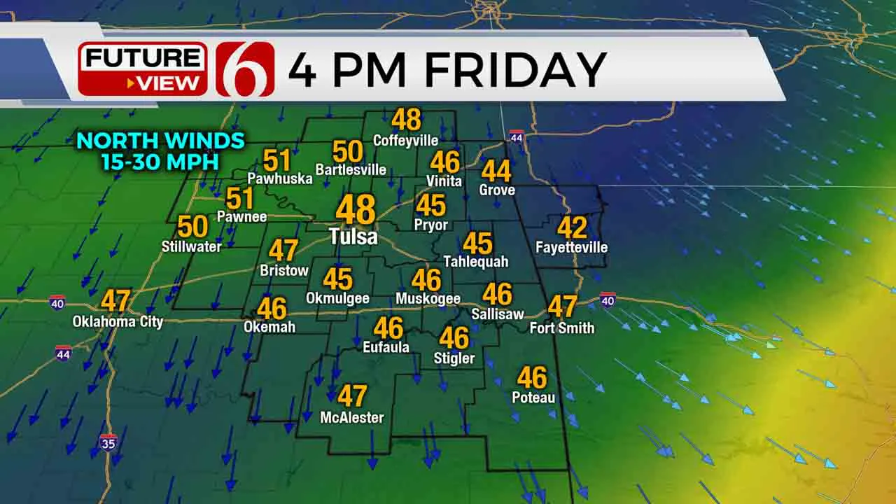
Goodbye t-shirts, hello coats! It’s a drastic temperature drop for our Friday with the first of two strong cold fronts. That cold front will make steady progress across all Green Country by mid-morning. Behind the front temperatures will drop sharply into the 40s, with stiff north winds pushing wind chills into the 30s.Friday, October 23rd 2020, 10:23 am
Goodbye t-shirts, hello coats! It’s a drastic temperature drop for our Friday with the first of two strong cold fronts.
That cold front will make steady progress across all Green Country by mid-morning. Behind the front temperatures will drop sharply into the 40s, with stiff north winds pushing wind chills into the 30s.
And don’t expect much of an afternoon rebound! We may be able to break out some sun by late in the day that could be enough to push us back to about 50 degrees, but for the majority of us, temperatures will generally hold in the 40s throughout our Friday behind the front. It’ll be a hot chocolate kind of night at any high school football games with evening temperatures in the lower 40s and wind chills back in the 30s.

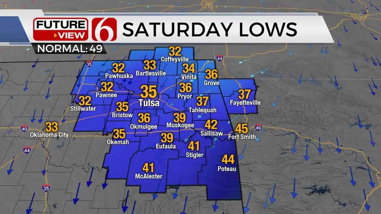
Skies will try to clear across parts of the area late Friday night. If they do, we’ll have a chance at the first freeze of fall Saturday morning in our northern counties. Lows will be right near freezing north and northwest of Tulsa, so I’d be ready to cover those plants up! The Tulsa metro could have some frost though we’ll stay above freezing. South and southeast of Tulsa, a frost or freeze is not expected Saturday morning. We’ll have a calm but chilly fall day Saturday with a sun-cloud mix and highs in the 50s.
A second strong cold front will be winding up as we hit the end of the weekend. Right now, it looks like that front will arrive late in the day Sunday, with some 60s in parts of Green Country Sunday ahead of that front. By Sunday evening, gusty north winds will start to kick back in as temperatures fall into the lower 40s and upper 30s again by Monday morning. Areas of cold rain are expected Monday, and it’ll be a raw, winter-like day with temperatures likely holding in the upper 30s to around 40.

With those cold surface temperatures in place, we will have to – believe it or not – keep an eye on the wintry weather potential from late Monday into Tuesday. Right now, any wintry precipitation would appear to be more likely across the western half of Oklahoma in that timeframe, with primarily cold rain more likely for eastern Oklahoma. But a swing of just a few degrees could change all that, so stick with us in the days ahead and we’ll keep you updated! Be prepared for winter-like cold to stick around though for the first half of next week. What a crazy weather ride!
I hope you have a great Friday, Green Country! You can follow me on Twitter @StephenNehrenz as well as my Facebook page Meteorologist Stephen Nehrenz to stay up to date with the very latest.
More Like This
October 23rd, 2020
February 14th, 2022
January 26th, 2022
January 25th, 2022
Top Headlines
December 11th, 2024
December 11th, 2024
December 11th, 2024
December 11th, 2024


