Another Windy Weather Day Ahead
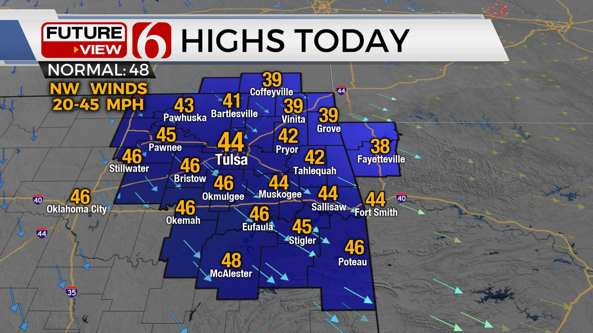
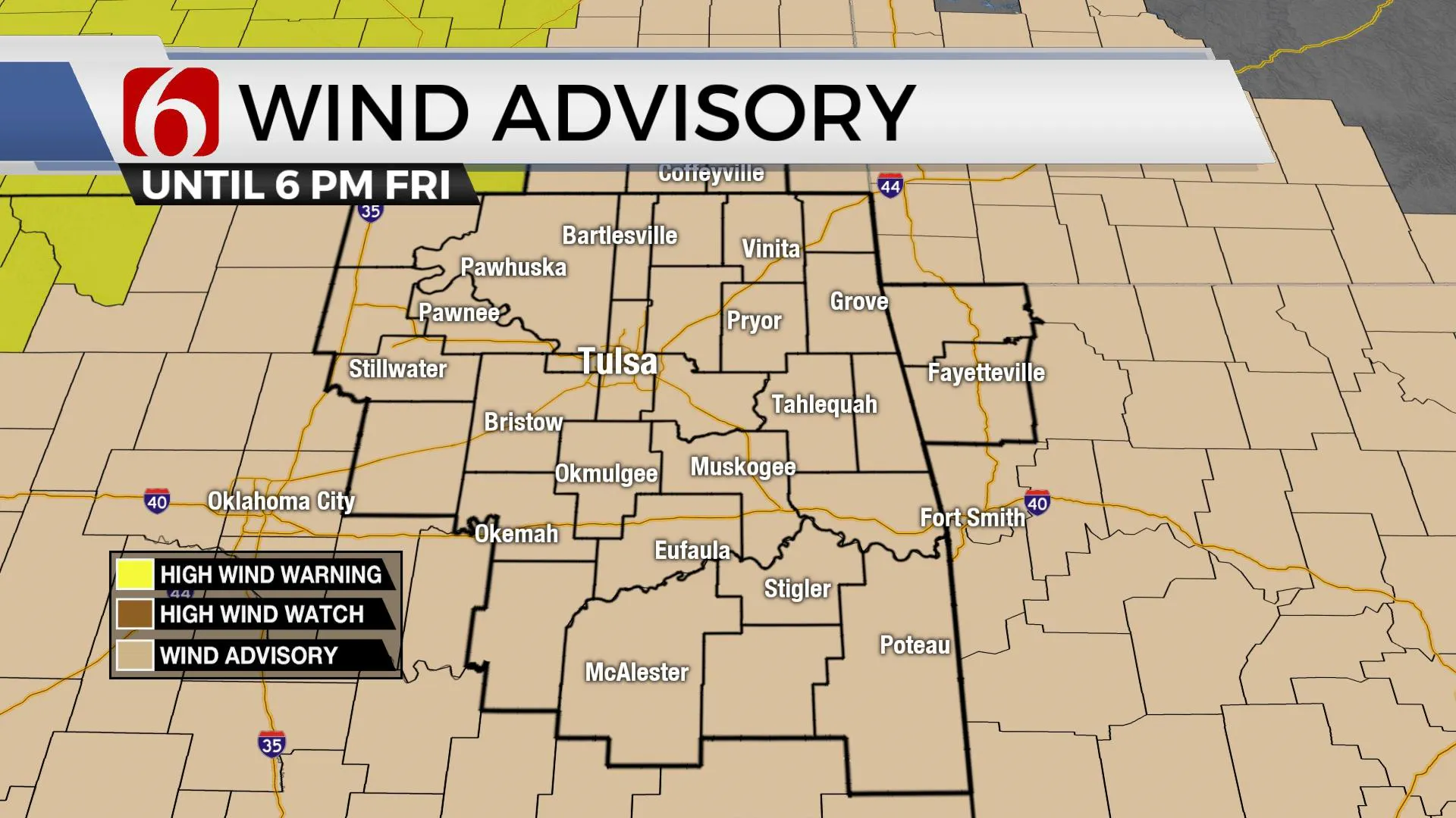
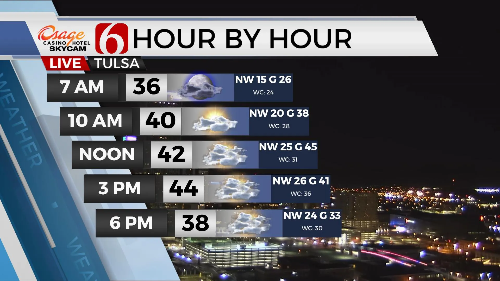
Another day of windy weather is underway across the state, including most of Eastern OK with northwest winds from 25 to 45 mph. Another wind advisory will be required today for most of the region. Temperatures will also remain chilly with morning lows in the upper 30s and afternoon highs in the lower to mid-40s. Wind chill values today will be in the 20s this morning and the 30s this afternoon. A few snow flurries will be likely along the OK-KS-AR-MO borders with any dusting removed from far norFriday, January 15th 2021, 7:07 am
Another day of windy weather is underway across the state, including most of Eastern OK with northwest winds from 25 to 45 mph. Another wind advisory will be required today for most of the region. Temperatures will also remain chilly with morning lows in the upper 30s and afternoon highs in the lower to mid-40s. Wind chill values today will be in the 20s this morning and the 30s this afternoon. A few snow flurries will be likely along the OK-KS-AR-MO borders with any dusting removed from far northeastern Oklahoma. These strong and gusty northwest winds will finally ease up later tonight as the powerful cold-core low pulls away from the Midwest. A chilly weekend will remain, but winds will be much lighter for most of the area.

The fire spread rate continues to be very high today due to the expectation of the strong environmental winds. The drying vegetation and dormant season will lead to elevated conditions today despite the slightly higher humidity values compared to yesterday afternoon.

The next upper-level wave will quickly drop down the intermountain region Saturday morning and approach the state by evening but dry air in the lower part of the atmosphere should keep the area dry. Saturday looks mostly sunny and chilly before a few clouds arrive by evening. We get a minor respite in wind and temps Sunday into Monday before the next storm system nears the state for the middle of next week bringing additional rain chances and some colder weather by the end of the week.
Another series of disturbances will arrive next week and bring a system near the are Tuesday and also Thursday. The first one brings a few showers for northern OK with much higher chances across the southeastern sections of the state. The 2nd system may have a broader impact with higher rain chances across a larger area of the state.

We continue to watch the ensembles and long-range data suggesting the potential for arctic air to break loose and move southward for the latter half of the month. While it’s impossible to know the exact outcome for the state at this point, it’s appearing more likely for at least the northern half of the nation to experience some very cold air in the near future and we may see the leading edge nearing around January 25th or so.
Thanks for reading the Friday morning weather discussion and blog.
Have a super great day!
Alan Crone
KOTV
Search for NewsOn6 and ‘Weather Out The Door’ on most podcast providers, including Here on Spotify.
More Like This
January 15th, 2021
February 14th, 2022
January 26th, 2022
January 25th, 2022
Top Headlines
December 11th, 2024
December 11th, 2024
December 11th, 2024
December 11th, 2024


