Sub-Freezing Temperatures Continue For The Foreseeable Future
Our forecast continues with sub-freezing temperatures for the foreseeable future. A second surge of arctic air should arrive this weekend with even colder conditions persisting into early next week. As stated here many times, once an air mass such as this one becomes entrenched across the plains, it takes a big pattern change to scour out the colder air and replace it with a moderating continental air mass. I don’t see this happening until possibly late next week or even possibly as late as nextThursday, February 11th 2021, 6:43 am
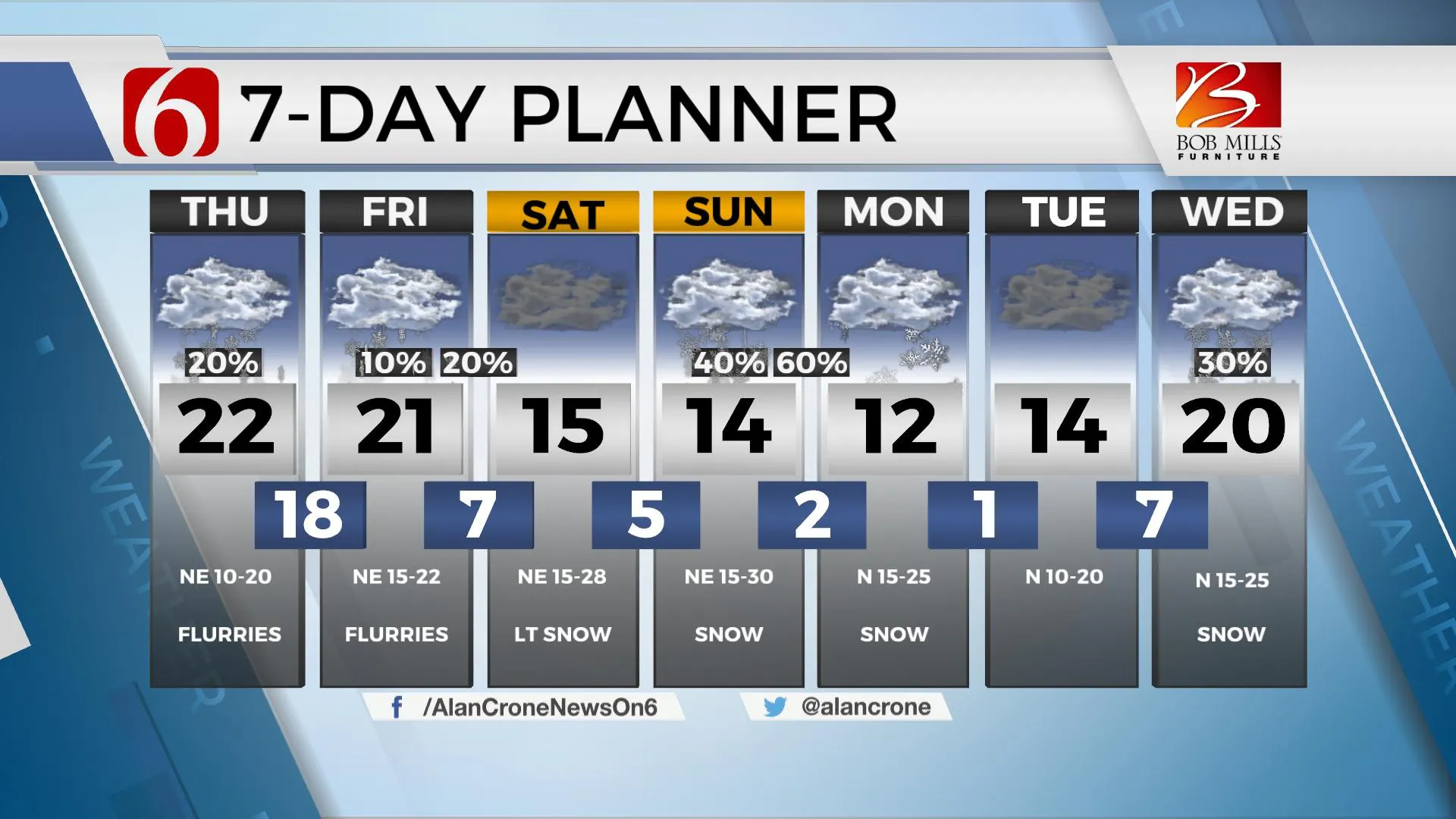
Our forecast continues with sub-freezing temperatures for the foreseeable future. A second surge of arctic air should arrive this weekend with even colder conditions persisting into early next week. As stated here many times, once an air mass such as this one becomes entrenched across the plains, it takes a big pattern change to scour out the colder air and replace it with a moderating continental air mass. I don’t see this happening until possibly late next week or even possibly as late as next weekend. While it will get much colder as the cold air will become deeper from a total column standpoint, the good news will be in precipitation type forecasting: after today, almost all of the precip types should be in the form of snow this weekend into next week across most of the state. Our bouts with freezing drizzle and rain will soon wan but our battle with snow may just begin.

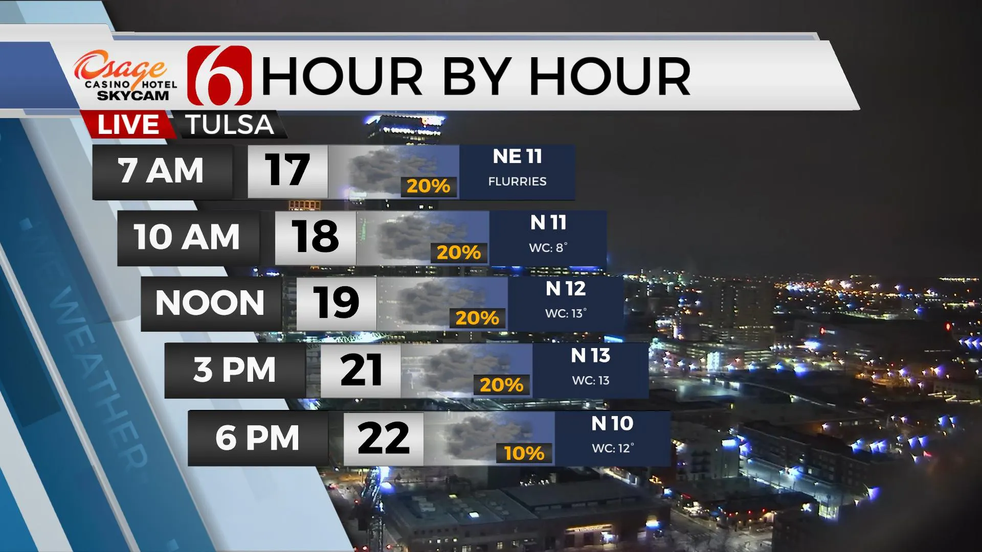
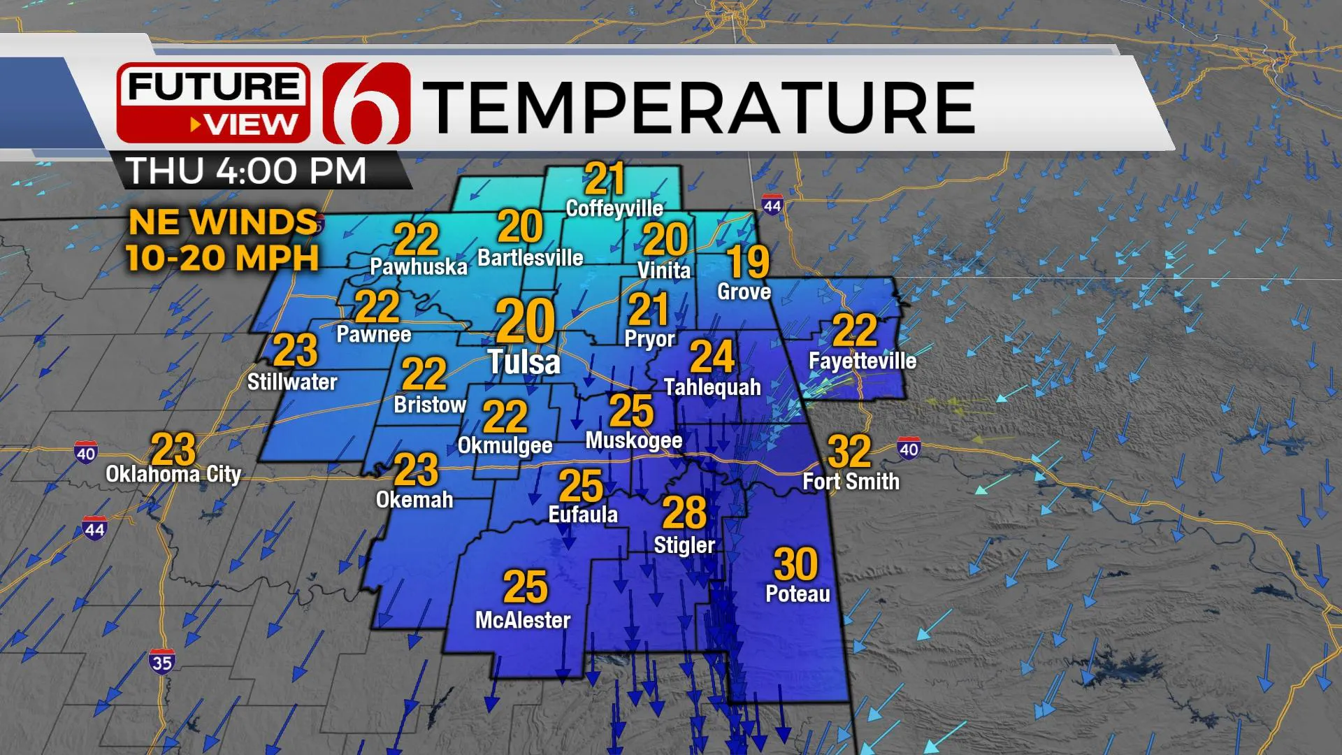
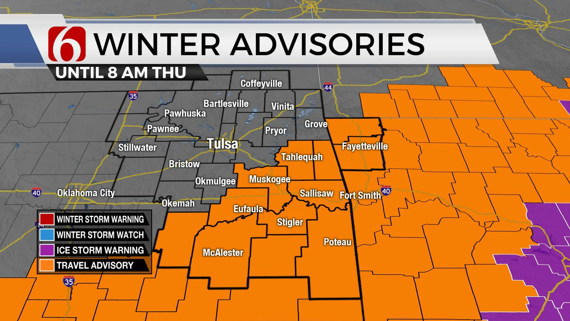
We’ll be in the running for some occasional snow grains or flurries today and tomorrow across northern OK, but this will not be significant nor impactful. I’ve already noticed some local lake effect snow showers this morning across part of the area. So don’t be shocked if you get a snow shower or two. Locations across far southeastern OK, mostly along the Red River and Texoma region may still have some light freezing drizzle or even some rain this morning but the main plume of available moisture has shifted slightly southeast. The winter storm watch is no longer in effect for extreme southeastern OK, yet a winter weather advisory will remain for extreme southeastern this morning. Highs both today and tomorrow will remain in the 20s for the metro and most of northeastern OK along with northeast winds around 10 to 20 mph.

This weekend represents the first opportunity for some snow developing as a weak wave drops across the Rockies and then well south of the region Saturday morning to midday. Some light snow seems possible late Friday night into Saturday morning but the positioning of the main disturbance in correlation to the state seems to keep most of the impactful snow west of our immediate areas of NE OK. We’ve had a 50% chance for snow earlier this week for this period but started dialing down this chance yesterday and will continue to do so for this forecast update this morning. Our probability for snow Friday night into Saturday morning now stands at 20 to 30% with no major impacts if it occurs at all. But the 2nd disturbance in a trio of waves may be more significant for Sunday into early next week.

The upper-level system that will be tracking for Sunday into early next week is currently located near the Aleutian Island chain region and will not be entering the pacific northwest for at least another 36 to 48 hours. I always hesitate to make any major forecast statements with these types of winter storms before the main low is across part of the U.S. due to the variability of upper air data in the various model suites. Usually, after such a system makes its way into the U.S., it typically has a better chance of being sampled correctly and the result is usually more consistency and reliability of the data. But even at this point in the forecast cycle, we’ll need to make you aware of the potential for a significant winter storm evolving into the region Sunday into early Monday, including the potential for impactful snows, bitterly cold temperatures including dangerous subzero wind chills, and possibly winds nearing 20 to 30 mph creating blizzard-like conditions. But this system is far from a slam dunk regardless of what you may see or read on social media. Here’s what I know at this point regarding this second system for Sunday into Monday.
The first part of this developing system may spread some snow across part of the state, including northeastern OK Sunday with light to moderate snow developing by afternoon and evening. By Sunday evening into Monday morning, the main upper-level trough will be nearing north Texas or the southern OK region while a surface low will be positioned southward across Texas. Strong forcing will arrive from this upper trough and snow production should be moving from the southwest to northeast across almost the entire state. This system may not clear or exit our area until Monday midday or afternoon. As confidence in the trajectory of the system and timing increases, snowfall accumulation forecasts will gain more credibility, but impactful snow will be possible based on what we know at this point.

As I mentioned yesterday, preparations should be completed now for the possibility of some very long duration of sub-freezing temperatures. This includes checking air pressure in tires, the fluid levels, and the heath of the battery in your vehicle. Some residents may need to open cabinets adjacent to water pipes and sinks while allowing faucets to drip. Water hoses should already be disconnected from outside water sources. Exposed spickets should be covered from the elements. And of course, please check on elderly residents, neighbors and family members who may need some assistance to accomplish these preparations. It’s also a good idea to pack extra blankets and coats in vehicles in case of breakdowns or being stranded on roadways.
Thanks for reading the Thursday morning weather discussion and blog.
Have a great and safe day.
Alan Crone
KOTV
More Like This
February 11th, 2021
February 14th, 2022
January 26th, 2022
January 25th, 2022
Top Headlines
December 11th, 2024
December 11th, 2024
December 11th, 2024
December 11th, 2024


