Wind Chills, Deep Freeze Continues For Green Country
One system exits the area today after some additional snow before a 2nd storm system arrives with more snowfall Tuesday evening into Wednesday. We’ll continue to remain in the deep freeze for the rest of the week but will finally see some improvement as the pattern begins to change later this week. We should finally move above freezing for afternoon highs this weekend. But we continue to stay in a very cold pattern for most of the week, including some bitterly cold conditions for the next 36 houMonday, February 15th 2021, 9:37 am
TULSA, Okla. -
One system exits the area today after some additional snow before a 2nd storm system arrives with more snowfall Tuesday evening into Wednesday. We’ll continue to remain in the deep freeze for the rest of the week but will finally see some improvement as the pattern begins to change later this week. We should finally move above freezing for afternoon highs this weekend. But we continue to stay in a very cold pattern for most of the week, including some bitterly cold conditions for the next 36 hours.

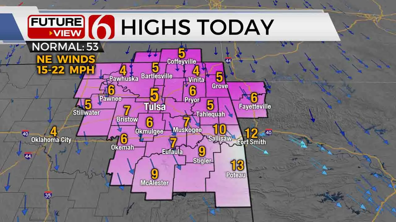
Wind chill warnings remain with wind chill values dropping into the -20 to -30 range for the morning hours. Highs will remain in the single digits across northeastern OK today with northeast winds at 15 to 25 mph. Our current system exits the area this morning but will still present some light snow this morning through the day with minor accumulations near the metro with higher potential for another inch or two along and east of highway 69.
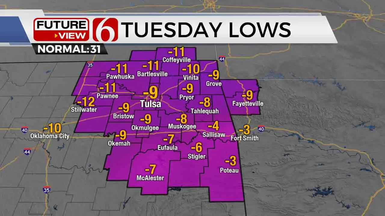
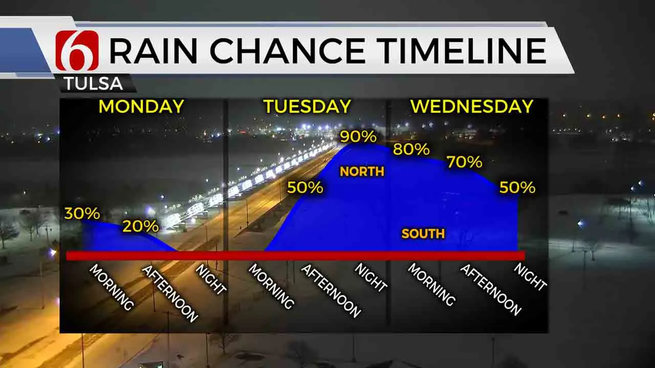
Some of the area lakes may also offer additional lake effect snow as surface winds remain oriented along some of the shapes of these area lakes. Some partial clearing of sky cover is possible later this evening. Regardless, temps are expected to drop significantly later tonight through Tuesday morning with many locations from -5 to 15 for morning lows along with wind chill values in the -15 to -29 area and wind chill warnings will remain through Tuesday morning. Another system will quickly approach the area Tuesday afternoon and evening with another good chance of accumulating snow that would prompt another winter storm warning for a large portion of the region.

Data has been consistent in this next system, but we’ll continue to have some issues with the snowfall accumulation forecast due to the variability of available moisture and the potential snow ratios the atmosphere will support Tuesday evening into Wednesday. Our first look forecast will keep a 3 to 6 inch potential for a large portion of the northern OK region with some locally higher totals across extreme southeastern OK, where totals over 7 inches will remain possible, and even likely. I do need to stress that some data continue pointing toward higher accumulations for part of northeastern OK, but we’ll continue to stay under some of these numbers for this updated and take a look at the incoming data later this morning and early afternoon.

Finally, we see a little light at the end of the tunnel with temps moving into the upper 30s and lower 40s for Saturday afternoon and possibly into the mid to upper 40s Sunday.
Thanks for reading the Monday morning weather discussion and blog.
Be warm and safe.
Alan Crone
More Like This
February 15th, 2021
August 8th, 2023
July 4th, 2023
May 8th, 2023
Top Headlines
December 12th, 2024
December 12th, 2024
December 12th, 2024


