Early Morning Showers, Gusty Northwest Winds
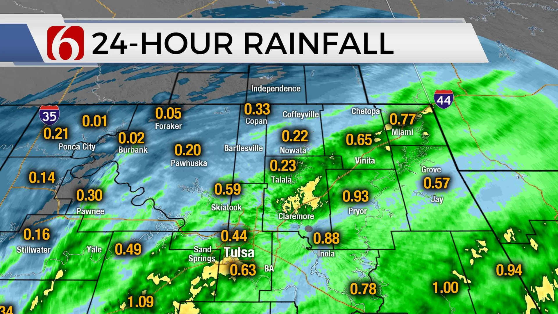
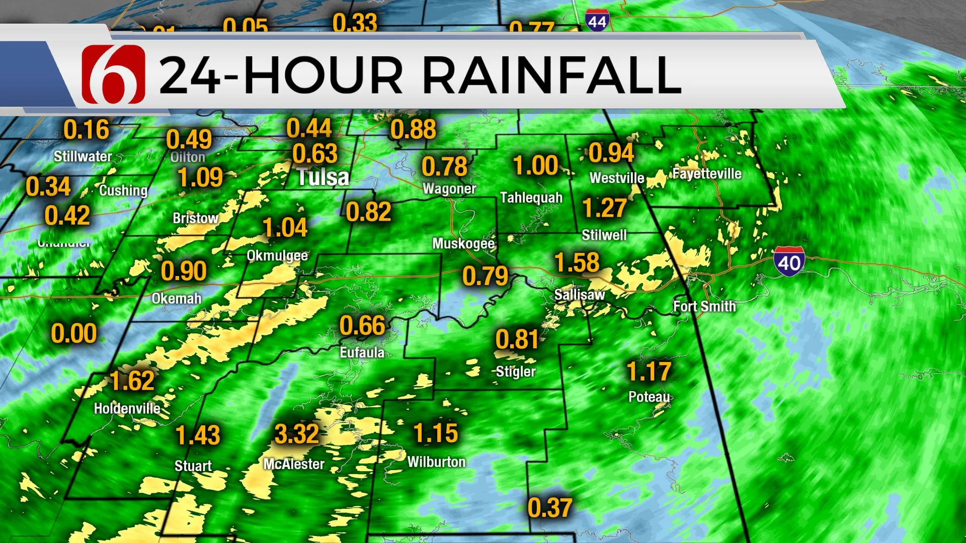
Early morning showers will continue after a night of severe weather threats.Tuesday, May 4th 2021, 5:18 am
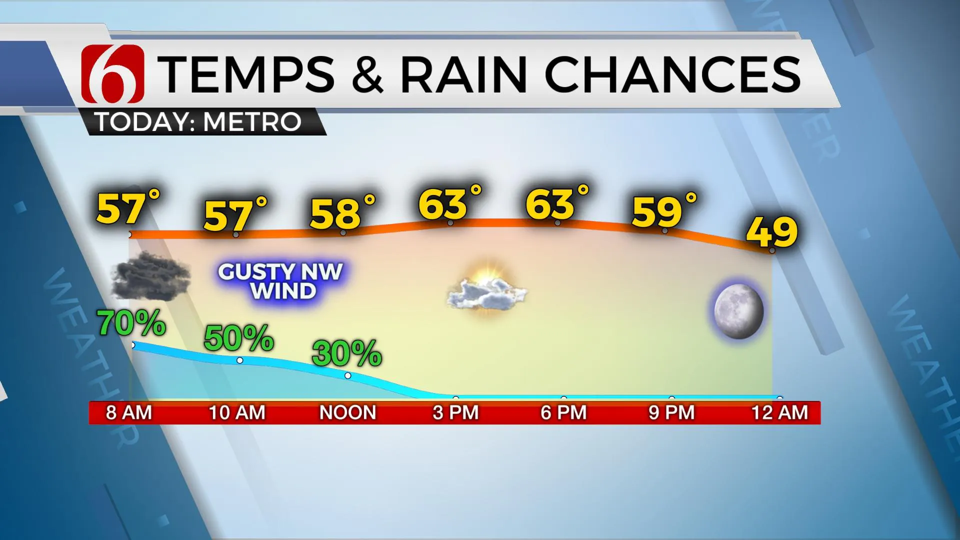
A few left-over showers and storms will continue this morning near the area as our main upper-level system continues to pull away to the east. Gusty northwest winds from 15 to 30 mph will be likely for the next few hours bringing blustery, cooler weather into the state. Temps this morning will start in the mid-50s and may only reach the lower 60s for afternoon highs. Some data keeps clouds for most of the morning before slowly thinning some later this afternoon which may delay the upward climb until the 2nd half of the afternoon. Bottom line: a rather cool blustery day is expected. The showers along and north of Highway 412 should gradually end or fade away later this morning. Outdoor activities tonight look clear and cool with winds diminishing through the evening. Clear sky brings Wednesday morning lows into the lower 40s along with afternoon highs reaching the upper 60s and lower 70s. We’ll be tracking two additional waves in the short term, but the potential for active weather will return this weekend and may continue for several days early next week.

The first disturbance nears the region Wednesday afternoon into Thursday morning, but most data support the higher chances for showers or storms either too far north or too far southwest of the immediate region. I’ll continue to keep a low chance for a few showers. It does not appear that severe weather will be a main concern with this next disturbance. Mostly pleasant weather will follow with Thursday morning lows in the 50s and highs reaching the mid-70s along with north winds from 10 to 20 mph. As the pattern changes into the weekend, low-level moisture returns and so will the mention for a few storms.

South winds will return Friday with morning lows in the 50s and highs in the mid to upper 70s, but we’ll continue with a mostly sunny day. Low-level moisture is expected to rapidly return across central and eastern OK Friday night into Saturday with dew points reaching the upper 60s and lower 70s. Another strong upper trough develops across the northwestern intermountain region and moves southeast into the central plains this weekend. While most of the forcing will remain slightly north, this will bring the potential for a few rounds of storms near the state this weekend into early next week.

As the forcing begins to move across northern OK Saturday night into Sunday, our next cold front slides southeast and should move near the I-44 corridor as additional storms try to develop early Sunday morning, and then again Sunday evening south of the front. This boundary may nudge slightly southward Sunday night into Monday before stalling near the region through early next week as another strong upper trough develops across the four corners region. Energy is expected to eject around the base of the trough early next week and could trigger additional showers and storms, including some severe storms and heavy rainfall threats.
Thanks for reading the Tuesday morning weather discussion and blog,
Have a super great day!
Alan Crone
KOTV
If you’re into podcasts, check out my daily weather update below. Search for NewsOn6 and ‘Weather Out The Door’ on most podcast providers, including Apple, Stitcher, Tune-In and below on Spotify.

More Like This
May 4th, 2021
February 14th, 2022
January 26th, 2022
January 25th, 2022
Top Headlines
December 12th, 2024
December 12th, 2024
December 12th, 2024
December 12th, 2024


