Scattered Showers Exit The Area, Thursday Highs Reaching Into The Lower 80s
Early morning fog expected in a few spots. Thursday highs reaching into the lower 80s.Thursday, June 3rd 2021, 8:21 am
TULSA, Oklahoma -
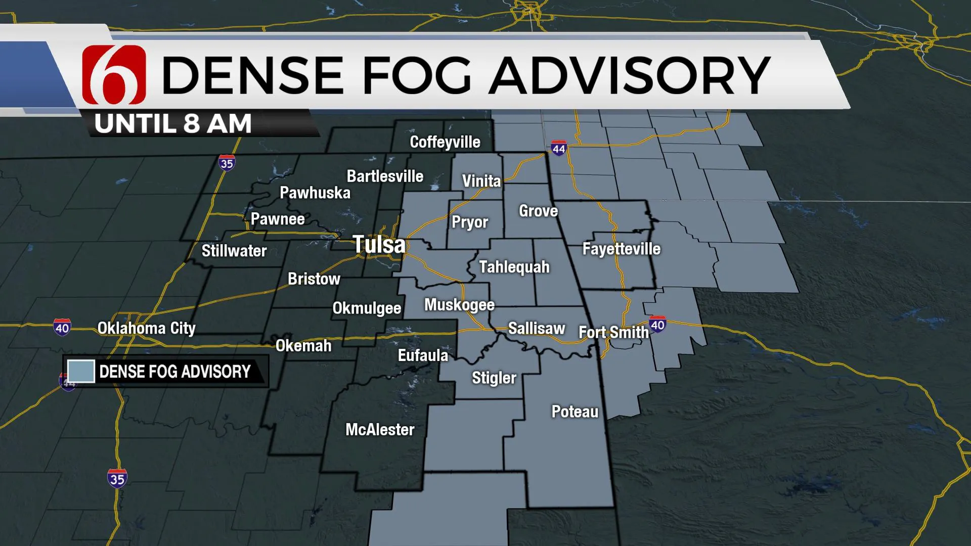
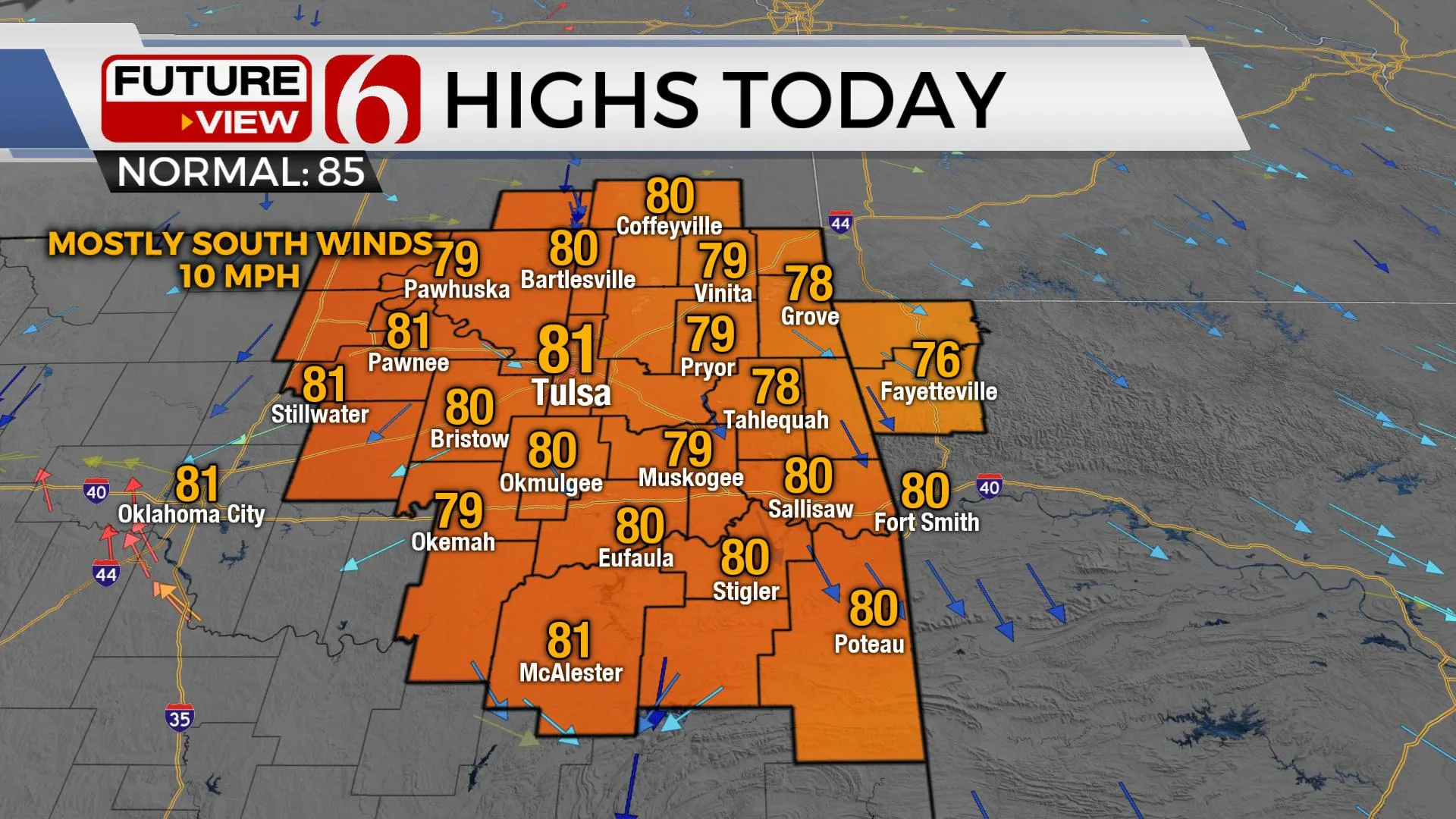
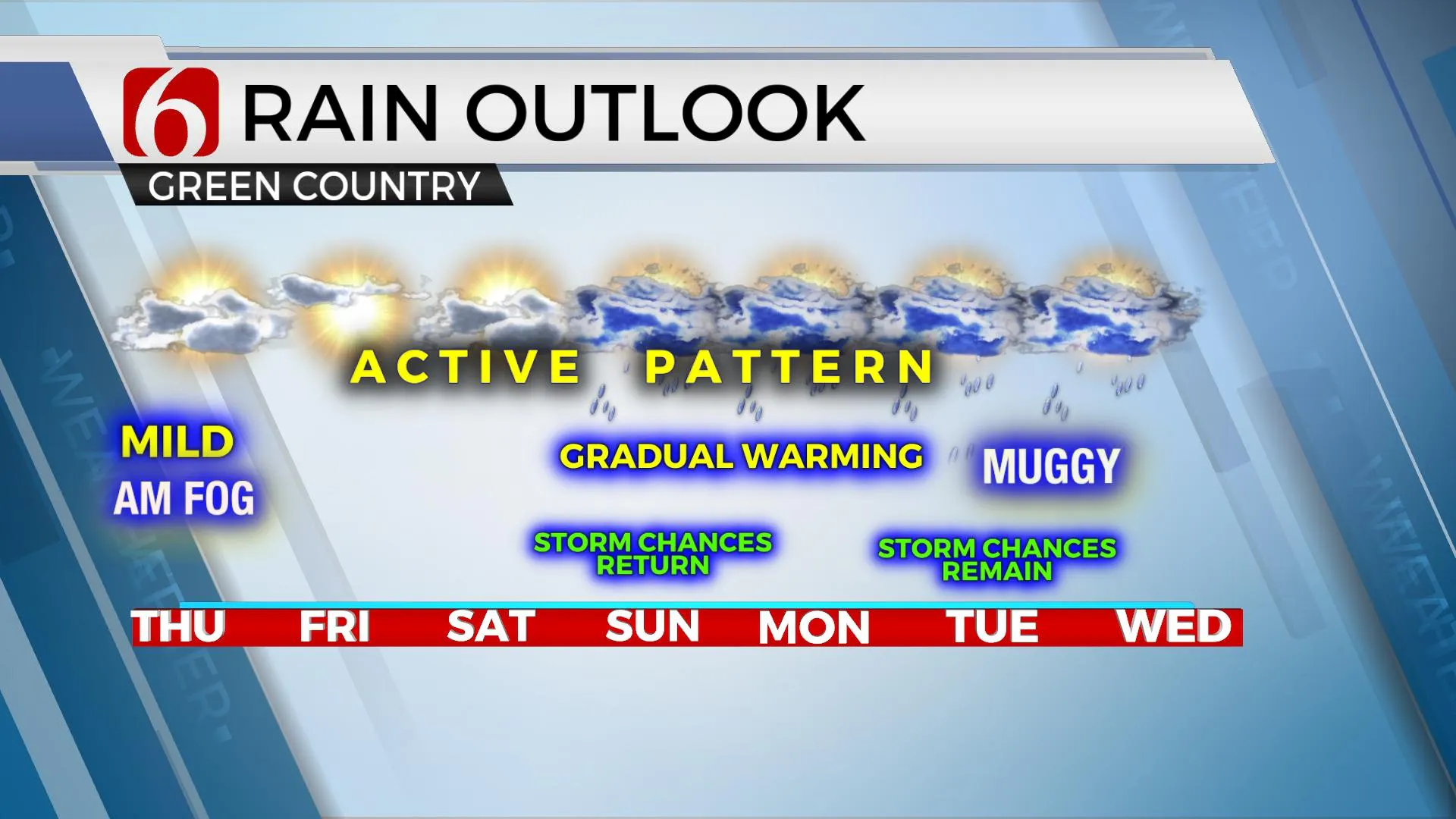
Clouds cleared overnight after scattered showers exited the area and dense fog formed in a few spots. A dense fog advisory will remain for the early morning hours near and east of Tulsa. Later this morning, fog quickly diminishes, and a sunshine-cloud mix arrives with highs reaching the lower 80s. Our next system will slowly approach the area this weekend and linger for several days next week.

We may get a small break in the storm chances both today and Friday before additional chances return this weekend and continue into early next week as a weak upper-level trough nears the state. Highs this afternoon should finally reach the lower 80s along with partly sunny sky and south winds returning around 10 mph across most of the area. These same conditions with slightly warmer daytime highs will be likely Friday with many spots finally reaching the mid-80s. Humid weather will be notable Friday into the weekend but may increase even more early next week.

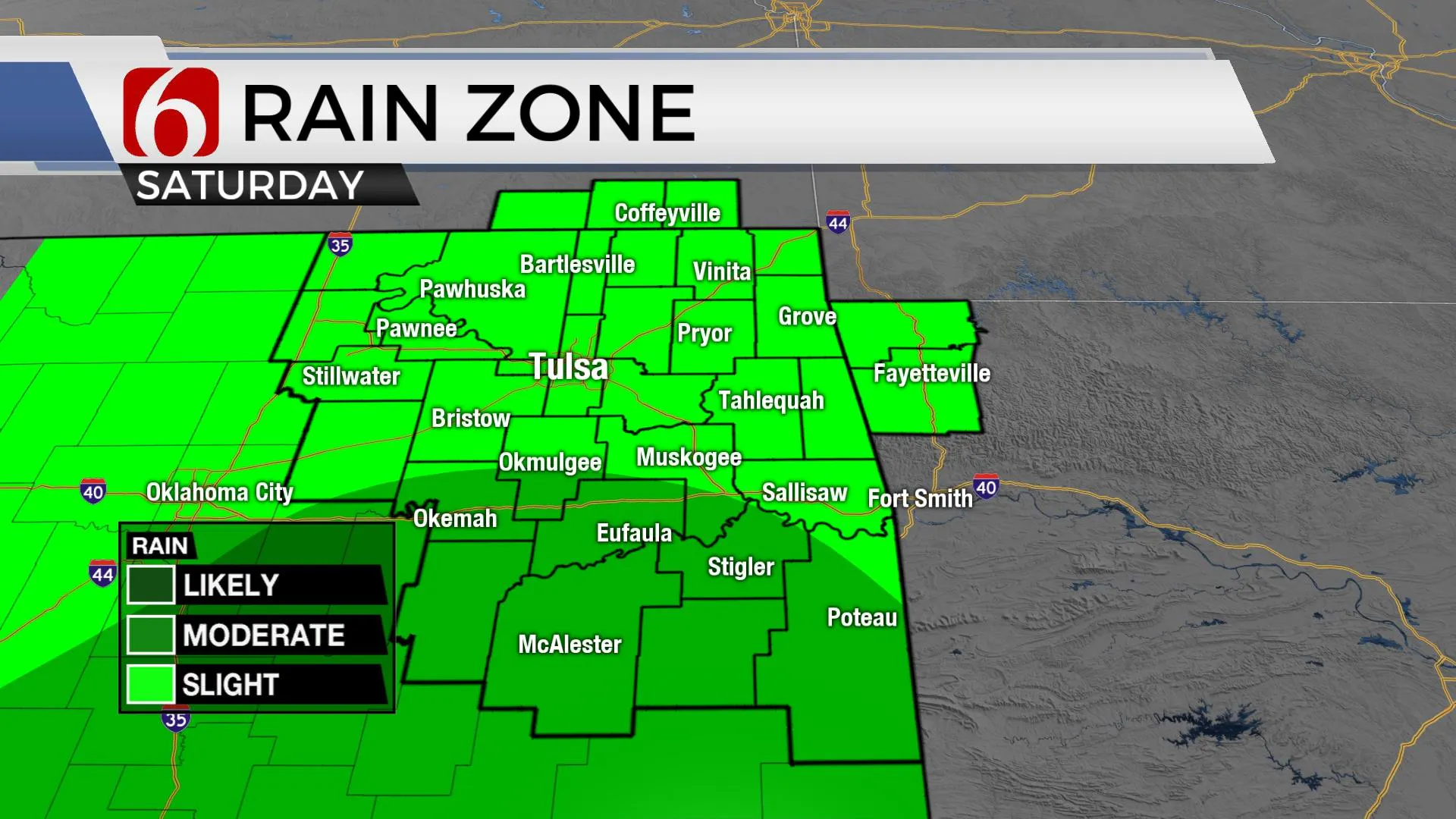
Low-level moisture, in the form of 60-degree dew points, will remain in place today and should be reinforced with higher content dews Sunday into Monday. Some data suggesting lower-70s will return across central and eastern OK by the middle of next week. The upper air pattern today represents some midlevel ridging across the Rockies eastward into part of the state which should act to keep most of the organized storms void from the area. A few isolated or pop-up storms can’t be ruled out, but seem unlikely at this point, yet I’ll keep a low, isolated mention both today and tomorrow. The ridge will weaken and the upper flow will bring a weak upper-level trough from Texas into eastern OK for the 2nd half of the weekend into early next week. This feature will be positioned near or south of us for the weekend but close enough to bring a few storms nearby. Monday through Wednesday, the feature is across Eastern OK and Western Arkansas while weakening but will produce diurnal storm chances for some spots. The upper flow is not very strong during this period but with the presence of deep and persistent moisture, a few precip-loaders could produce some downbursts with locally heavy downpours.

By midweek, this feature will eject northeast as a mid-level ridge of high pressure expands from the desert southwest into the Rockies and could possibly impact at least the western half of Oklahoma for the middle to end of next week. The northwest flow pattern on the top-east side of the ridge may bring a few systems near our area but chances remain low at this point. Temps will be climbing into the 90s late next week across western OK and into the lower or mid-80s across the east with some typical early June humidity.

Early June and July also typically brings us a few weeks of possible MCS or storm complex activity. The upper flow during these periods, usually from the northwest, supports this type of storm activity that develops into large storm complexes and rolls southeast capable of large swaths of damaging winds and rainfall. We see no major signal for this type of setup in the short term, but we’re always watching this time of year.
Thanks for reading the Thursday morning weather discussion and blog.
Have a super great day!
Alan Crone
KOTV
If you’re into podcasts, check out my daily weather update below. Search for NewsOn6 and ‘Weather Out The Door’ on most podcast providers, including Apple, Stitcher, Tune-In and down below on Spotify.
More Like This
February 14th, 2022
January 26th, 2022
January 25th, 2022
Top Headlines
December 11th, 2024
December 11th, 2024
December 11th, 2024
December 11th, 2024


