Highs In The Lower 60s, Slight Tuesday Rain Chances
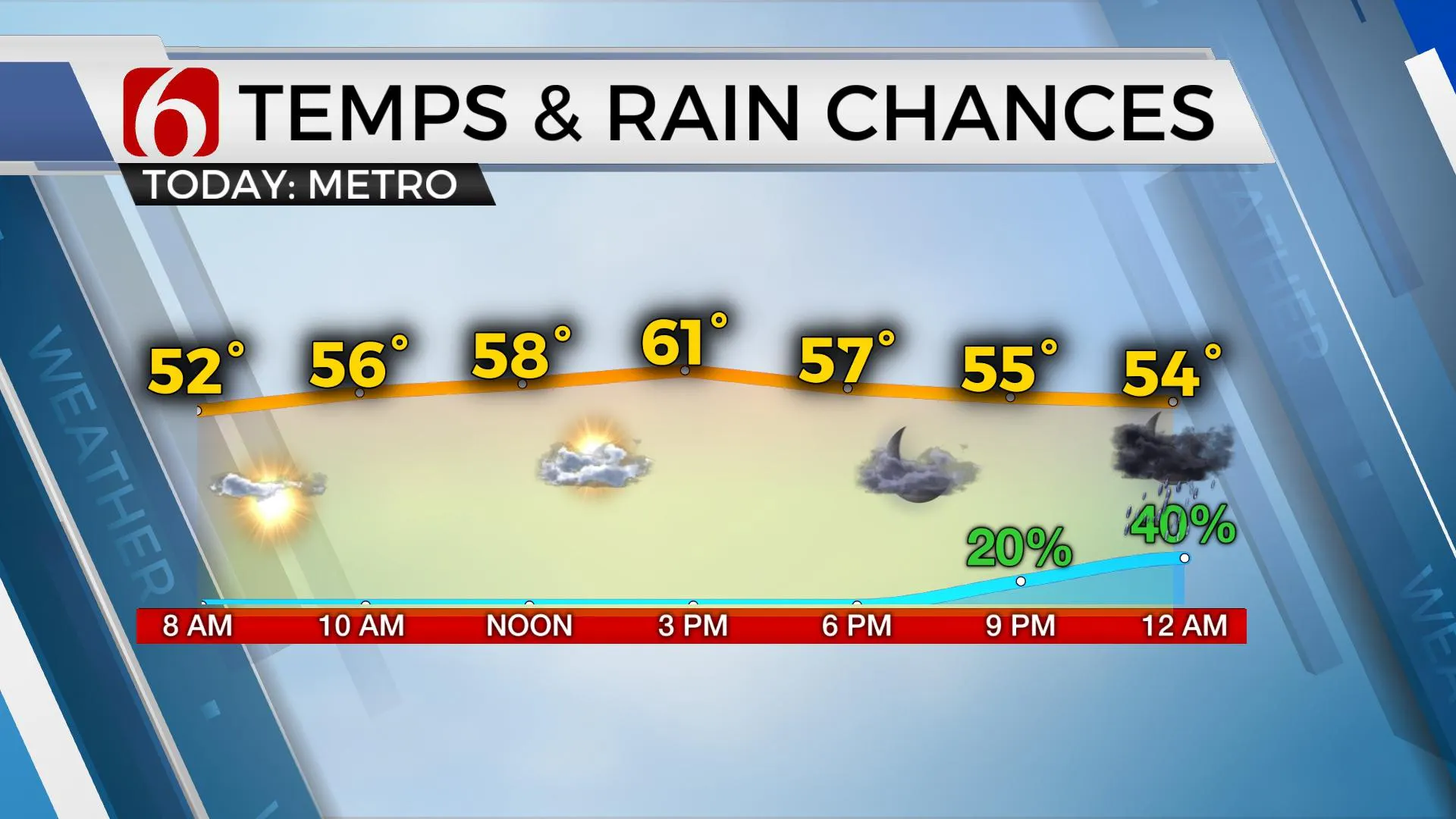
A weak cold front is moving across the state this morning and will bring north winds and highs in the lower 60s for the metro this afternoon before the boundary quickly returns as a warm front later tonight through Tuesday morning.Monday, December 27th 2021, 7:55 am
TULSA, Oklahoma -
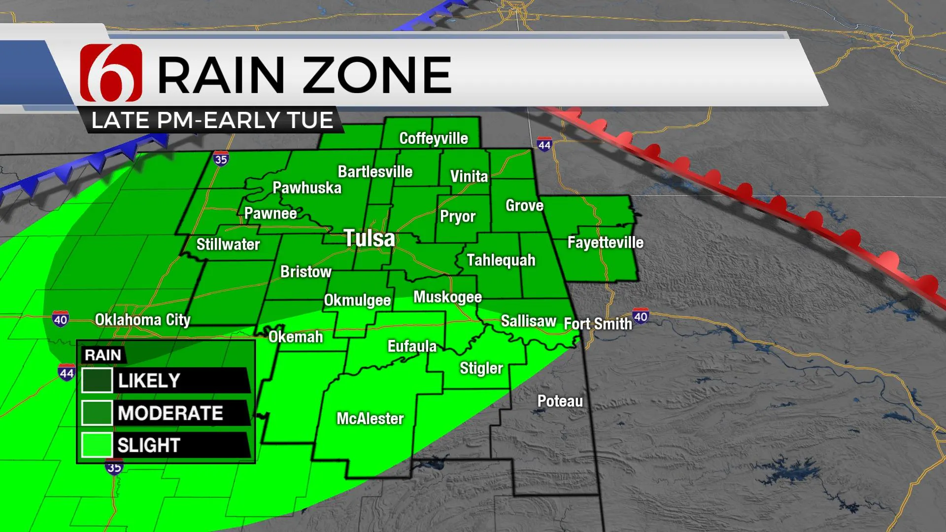
A weak cold front is moving across the state this morning and will bring north winds and highs in the lower 60s for the metro this afternoon before the boundary quickly returns as a warm front later tonight through Tuesday morning. Moisture will also return with the warm front and provide a chance for some scattered showers and storms near and north of the boundary late tonight through Tuesday morning. These chances will be highest near and north of the metro beginning later tonight through Tuesday morning. Gusty southwest winds return Tuesday with morning lows in the lower 50s and afternoon highs reaching the lower 70s before another front arrives Tuesday night into Wednesday morning dropping the temps closer to seasonal averages with Wednesday morning lows in the mid-30s and afternoon highs in the lower 50s north and lower 60s south. The roller-coaster continues Thursday into Friday with a return of gusty southwest winds and warmer weather as highs reach the mid to upper 60s Friday before a strong surge of arctic air is likely to invade the nation, including the southern plains.

Later this week, the northern polar jet is expected to drop southward while a stout upper-level low is positioned across the southern stream over the Baja. As the main belt of westerlies drops southward, a surge of arctic air will be plowing across the plains and will enter the state sometime Saturday morning to midday with a rapid drop in temps along with strong north winds. As the polar jet migrates southward, the southwest Baja low is expected to be absorbed by a medium to longwave trough moving across the western U.S. before moving eastward of the state sometime late Saturday night into Sunday. This pattern can bring wintry precipitation to the state. While its too early to pinpoint exact probabilities, there will be a chance for some wintry precipitation Saturday as the shallow cold air surges southward and the upper-level trough remains west of the area. The EURO typically is the fastest and strongest of the model data with the GFS slightly slower in the onset of colder weather. The big differences right now exist in the amount of precipitation, if any, following the frontal passage. EURO brings a large slug of moisture up and over the shallow cold dome, while the GFS is wet for Saturday morning but clears out the precip quickly before most of the cold air arrives. We’ll err on the side of caution and hold a decent chance of precipitation for Saturday based on the potential scenarios for impactful weather. Additional changes to the New Year’s Day Weekend is likely. dig

Thanks for reading the Monday morning weather discussion and blog.
Have a super great day!
Alan Crone
KOTV
If you’re into podcasts, check out my daily weather update below. Search for NewsOn6 and ‘Weather Out The Door’ on most podcast providers, including Apple, Stitcher, Tune-In and down below on Spotify.

More Like This
December 27th, 2021
February 14th, 2022
January 26th, 2022
January 25th, 2022
Top Headlines
December 13th, 2024
December 13th, 2024
December 13th, 2024
December 13th, 2024


