Blustery Winter Weather Arrives For The Weekend
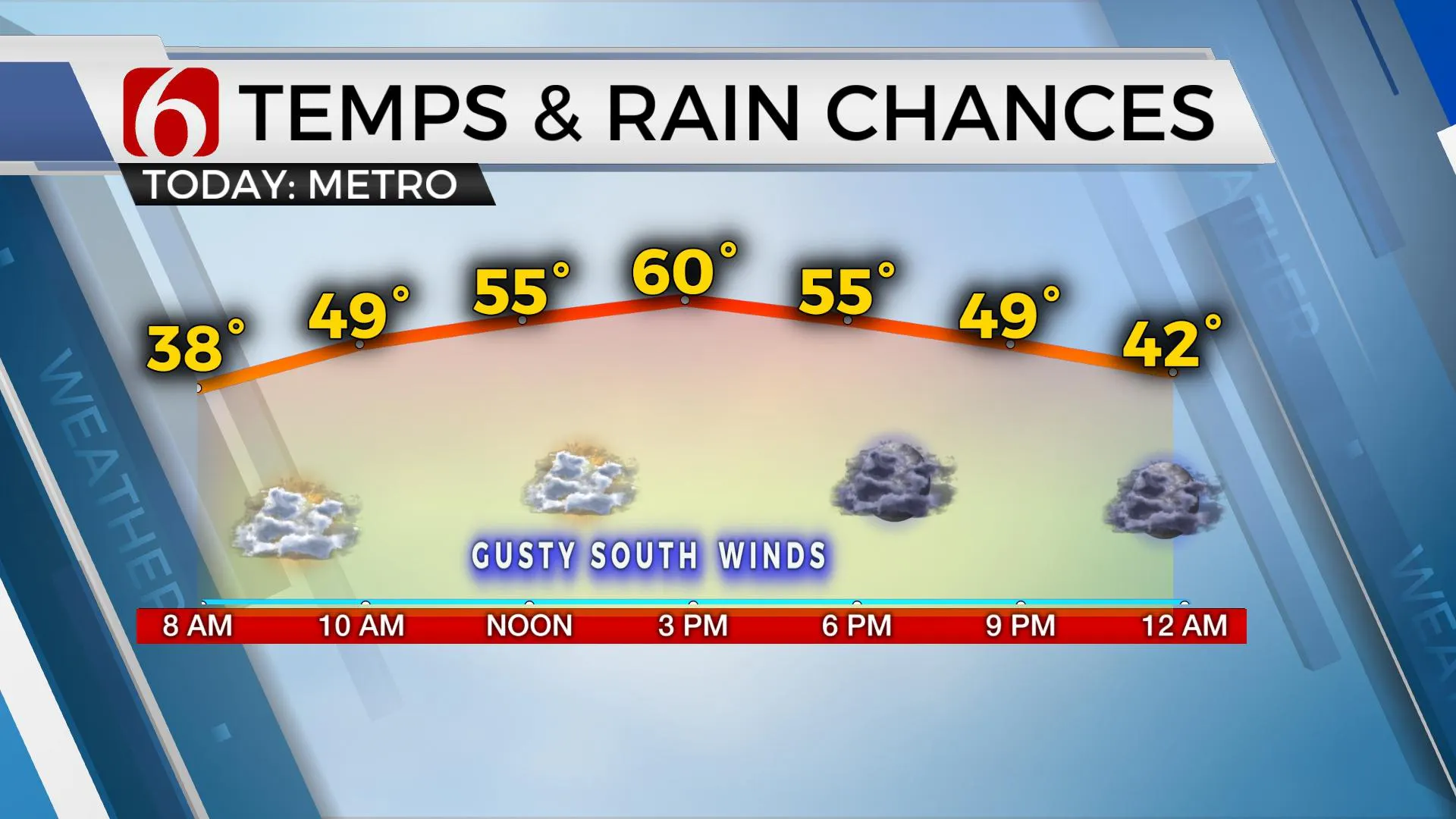
Gusty southeast winds return later in the day on Friday along with increasing clouds and highs in the upper 50s and lower 60s before a developing winter system brings blustery weather and some light snow across part of Eastern Oklahoma on Saturday.Friday, January 14th 2022, 7:03 am
TULSA, Oklahoma -
The potential for winter weather arrives this weekend.
Here are the details from News On 6 Meteorologist Alan Crone:
Gusty southeast winds return later in the day on Friday along with increasing clouds and highs in the upper 50s and lower 60s before a developing winter system brings blustery weather and some light snow across part of Eastern Oklahoma on Saturday.

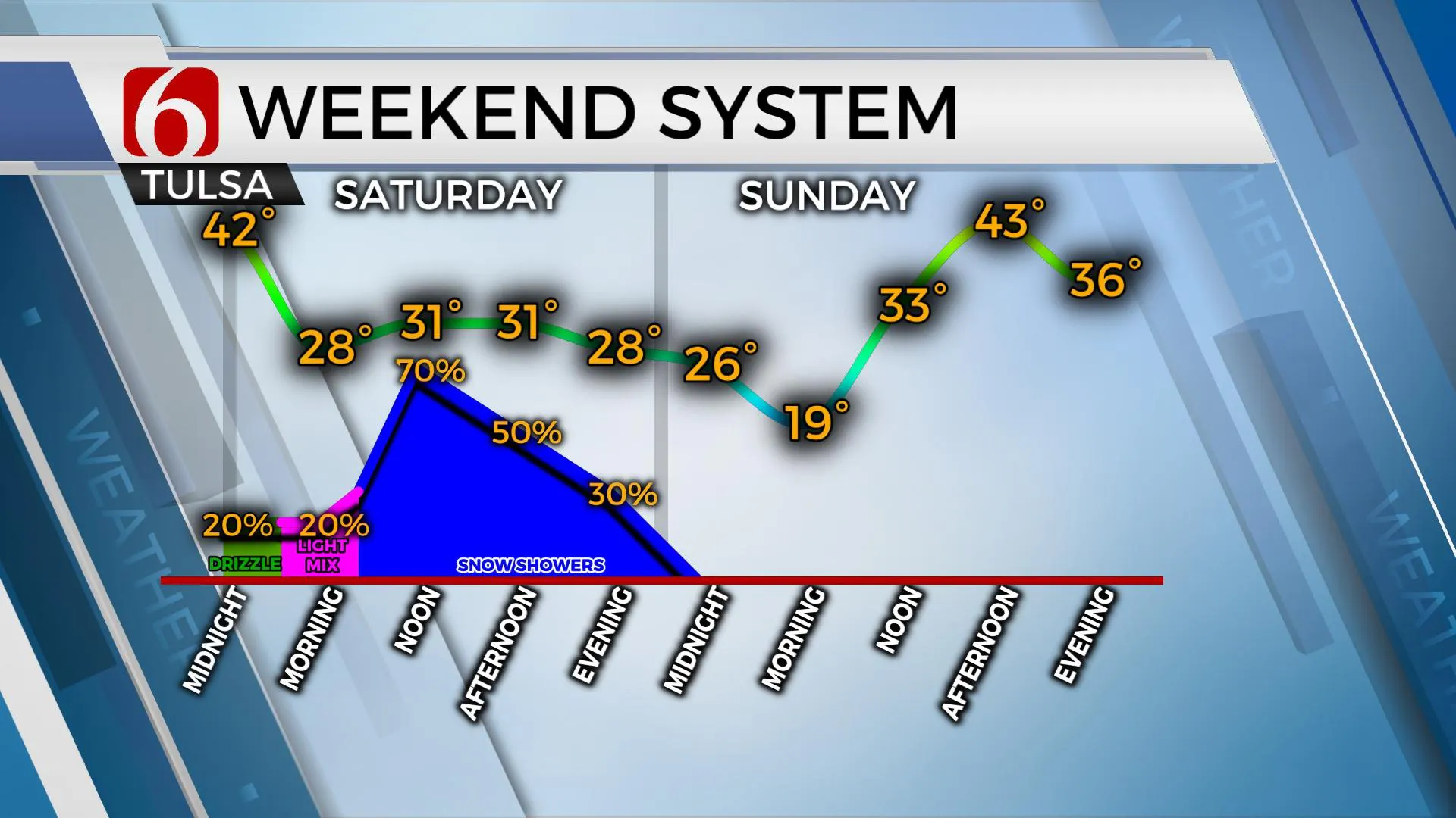
We're tracking several items Friday. A surface low will develop Friday morning across southeastern Colorado and will drop along the Red River Valley Friday night before exiting the area Saturday evening. As this low moves across the region, strong north winds (the cold front) will move across the area shortly after midnight with falling temps, gusty north winds and some light rain showers across NE Oklahoma. This will quickly develop into or mix with snow through Saturday. It's later Saturday midday to afternoon that higher chances for wintry precip will develop.

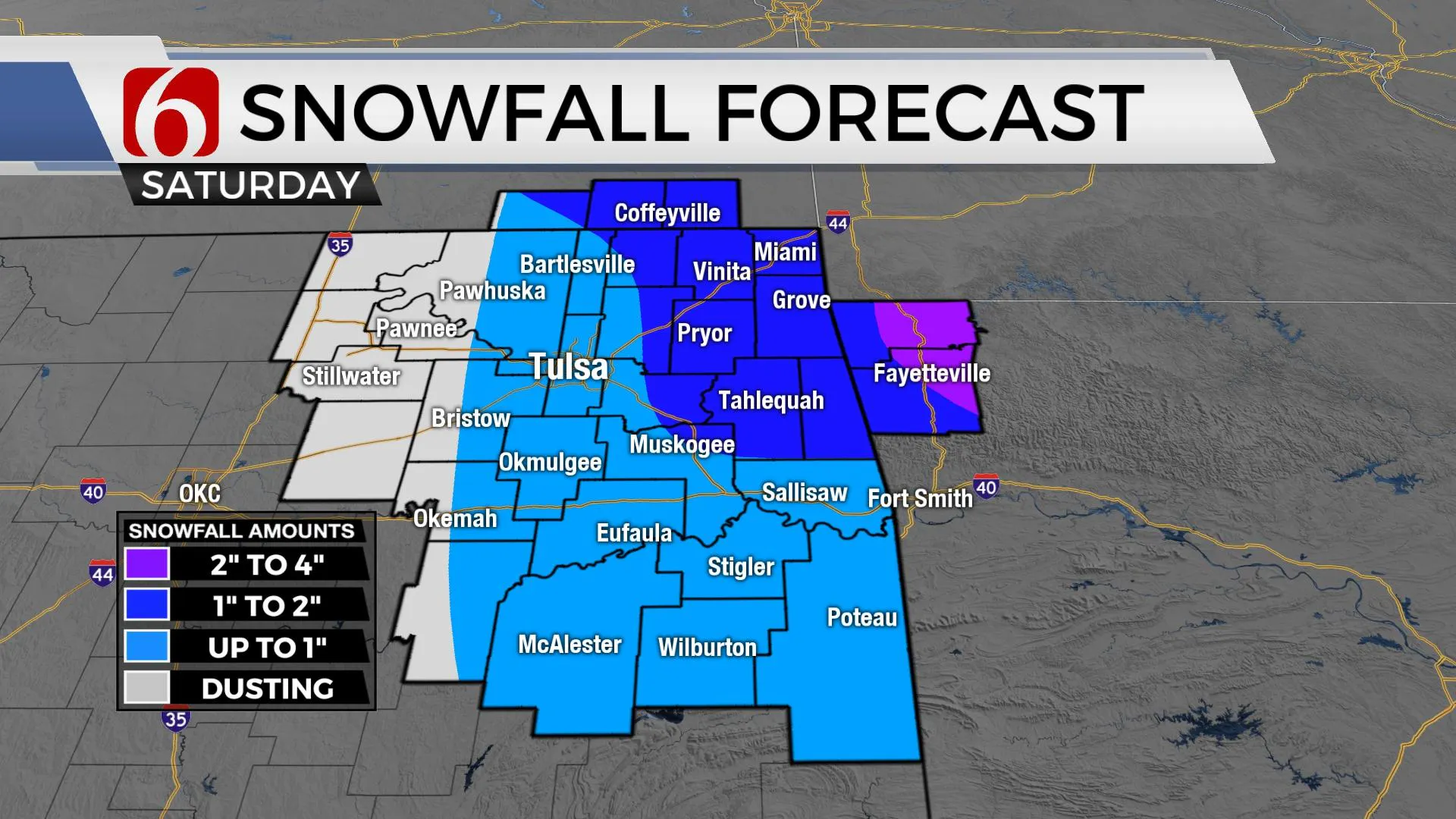
The main upper-level wave of interest is located across the northern plains Friday morning and will rapidly drop south. Near and east of the center of this developing low, snow will develop, across a large portion of the northern plains, the Midwest, and the Missouri Valley later in the day on Friday and into the night. As this system nears the state, our chances for light snow will increase, mostly Saturday midday through early afternoon before this storm quickly turns eastward bringing significant snow up part of the Eastern U.S. Sunday into early Monday. While this upper feature will pass in a favorable position for snowfall for Eastern OK, moisture will remain limited. Snowfall accumulations between a dusting to near two inches will be possible across Eastern OK with higher amounts located along the OK-AK-KS-MO state line regions. Locations across NW Arkansas, including the higher elevations of the Boston Mountains, will see the highest amounts near or over four inches where winter storm watches are currently posted. We anticipate that winter weather advisories will be needed for part of Eastern OK and southern Kansas Saturday for the potential for some snow.

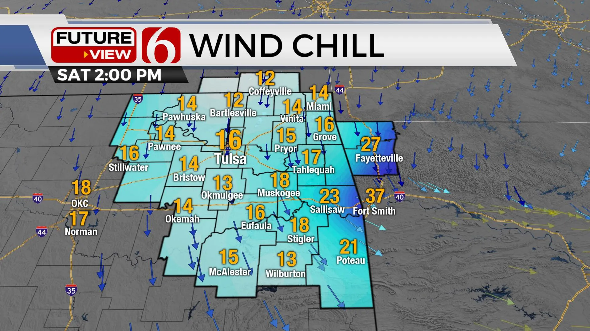
Temps will drop into the 30s Saturday with strong north winds from 20 to 40 mph creating wind chill values into the teens and lower 20s by the afternoon. A wind advisory will also be posted for a large part of central and some locations of eastern OK Saturday. As the system exits, clearing sky will result in Sunday morning lows in the upper teens and lower 20s with afternoon highs in the upper 30s to lower 40s. Another mini-warming trend is likely early next week with lower 50s Monday and lower 60s Tuesday before the next strong front brings blustery and colder weather Wednesday through the end of next week.

The approaching winter system Saturday does not appear to be a major system regarding significant snowfall for our immediate areas. As with all winter systems, minor changes in both the exact track and temperature profile can result in additional changes to the forecast.
Thanks for reading the Friday morning weather discussion and blog.
Have a super great day!
Alan Crone
KOTV
If you’re into podcasts, check out my daily weather update below. Search for NewsOn6 and ‘Weather Out The Door’ on most podcast providers, including Apple, Stitcher, Tune-In and down below on Spotify.

More Like This
January 14th, 2022
June 21st, 2023
June 19th, 2023
June 13th, 2023
Top Headlines
December 12th, 2024
December 12th, 2024
December 12th, 2024
December 12th, 2024


