Storm Chances Arrive Before Winter Weather Moves In
A warm and windy Monday is expected before storm chances move in.Monday, February 21st 2022, 6:30 am
TULSA, Oklahoma -
A warm and windy Monday is expected before storm chances move in.
Here are the details from News On 6 Meteorologist Alan Crone:
A progressive weather pattern brings storm chances into the area late Monday night, including the threat of strong to severe storms before much colder air arrives Tuesday through the end of the week. A series of upper-level disturbances are likely to bring at least two waves of wintry precipitation across part of the area Wednesday and Thursday. Some impactful precipitation is likely, including freezing rain across southeastern OK and a sleet-snow mix across the northern third of the state. Many of the upper air point soundings support sleet as the dominant precipitation type for northern OK Wed and Thu before changing to snow Thursday evening. The possibility of sleet will reduce total accumulations compared to all snow but can be more problematic for travel. Freezing rain potential will be maximized across far southeastern OK into western Arkansas during the event and may result in some significant icing issues. Winter storm watches are possible soon for this event. Before the wintry weather chances arrive, windy and warm weather is likely today before the initial surge of colder air arrives late tonight early predawn Tuesday morning.

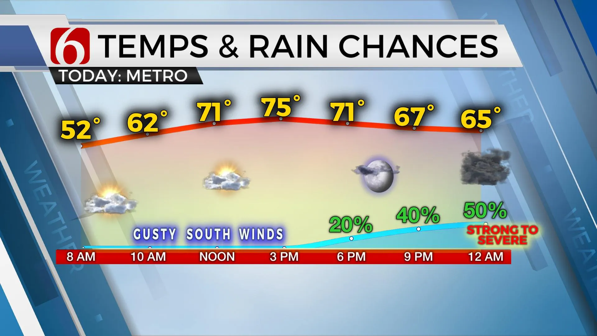
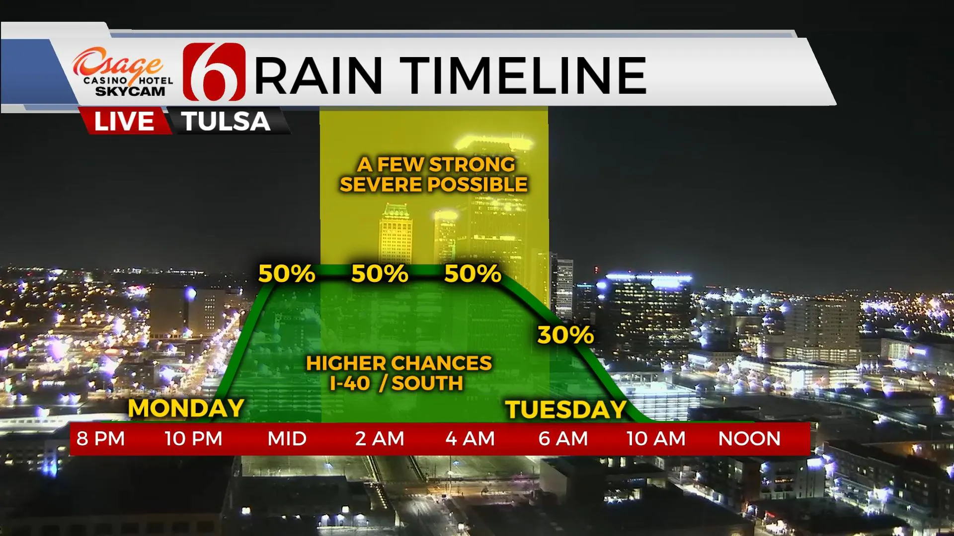
Strong southerly winds from 15 to 30 mph will be likely today with afternoon highs reaching the mid-70s. Despite the increasing low-level moisture, the fire spread rates will continue to be high for the afternoon. Later tonight, the lead wave in the southwest flow nears the Red River as the surface cold front enters northwestern OK. Storms will rapidly develop across north TX and move into southeastern OK overnight. Some of these storms will be strong to severe with all modes possible. The Tulsa metro will be on the far northern edge of this system with a much lower severe weather threat.

The cold front arrives Tuesday morning and takes the storms out of the state quickly. Cold and dry conditions are likely Tuesday before the first wave of possible wintry weather nears the area Wednesday morning to midday. The second nears Thursday morning through the afternoon. Temps from Tuesday afternoon through Saturday morning are expected to be below freezing. Pease check often and remain aware of the weather this week.
Thanks for reading the Monday morning weather discussion and blog.
Have a super great day!
Alan Crone
KOTV
If you’re into podcasts, check out my daily weather update below. Search for NewsOn6 and ‘Weather Out The Door’ on most podcast providers, including Spotify, Stitcher, Tune-In and down below on Apple.

More Like This
February 21st, 2022
June 21st, 2023
June 19th, 2023
June 13th, 2023
Top Headlines
December 11th, 2024
December 11th, 2024
December 11th, 2024
December 11th, 2024


