Warmer Weather Returns Next Week
The winter system is east of the state this morning. Clearing sky and relatively light winds will allow temps to bottom out this morning in the single digits and lower teens. Winds will remain light but with these very low temperatures, wind chill values will be sub-zero to single digit readings during the morning hours.Friday, February 25th 2022, 5:10 am
TULSA, Oklahoma -
Warmer temperatures return after a few days of winter weather.
Here are the details from News On 6 Meteorologist Alan Crone:
The winter system is east of the state this morning. Clearing sky and relatively light winds will allow temps to bottom out this morning in the single digits and lower teens. Winds will remain light but with these very low temperatures, wind chill values will be sub-zero to single digit readings during the morning hours.
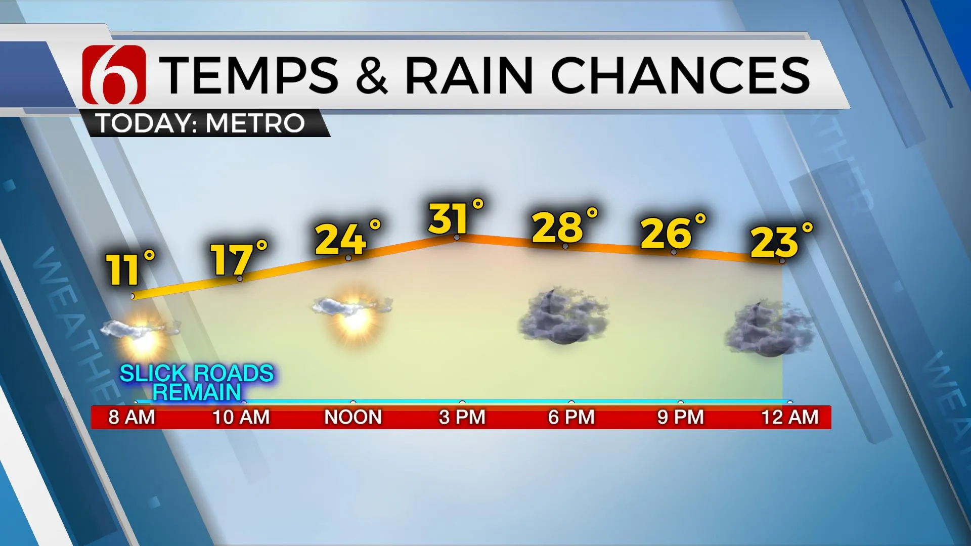
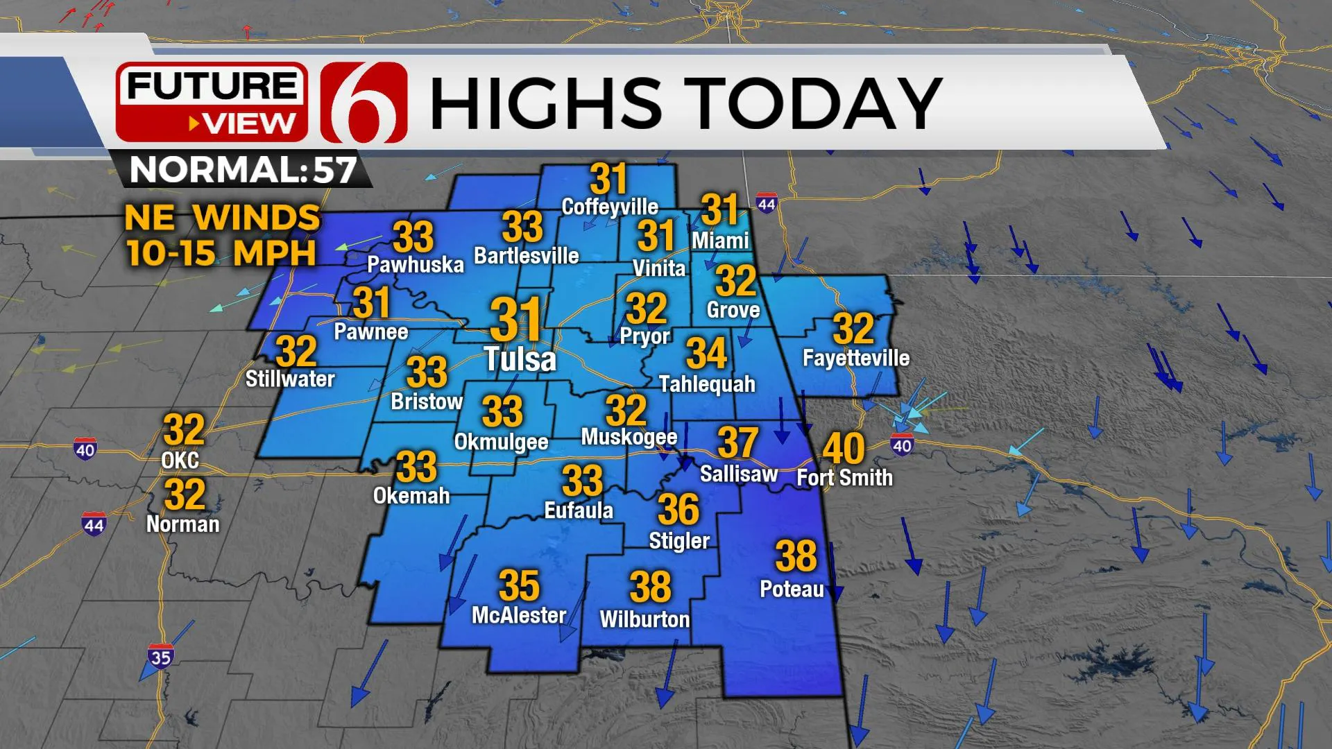
Afternoon highs will remain cold over the sleet pack with northern OK near freezing and southeastern sections in the mid to upper 30s. We'll have some periods of sunshine, but our next upper-level disturbance will be nearing the state soon and a few clouds are likely to arrive from the west through the day despite a surface ridge of high pressure near and northeast of the metro. Of course, residual slick spots on streets and highways will remain for the next two to three days, so exercise caution while driving. Fall and slip hazards will be very high today and tomorrow.
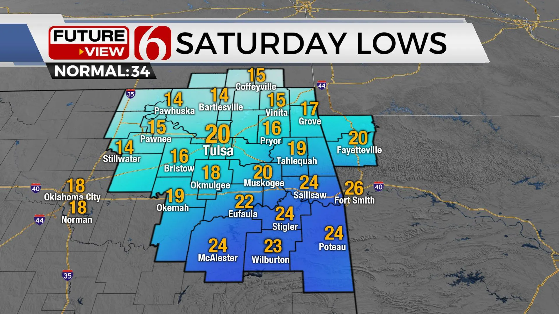
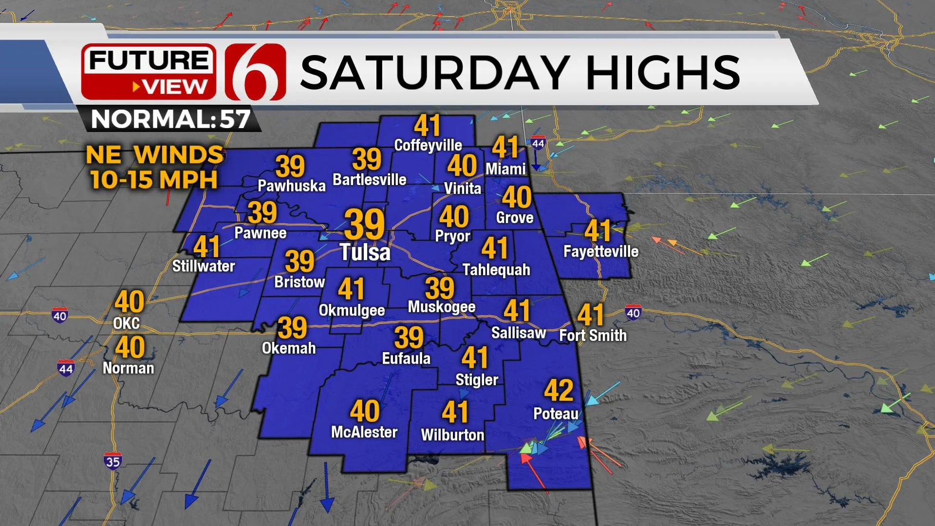
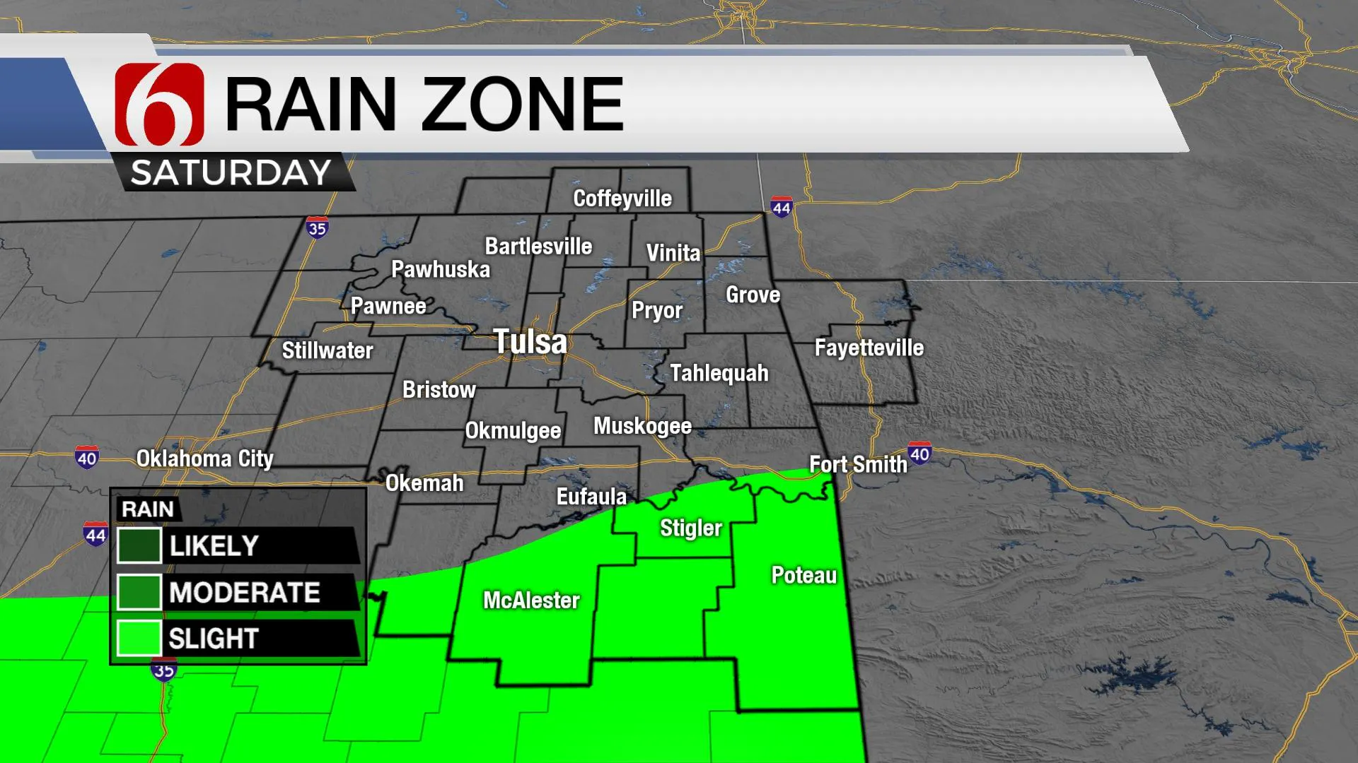
Saturday the upper-level wave drops across the central plains and showers will attempt to develop across the Red River Valley region by afternoon and evening. Most of this will remain south of our immediate areas of concern, but I'll keep a low mention in case this system waffles slightly northward this weekend. Temps Saturday will continue to be chilly with morning lows in the teens and lower 20s. Afternoon highs will more than likely remain below computer guides, and we have made some adjustments downward into the upper 30s and lower 40s.
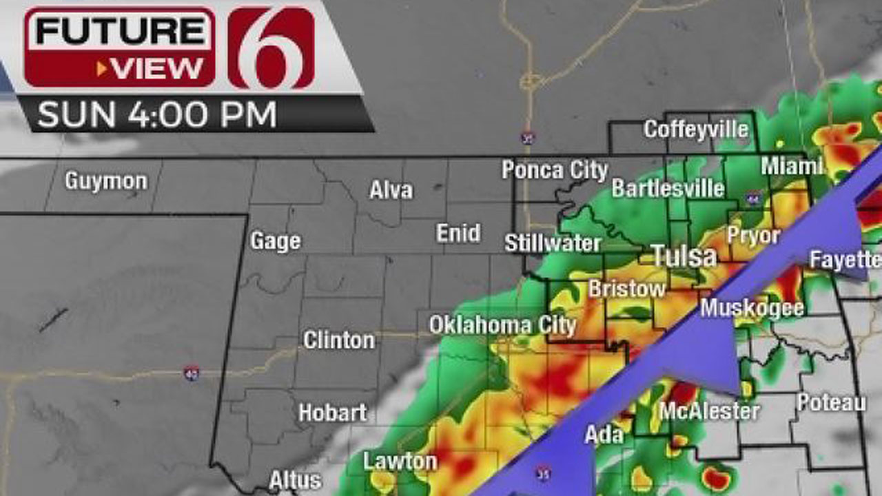
The better news begins Sunday into most of next week with a nice stair-step pattern of warming weather. The early part of the week features afternoon highs in the 60s, with some lower 70s possible Wednesday into Thursday. The pattern will remain progressive with several disturbances nearby but with little in the way of sensible weather changes. Increasing shower and storm chances should return by the end of next week into the weekend.
Thanks for reading the Friday morning weather discussion and blog.
Have a super great day!
Alan Crone.

More Like This
February 25th, 2022
April 24th, 2022
April 24th, 2022
April 16th, 2022
Top Headlines
December 14th, 2024
December 14th, 2024
December 14th, 2024
December 14th, 2024


