

Pleasant Afternoon Before Unsettled Weekend Weather
A chilly morning is underway across Green Country after a day of showers and storms.Thursday, April 14th 2022, 7:00 am
TULSA, Oklahoma -
A chilly morning is underway across Green Country after a day of showers and storms.
Here are the details from News On 6 Meteorologist Alan Crone:
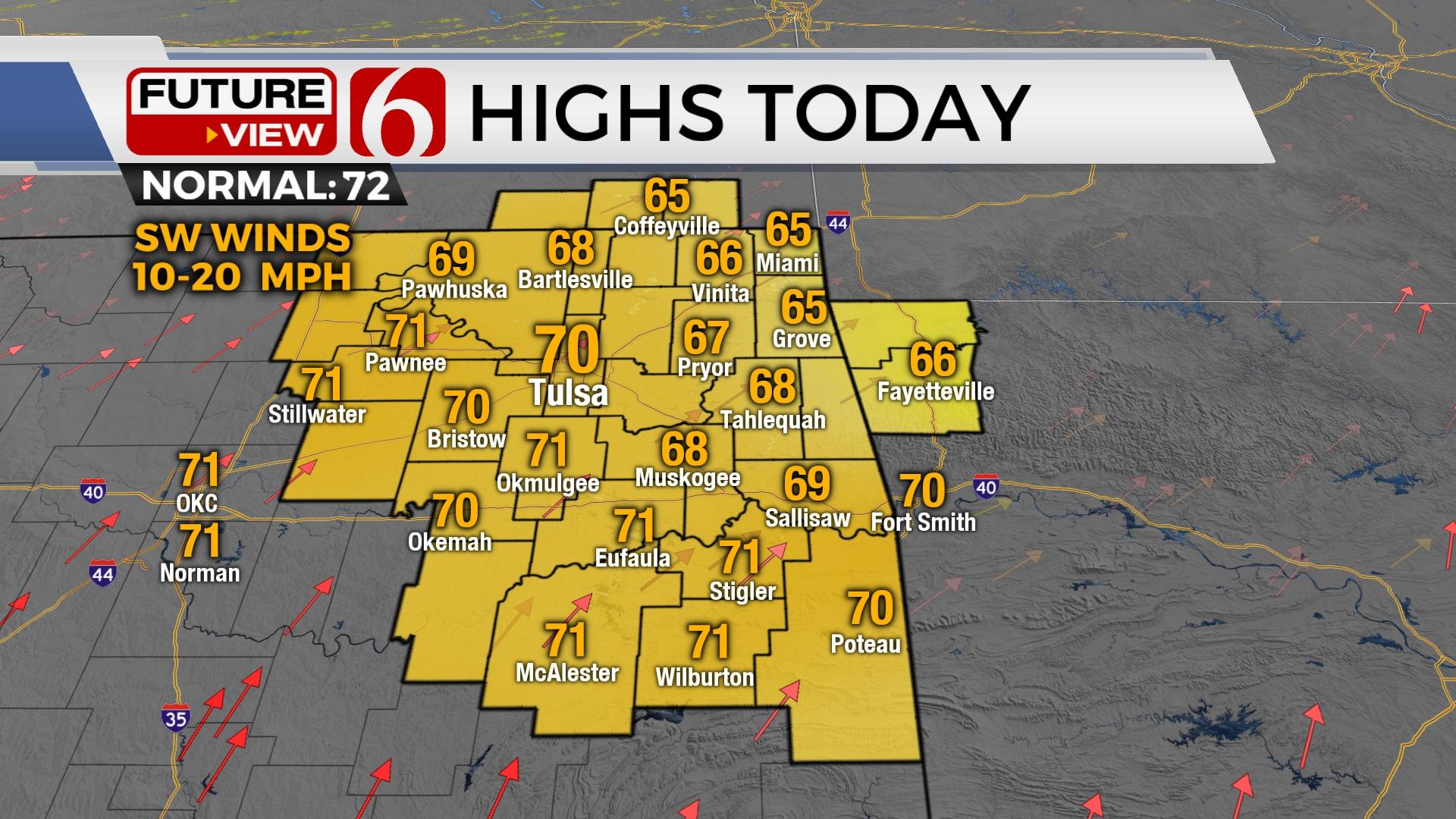
Frost and freeze issues remain Thursday morning across the northern third of the state with clear sky and light winds. Temps have dropped into the lower and mid-30s. A surface ridge of high pressure will move slowly east later Thursday morning with southwest winds returning at 10 to 15 mph by midday with a few gusts near 20 mph by afternoon. Mostly sunny conditions are likely with afternoon highs in the upper 60s and lower 70s. This will be the best weather day of the week. A series of fronts will be near the state Friday into the Easter Holiday weekend bringing some rain and storm chances Friday night into Saturday, and some cooler weather for the Holiday weekend.

Gusty south winds return Friday as a weak mid-level wave moves out of the Rockies with a deepening surface low across southeastern Colorado. Wind speeds once again will be in the 15 to 30 mph range from the south Friday with afternoon highs reaching the upper 70s and lower 80s. As the mid-level wave passes east, this will bring a surface low across the Red River Friday night into early Saturday morning. Low level moisture quickly returns across the Texoma valley extending into northern OK as a cold front develops and moves across northeastern OK early Saturday. Even though stronger flow will be north of the area, enough energy and shear values support the possibility of strong to severe storms pre-dawn Saturday as the boundary sags southward. Primary threats should be hail and wind. A tornado threat, while not high is non-zero.

The front may stall across part of North TX into southern OK Saturday afternoon. We're anticipating a noticeable cool-down Saturday with daytime highs in the upper 50s north and lower 60s south. Easter Sunday morning starts with temps in the lower 40s and afternoon highs reaching the lower 60s. Another wave will move across the northern high plains Sunday bringing yet another cold front southward Sunday afternoon and evening. We'll have a brief return of gusty south winds Easter Sunday with afternoon highs reaching the 60s before this front arrives with additional shower chances followed by north winds late afternoon and cooler weather for a few days next week.

Thanks for reading the Thursday morning weather discussion and blog.
Have a super great day!
Alan Crone
KOTV
If you’re into podcasts, check out my daily weather update. Search for NewsOn6 and ‘Weather Out The Door’ on most podcast providers, including Spotify, Stitcher and Tune-In, or Click Here to listen on Apple Podcasts.

Get The Daily Update!
Be among the first to get breaking news, weather, and general news updates from News on 6 delivered right to your inbox!
More Like This
April 14th, 2022

June 21st, 2023

June 19th, 2023

June 13th, 2023
Top Headlines

December 13th, 2024

December 13th, 2024

December 13th, 2024

December 13th, 2024