

Tracking More Wind, Storms For Part Of The Weekend
A few morning showers are possible on this windy and warm Thursday.Thursday, April 21st 2022, 6:06 am
TULSA, Oklahoma -
A few morning showers are possible on this windy and warm Thursday.
Here are the details from News On 6 Meteorologist Alan Crone:

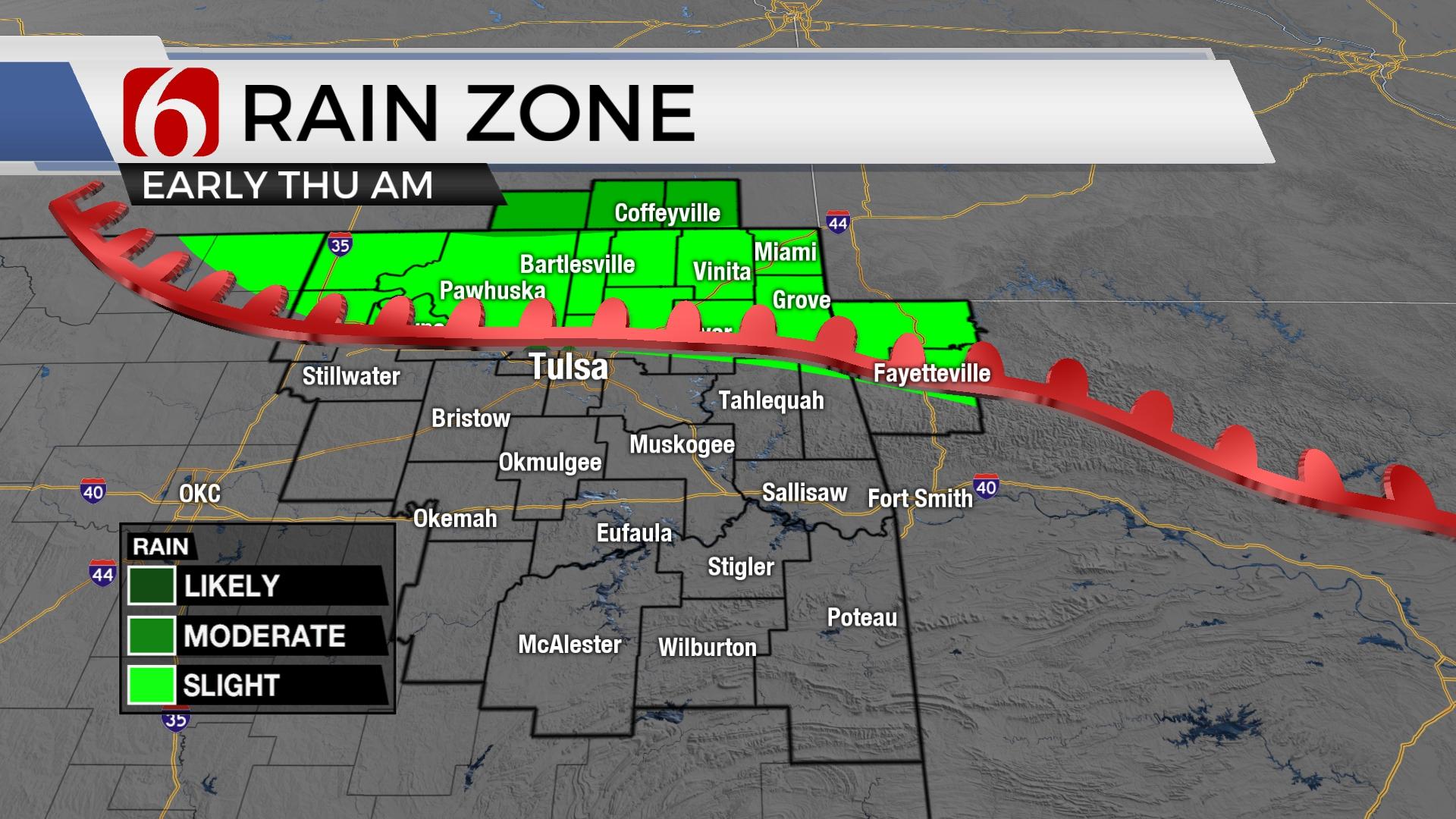
A few scattered showers will remain across far northern OK and southern Kansas Thursday morning before accelerating away from the area midday. Morning clouds will thin with partly cloudy and breezy weather this afternoon with highs near 80. The active pattern brings stronger south winds Saturday and more storm chances for part of the weekend.

The front that entered northern OK Wednesday night has stalled and will lift northward Thursday morning as a warm front. A few scattered showers or storms will be possible along the northern edge of this boundary through the morning hours before accelerating northeast into the Missouri Valley. Breezy and warm weather will encompass most of the area Thursday with afternoon highs in the upper 70s to lower 80s. Similar to yesterday, locations west will be warmer with afternoon highs in the upper 80s. Most of the upper air forcing both Thursday and Friday will be located northwest of the area, but a few isolated showers or storms will remain a low probability, near 20% or less. Moisture will remain across the region as a cold front finally nears the area Saturday evening into Sunday morning bringing periods of rain and thunder into northeastern and eastern OK. The southwest flow will be parallel to the boundary by Saturday evening. This means the front will be a slow mover Sunday keeping high chances for rain and storms Sunday, but also ending from the north to south through the day. Severe threats will be limited but a few strong to severe storms may remain possible, more so Saturday evening as the front nears the region. We think the main issue will be the training of cells moving from the southwest to northeast as the front slowly sinks south Sunday. This pattern usually supports heavy rainfall threats. Some localized flooding and stream-river flooding will be possible across extreme eastern OK. This front finally clears the area late Sunday night as the main upper-level trough also moves away. A surface ridge of high pressure arrives Monday with sunshine and pleasantly cool weather before our next system arrives by the middle to end of next week.

Thanks for reading the Thursday morning weather discussion and blog.
Have a super great day!
Alan Crone
KOTV
If you’re into podcasts, check out my daily weather update. Search for NewsOn6 and ‘Weather Out The Door’ on most podcast providers, including Spotify, Stitcher and Tune-In, or Click Here to listen on Apple Podcasts.


Get The Daily Update!
Be among the first to get breaking news, weather, and general news updates from News on 6 delivered right to your inbox!
More Like This
April 21st, 2022

June 21st, 2023

June 19th, 2023

June 13th, 2023
Top Headlines

December 11th, 2024

December 11th, 2024

December 11th, 2024

December 11th, 2024