

Another Pleasant Morning Before Afternoon Heat Returns
Hot and humid conditions hang around on Thursday ahead of the holiday weekend.Thursday, June 30th 2022, 6:46 am
TULSA, Oklahoma -
Hot and humid conditions hang around on Thursday ahead of the holiday weekend.
Here are the details from News On 6 Meteorologist Alan Crone:

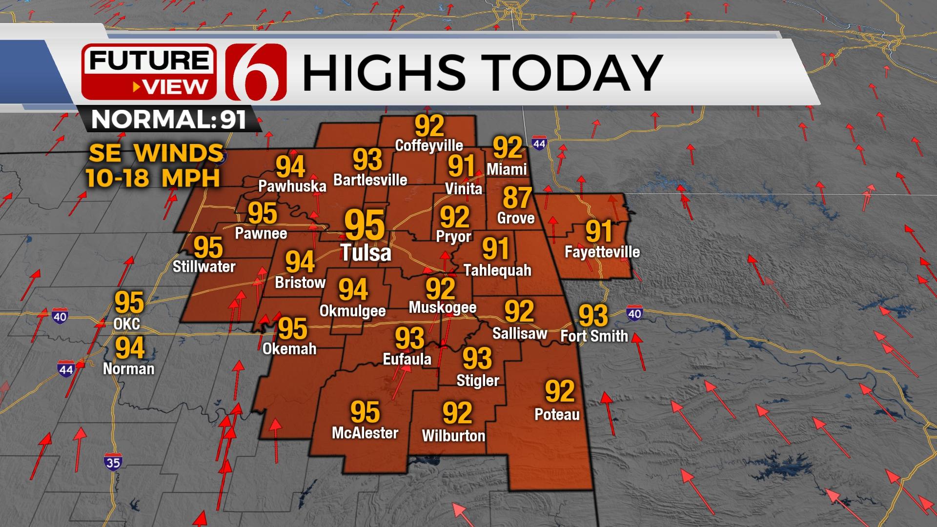
After another pleasant morning, temperatures rise quickly with afternoon highs above normal. We’ll experience full sunshine and south winds from 10 to 20 mph, yet with no significant heat index issues on Thursday afternoon. Warmer and muggy weather will be increasing through the weekend with a slight chance for a few scattered storms.

The tropical-like system currently located across the southeast Texas coastal region will lift north later today and begin moving north to northeast Friday and Saturday. The consensus trajectory supports most, if not all this system will remain slightly southeast of our main area of interest for the weekend. There’s always a slim chance this system will move more west than anticipated. Regardless, our probabilities remain for low-end storm chances for northeastern OK. A strong upper-level system will move across the northern U.S. into southern Canada this weekend while bringing a weak front south into at last southern Kansas before stalling Saturday. Scattered storms may develop near this boundary late Friday evening through the weekend. A few of these may sneak-down across far northern OK and southern Kansas. Even accounting for some track errors with both features, our forecast appears to be slightly more optimistic for storm chances. I’ll more than likely reduce our pops from 30% down to 20% for the weekend and keep the 10% mention for Monday, July 4th. The exception will be across far southeastern OK where the better chance for scattered storms will exist for part of the weekend.

Temps will continue to warm-up into the weekend along with increasing heat index values as low-level moisture flows into the eastern OK. Dew points in the lower 70s are likely and heat index values nearing 100 to 104 will be expected. A mid-level ridge of high pressure strengthens early next week nearby brining another run-up into the upper 90s near 100 before the feature weakens and retros west by the end of the week. This will knock the temps down a few degrees and introduce a slight chance for a few storms Thursday and Friday.
Thanks for reading the Thursday morning weather discussion and blog.
Have a super great day!
Alan Crone
KOTV
If you’re into podcasts, check out my daily weather update. Search for NewsOn6 and ‘Weather Out The Door’ on most podcast providers, including Spotify, Stitcher and Tune-In, or Click Here to listen on Apple Podcasts.

Get The Daily Update!
Be among the first to get breaking news, weather, and general news updates from News on 6 delivered right to your inbox!
More Like This
June 30th, 2022

June 21st, 2023

June 19th, 2023

June 13th, 2023
Top Headlines

December 13th, 2024

December 13th, 2024

December 13th, 2024

December 13th, 2024