Above Normal Temperatures Before Weekend Storm Chances Arrive
Warmer temperatures return to the metro as the weekend approaches.Thursday, August 25th 2022, 7:14 am
TULSA, Okla. -
Warmer temperatures return to the metro as the weekend approaches.
Here are the details from News On 6 Meteorologist Alan Crone:

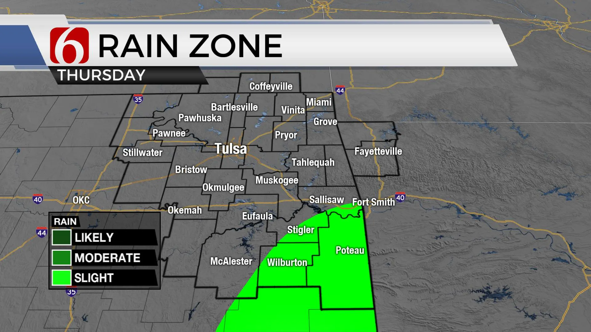
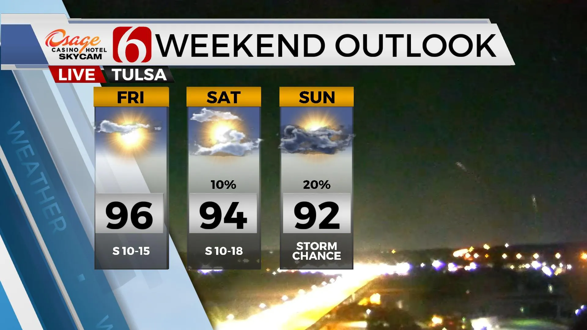
The next few days represent a warming trend for most of the area before the pattern supports rain mentions across the northern third of the state this weekend into early next week. Data is inconsistent and inconclusive regarding exact specifics. This is not unusual. But the pattern suggests we'll be dealing with some scattered storm chances Sunday into early next week. Data has been hinting at a surface frontal boundary moving across the area next week for a few days, but recent runs have not exactly been ringing the bell for this occurrence. Basically, this frontal passage is highly suspicious at this point, but scattered storm chances will remain during the same space and time as hinted before. This means I'll keep some low chances across eastern OK Saturday as a lead (weak ) wave influences extreme southern and eastern OK into western Arkansas. This should stay east or south of the metro. It will be represented by a 10% chance for Tulsa and higher chances to our east.

Saturday evening into Sunday morning another impulse ejects from the Rockies into the central plains and scattered storms will be possible across southern Kansas and part of northern OK. This 30% chance for Tulsa will have higher possibilities along the OK-KS state line region. Sunday evening into Monday and Tuesday, additional scattered storms are likely to occur across central Kansas and possibly Oklahoma. Either way, we'll need at least 30% probabilities for storms developing across the region, or storms moving into the area from Kansas. While I don’t think the actual front makes the trip early next week, additional clouds and the scattered storms will keep the highs in the upper 80s to lower 90s during these periods. The front may cross the area Wednesday before becoming diffuse as a series of disturbances arrive late next week. The flow should become more active with numerous chances for showers and storms that may eventually require higher probabilities. The data is very messy at this point.

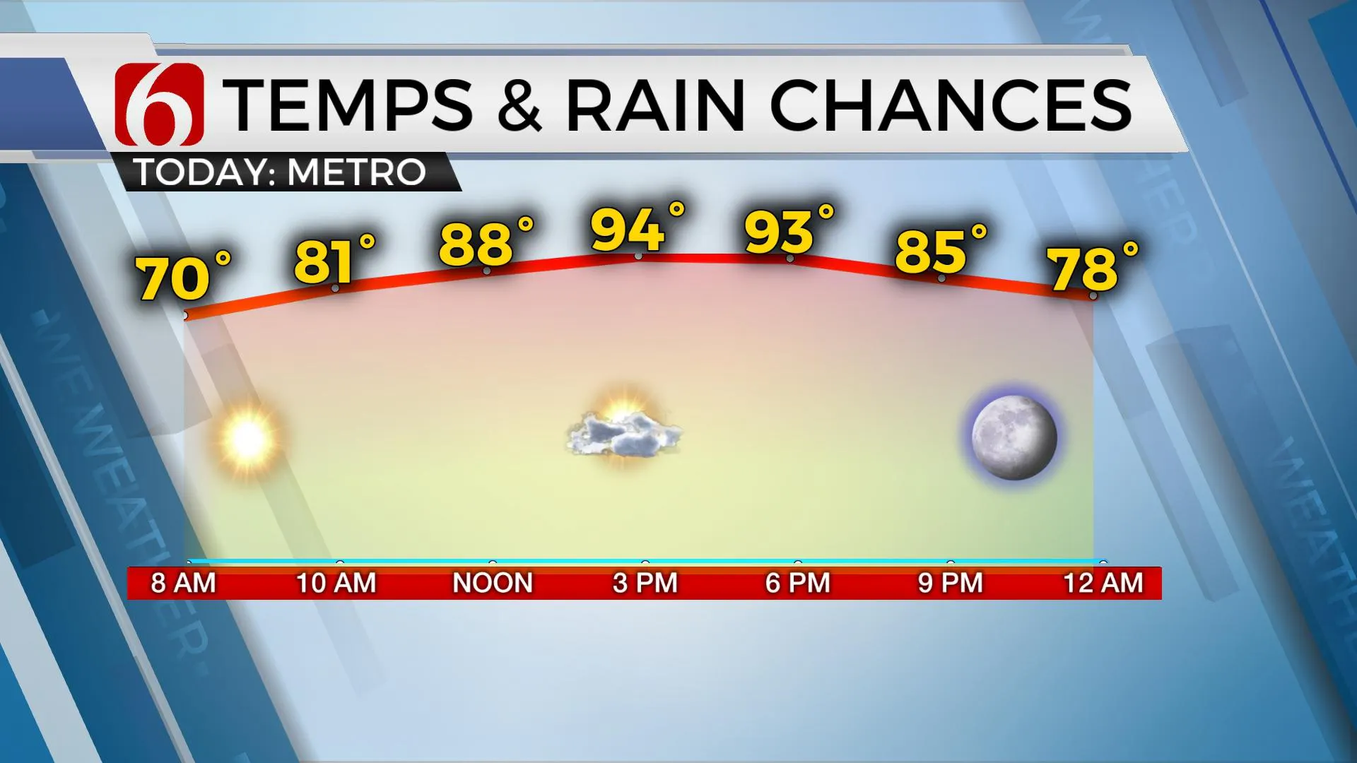
Temps today will reach the lower to mid-90s after starting in the 60s.
Thanks for reading the Thursday morning weather discussion and blog.
Have a super great day!
Alan Crone
KOTV
If you’re into podcasts, check out my daily weather update. Search for NewsOn6 and ‘Weather Out The Door’ on most podcast providers, including Spotify, Stitcher and Tune-In, or Click Here to listen on Apple Podcasts.
More Like This
August 25th, 2022
June 21st, 2023
June 19th, 2023
June 13th, 2023
Top Headlines
December 13th, 2024
December 13th, 2024
December 13th, 2024
December 13th, 2024


