Late Summertime Pattern Continues
Highs climb back into the 90s on Tuesday after a day of cool weather.Tuesday, September 13th 2022, 5:31 am
TULSA, Okla. -
Highs climb back into the 90s on Tuesday after a day of cool weather.
Here are the details from News On 6 Meteorologist Alan Crone:

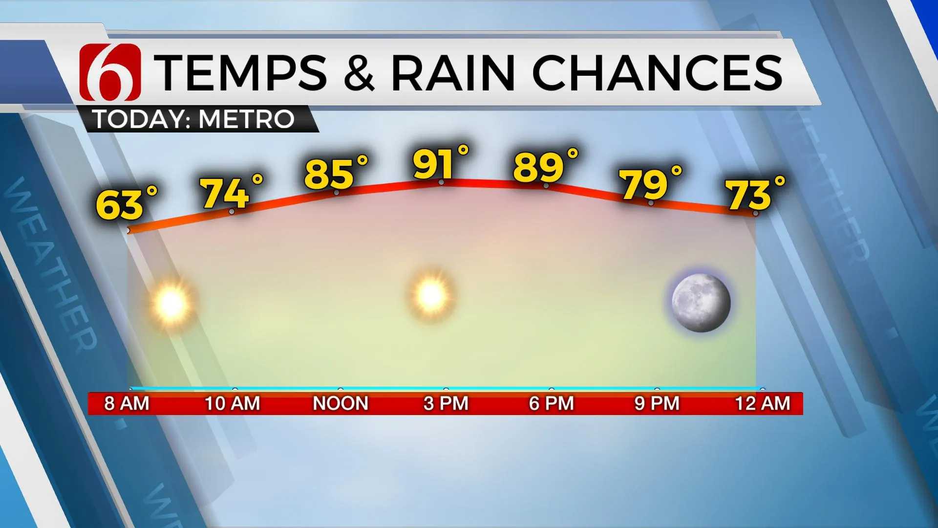
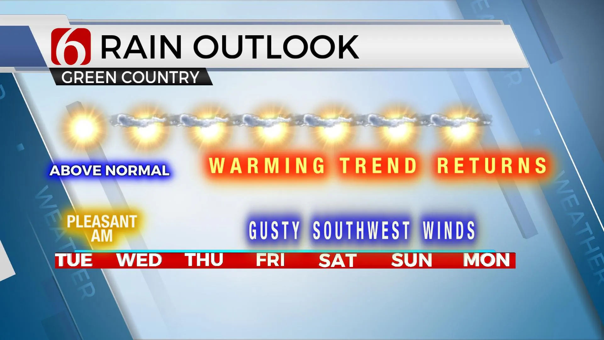
A pleasant morning brings another above normal afternoon across the state. This pattern will continue for several days.

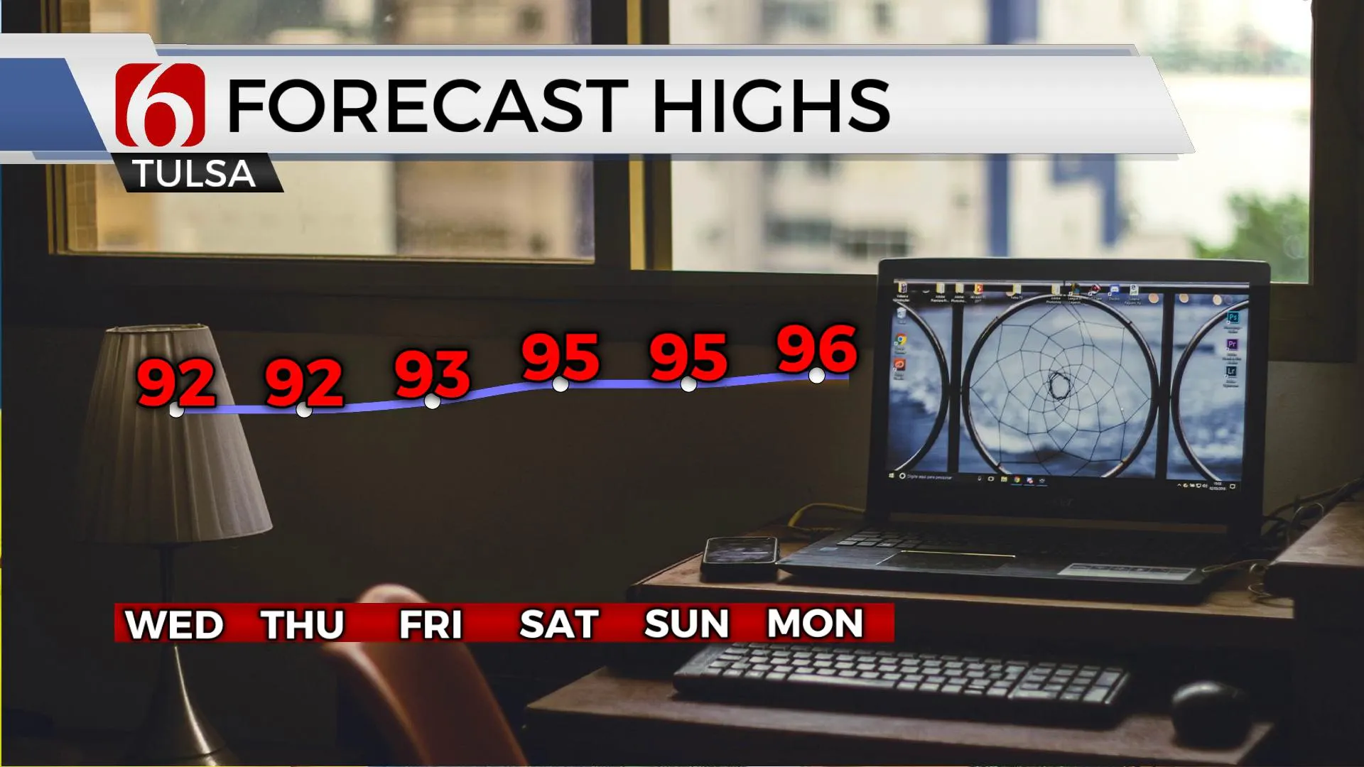
We’re starting with temps mostly in the 50s on Tuesday morning across the eastern third of the state. Mostly clear sky and south winds near 10 to 15 mph will bring highs back into the lower 90s for most of the area on Tuesday afternoon. A few spots may stay in the upper 80s across extreme eastern Oklahoma and western Arkansas. A weak northwest flow positioned across the state could bring a few isolated showers across extreme western Oklahoma Tuesday and Wednesday, but not across the eastern sections. The pattern supports a mostly dry and warm weather regime with afternoon highs in the lower 90s for the rest of the week, and slightly higher, the mid 90s this weekend.

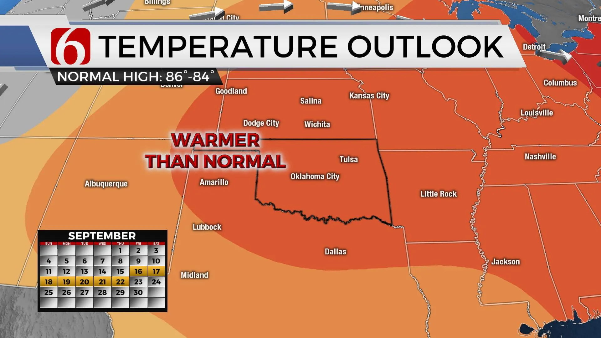
The next cold front will move across the central plains this weekend but will have no impact on our immediate weather. Before this front ejects into the plains, a short-wave disturbance is likely to move across the southern Rockies and into at least part of Southern to central Kansas Friday and Saturday. This may be close enough to trigger a few scattered showers and storms along the I-35 corridor into southcentral Kanas late Friday night and Saturday morning. A mid-level ridge of high pressure is also expected to expand from Texas northward into Oklahoma for at least the 2nd half of the weekend. As this ridge expands, it should limit any precipitation chances to the extreme northern side of the ridge, mostly to our north and northwest. Gusty southwest winds are likely to respond across the area this weekend. Temps are expected to also expand back into the mid-90s this weekend, and possibly the mid to upper 90s early next week. Fire spread rates will be increasing this weekend into early next week. The pattern suggests a western U.S. trough next week that may bring scattered showers and storms near the state by the latter half of the week.

Thanks for reading the Tuesday morning weather discussion and blog.
Have a super great day!
Alan Crone
KOTV
If you’re into podcasts, check out my daily weather update. Search for NewsOn6 and ‘Weather Out The Door’ on most podcast providers, including Spotify, Stitcher and Tune-In, or Click Here to listen on Apple Podcasts.
More Like This
September 13th, 2022
June 21st, 2023
June 19th, 2023
June 13th, 2023
Top Headlines
December 13th, 2024
December 13th, 2024
December 13th, 2024
December 13th, 2024


