Dry, Warm Weather Continues
Sunshine and very warm temperatures are expected on Tuesday.Tuesday, September 27th 2022, 7:48 am
TULSA, Okla. -
Sunshine and very warm temperatures are expected on Tuesday.
Here are the details from News On 6 Meteorologist Alan Crone:
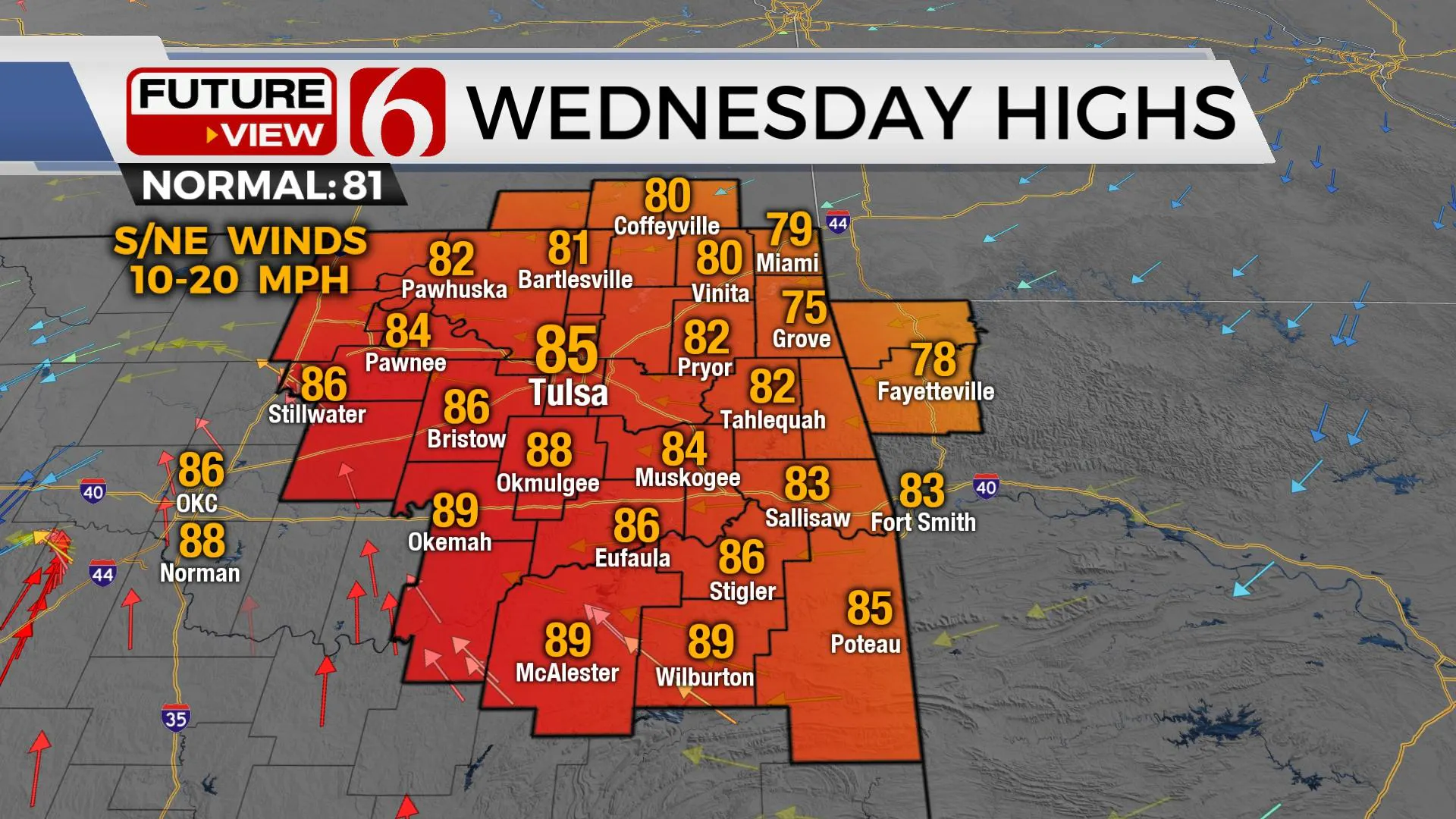
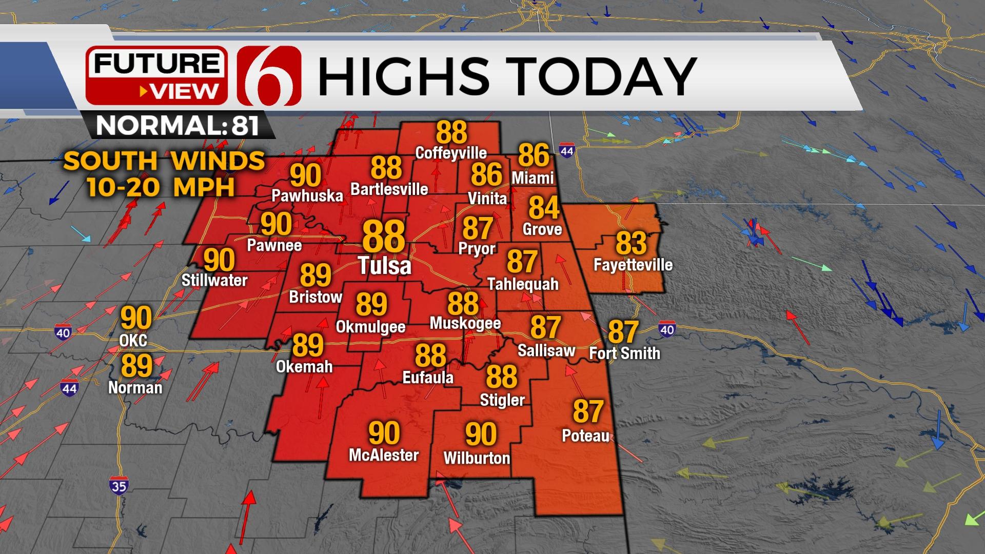
We’re in the middle of a relatively uneventful weather pattern for the state. A few clouds are noted on Tuesday morning across far northeastern Oklahoma but will dissipate quickly. A cool morning brings a warm afternoon with above normal temps Tuesday afternoon with sunshine and south breezes. A back-door front arrives Wednesday bringing northeast winds and even drier low-level air across the eastern third of the region. The dry pattern continues.

Hurricane Ian continues to intensify rapidly Tuesday morning and will remain a significant threat to the southeastern U.S. coaster regions, initially across western Cuba this morning and then into the Gulf coast of Florida region later Tuesday night. The system will begin slowing down as it tracks north to northeast along and off the west coast of Florida making landfall early Thursday morning around the St Petersburg-Tampa region. For more information about Ian, please visit the link below to hear my daily podcast. Our weather continues rather uneventful for the entire extended period.

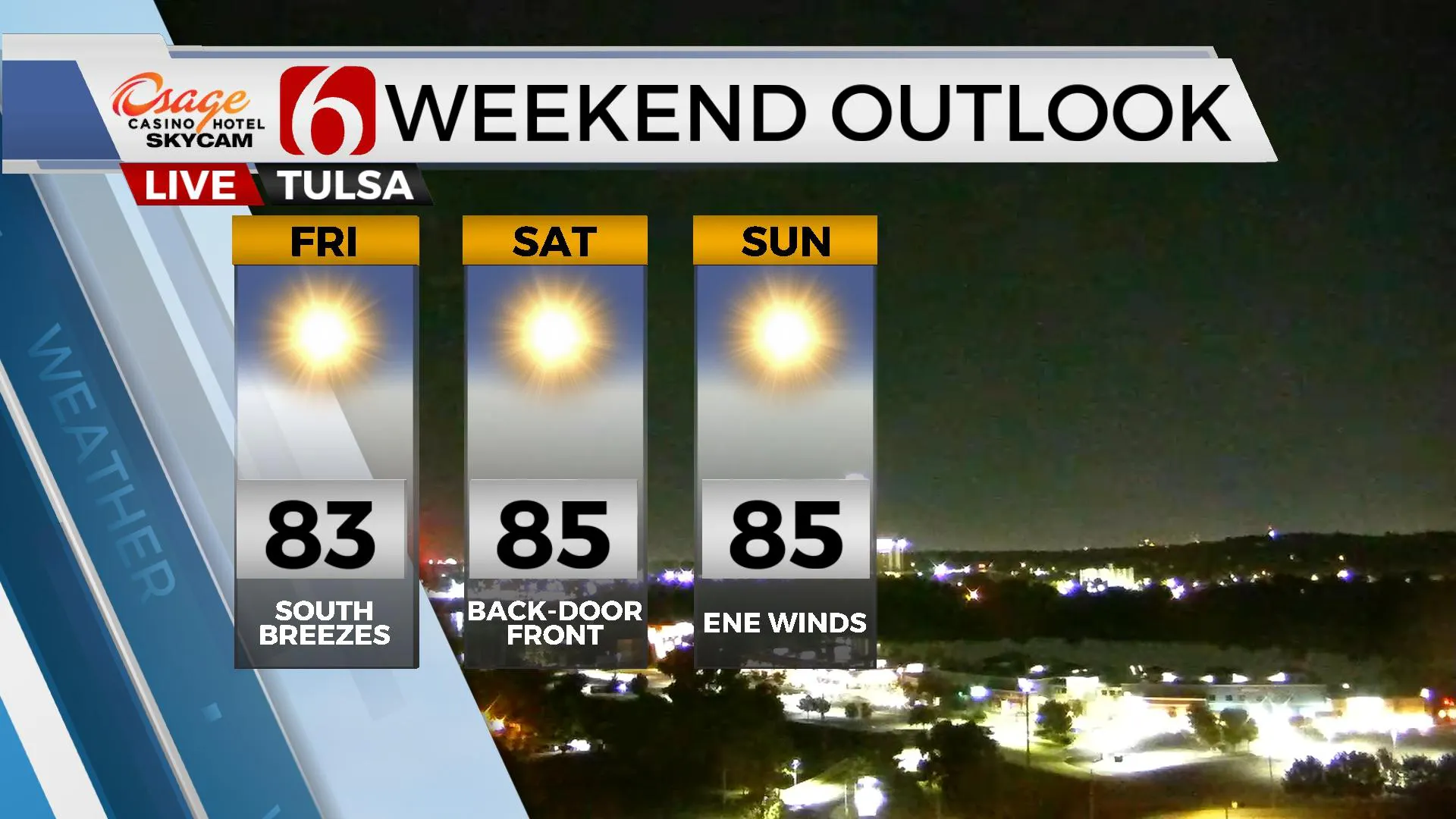
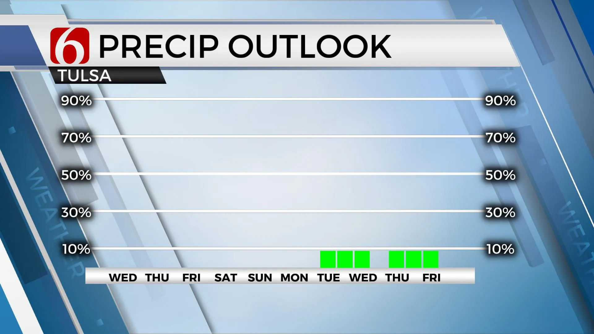
The upper air flow remains from the northwest for the next few days. This pattern can occasionally bring disturbances or storm systems across the state resulting in rainfall. Unfortunately, this will not be the case this week. We already have a relatively dry surface boundary layer across the area and additional dry air will arrive later tonight into Wednesday as a backdoor front enters northeastern Oklahoma from the Missouri Valley. Morning lows will continue to remain cool with most locations in the upper 40s and lower to mid-50s. Afternoon highs today and tomorrow will range into the mid to upper 80s. Daytime highs will drop into the upper 70s and lower 80s Thursday with gradually increasing highs Friday into the weekend. We continue to keep the entire extended period dry. These environmental conditions will increase fire danger threats for the foreseeable future. Thankfully, surface winds will not be exceptionally strong but will also be occasionally gusty during the afternoon. But humidity values will remain very low through the afternoon periods. Please use caution and avoid any activity that could spark a fire.

Thanks for reading the Tuesday morning weather discussion and blog.
Have a super great day!
Alan Crone
KOTV
If you’re into podcasts, check out my daily weather update. Search for NewsOn6 and ‘Weather Out The Door’ on most podcast providers, including Spotify, Stitcher and Tune-In, or Click Here to listen on Apple Podcasts.
More Like This
September 27th, 2022
June 21st, 2023
June 19th, 2023
June 13th, 2023
Top Headlines
December 13th, 2024
December 13th, 2024
December 13th, 2024
December 13th, 2024


