Tracking The Next System Soon
A cool fall day is underway before shower and storm chances return for parts of the state.Thursday, October 27th 2022, 8:37 am
If you’re into podcasts or in a rush, check out my daily weather update. Search for NewsOn6 and ‘Weather Out The Door’ on most podcast providers, including Spotify, Stitcher and Tune-In, or Click Here to listen on Apple Podcasts.
TULSA, Okla. - A cool fall day is underway before shower and storm chances return for parts of the state.
Here are the details from News On 6 Meteorologist Alan Crone:

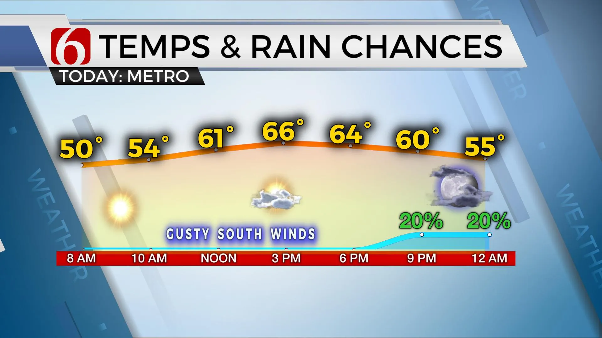
Daytime highs will reach the upper 60s and lower 70s on Thursday as our next system dives near the area bringing shower and storm chances for some locations. Daytime highs will drop a few degrees this weekend but will climb above normal early next week. The initial outlook for Halloween night appears fine with seasonal and dry conditions.

The track of the next upper-level system to influence our area should remain slightly west today and south of northeastern Oklahoma this weekend. Southern and western sections will support higher mentions for showers and some thunder, while northeastern sections remain with low but not zero chances.

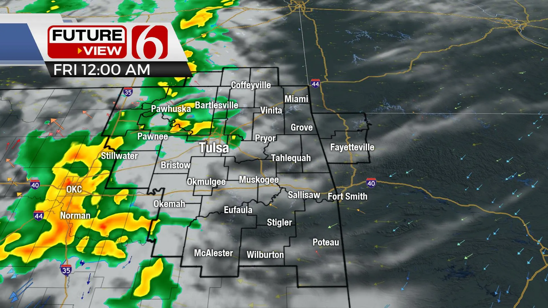
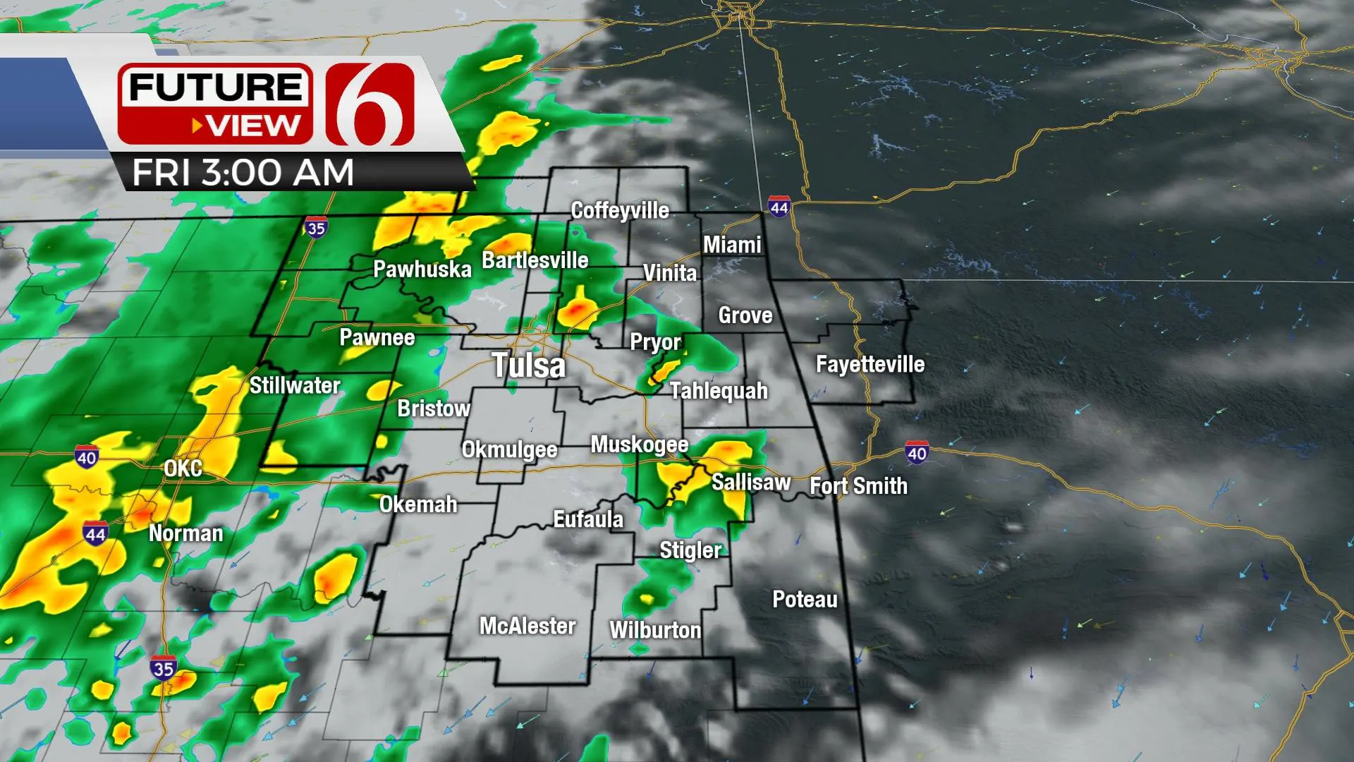
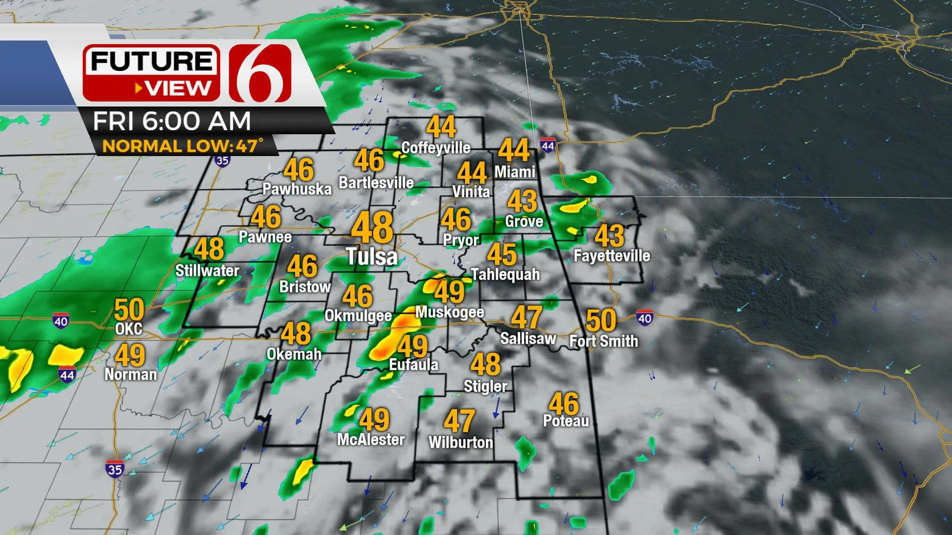
Gusty southeast winds return today as the pressure falls across the Rockies into the central plains as the main upper-level low dives across the panhandle this afternoon and slowly across north Texas Friday and part of the weekend. Afternoon highs will reach seasonal averages today with increasing clouds by afternoon and evening. A few showers may develop near I-35 this afternoon and extend eastward tonight near the metro. Rain with some thunder will be likely across southwestern to central OK later tonight into early Friday morning as the vertically stacked system slowly pivots across Texas. A few strong to severe storms will also be possible, mostly across the far southwestern third of the state into western areas of north Texas. Showers will be more likely Friday across the far southern regions with lower chances north. Saturday, as the system begins to enter the ArkLaTex, additional showers are likely across the southeastern quadrant of the state with lessoning chances near the metro after the pre-dawn and early morning hours. We’ll continue with a slight chance near Tulsa but with likely categories for southeastern OK. The system should finally exit our immediate area with dry conditions Sunday midday to afternoon with decreasing clouds and highs in the upper 60s. A warming trend is likely to arrive early next week with daytime highs nearing the lower 70s Monday and the mid-70s Tuesday and Wednesday. Another strong upper-level system is likely to impact part of the plains later next week.

Thanks for reading the Thursday morning weather discussion and blog.
Have a super great day!
Alan Crone
KOTV
More Like This
October 27th, 2022
June 21st, 2023
June 19th, 2023
June 13th, 2023
Top Headlines
December 12th, 2024
December 12th, 2024
December 12th, 2024
December 12th, 2024


