

Tracking Severe Storm Chances South
Expect pleasant temperatures on Wednesday morning before storms chances return in the evening.Wednesday, February 15th 2023, 7:06 am
If you’re into podcasts or in a rush, check out my daily weather update. Search for NewsOn6 and ‘Weather Out The Door’ on most podcast providers, including Spotify, Stitcher and Tune-In, or Click Here to listen on Apple Podcasts.
TULSA, Okla. - Expect pleasant temperatures on Wednesday morning before storms chances return in the evening.
Here are the details from News On 6 Meteorologist Alan Crone:

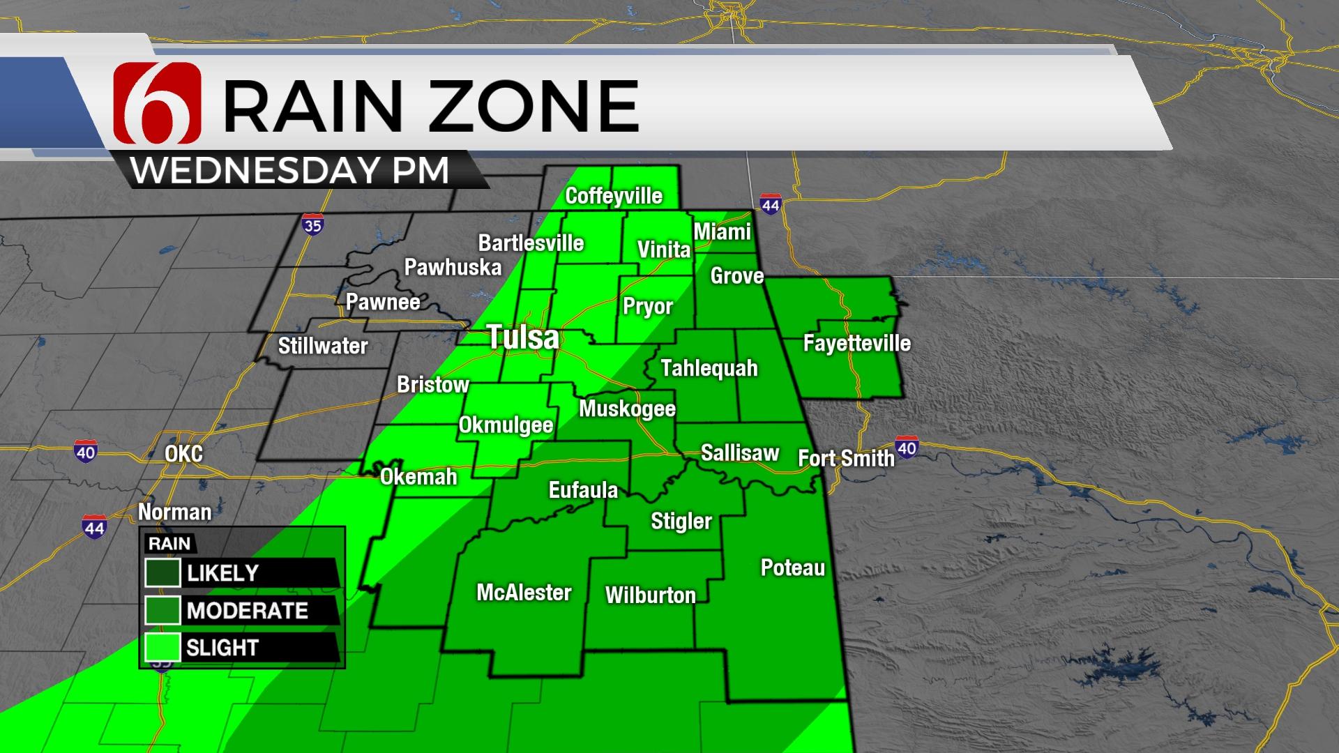
The intense storm system that brought strong winds across the area on Tuesday is located near the Great Lakes on Wednesday morning. A surface cold front has moved southward, and it is currently located slightly south of the Tulsa metro on Wednesday morning. This brings highs in the 50s across far northern, and the lower 70s near and south of I-40. The Tulsa metro should see highs in the mid-60s. The position of this boundary and the moisture return across southeastern Oklahoma later today will be important factors regarding thunderstorm chances later tonight as this system moves across the state.

Surface-based thunderstorms will more than likely remain possible across far southeastern OK later this evening while locations along and north of the I-40 corridor may see some elevated storms. The surface-based storms would be capable of all modes of severe weather. The elevated storms (more north) would be mostly concerned with hail potential. Not everyone will see thunderstorms this evening with lower chances north and higher chances southeast. As the system rolls out of the area later tonight, another surge of arctic air follows bringing cold and blustery weather Thursday. There will also remain a low probability of some wintry mix or snow flurries across far northern OK and southeastern Kansas pre-dawn Thursday. Higher impacts of winter weather will remain west and north, across the Panhandle, northwestern OK and part of southwestern to south central Kansas and points north where significant snow is likely with this system.

Thursday morning lows will be in the upper 20s but wind chill values in the teens are likely along with northwest winds from 15 to 30 mph. Afternoon highs Thursday stay in the upper 30s north and lower to mid-40s south. As winds decrease and clouds clear, Friday morning starts with lows in the teens and lower 20s. Afternoon highs will remain in the mid to upper 40s north and lower 50s south.

The weekend features a return of breezy southwest winds from 15 to 25 mph along with highs in the mid-50s Saturday and lower to mid-60s Sunday. The next storm system arrives early next week with increasing rain and thunder by Tuesday.
Thanks for reading the Wednesday morning weather discussion and blog.
Have a super great day!
Alan Crone
KOTV

Get The Daily Update!
Be among the first to get breaking news, weather, and general news updates from News on 6 delivered right to your inbox!
More Like This
February 15th, 2023

June 21st, 2023

June 19th, 2023

June 13th, 2023
Top Headlines

December 12th, 2024
December 12th, 2024

December 12th, 2024

December 12th, 2024